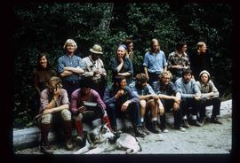
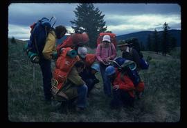
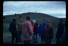
Item is a photograph depicting Thomas Norton, Warren Meyer, Trelle Morrow, Kent Sedgwick and a fifth man.
Item is a photograph depicting Thomas Norton, Kent Sedgwick and a third man.
Image depicts the hiking group. Kent Sedgwick is located in the back row, third from the left with a pipe.
Image depicts numerous individuals who appear to be searching among the rocks on a ledge at an uncertain location in the Peace River Region.
Image depicts a group of individuals standing on the corner of 3rd Ave in Prince George, B.C.
The photograph depicts seven men and women on the railway turntable at the CN Railyard in Prince George, B.C. Reproduction of photograph from 1984.
Image depicts a large group of people in a room at an uncertain location in the Peace River Region.
Image depicts a group of people in a kitchen area of the Mueller home in Sinclair Mills, B.C.; the man in the grey shirt is Ray Mueller displaying his taxidermy collection. Map coordinates 54.014188, -121.676973
Image depicts a group of people in a kitchen area of the Mueller home in Sinclair Mill, B.C.; the man in the grey shirt is Ray Mueller displaying his taxidermy collection. Map coordinates 54.014188, -121.676972
Image depicts a group of hikers examining something on the ground, most likely the small pink flower that is barely visible in the grass. The location is possibly near Riske Creek.
Image depicts a group of hikers on a hiking trail.
Image depicts a group of people hiking, possibly somewhere near Riske Creek, B.C.
Image depicts a group of people and two vans, apparently preparing to set out on a hike somewhere near Riske Creek, B.C.
Image depicts a group of hikers listening to a man, possibly a guide, speak. The location is possibly near Riske Creek, B.C.
Image depicts a group of hikers, possibly somewhere near Riske Creek, B.C.
Image depicts a group of people standing near a river. A glacier is visible in the background.
Image depicts a group of individuals and a bus with words that read: "Prince George Limousine & Charter." The river in the background is possibly the Peace River, and the location is possibly somewhere near Fort St. John, B.C.
Image depicts an aerial view of a grooved region of land at an uncertain location.
Image depicts an aerial view of grooves in the land near the Fraser River, possibly caused by glaciers.
Image depicts a view of grooves in the land near the Fraser River, possibly caused by glaciers.
Image depicts an aerial view of a grooved region of land at an uncertain location.
The item is a photograph depicting two people taking a picture of a green train engine. The engine number is 4651. Annotation on reverse side of the photograph states, "Oct 2009."
Image depicts a small graveyard at an uncertain location.
Image depicts layers of gravel at the BCR site in Prince George, B.C.
Image depicts the grave of John A. Fraser in Barkerville, B.C.
Image depicts the grave of John A. Cameron at Barkerville, B.C.
Image depicts numerous grave markers at an uncertain location.
Image depicts the grave of W.L. Meason in the upper Fraser Canyon.
Image depicts the grave of Frank Russell "Russ" Baker in Fort St. James, B.C.
Image depicts Grassy Plains, B.C.
The item is a photograph depicting a graveyard with flowers at Grassie Plains. Annotation on reverse side of photograph states, "Grassie Plains."
The item is a photograph depicting a graveyard with flowers at Grassie Plains.
The item is a photograph depicting a field with flowers at Grassie Plains. A lake can be seen in the background. Annotation on reverse side of photograph states, "Grassie Plains P Byle 2003."
Image depicts a large, electric shovel at a mine site somewhere in Granisle, B.C.
Image depicts a drill for blasting holes at a mine site somewhere in Granisle, B.C.
Image depicts numerous bags of blasting powder at a mine site somewhere in Granisle, B.C.
Image depicts an 80 tonne truck at a mine site somewhere in Granisle, B.C.
Image depicts an example of "typical housing" in Granduc, near the Granduc Mine and located north of Stewart, B.C.
Image depicts housing in Granduc, near the Granduc Mine and located north of Stewart, B.C.
Image depicts a row of boarded up houses in Granduc, near the Granduc Mine and located north of Stewart, B.C.
Image depicts a row of houses in Granduc, near the Granduc Mine and located north of Stewart, B.C.
The photograph depicts an old Grand Trunk Pacific train station West of Entwistle on Highway 16 West. The station is white with a brown roof and brick chimney. Annotation on reverse side of photograph states, "6 km west from Entwistle on the south side of HWY 16 W, Alberta, 2001-04-17."
The photograph depicts an old Grand Trunk Pacific train station on Highway 16, West of Edmonton. The train station is white with a dark roof. Annotation on reverse side of photograph states, "on HWY #16, West of Edmonton 1991-04-16."
The item is a photograph depicting the plaque containing information on the history and significance of the Grand Trunk Pacific bridge.
Image depicts the Fraser River and the Grand Trunk Pacific Bridge from Cottonwood Island Park.
The item is a photograph depicting the Fraser River going through the Grand Canyon of the Upper Fraser.