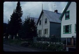
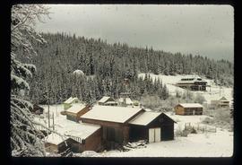
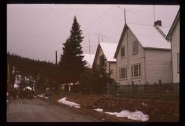
Print preview Close

Showing 4312 results

Archival description
3025 results with digital objects Show results with digital objects
House in South Fort George
2012.13.3.1.50.4 · Item · 2005
Part of J. Kent Sedgwick fonds

The item is a photograph depicting the back of a four-level stucco house in South Fort George. Various appliances are being kept by the house. The house is likely located in the Hazelton Street area, Prince George.

House Interior
2012.13.1.6.027 · Item · May 1974
Part of J. Kent Sedgwick fonds

Image depicts the interior of an old house, possibly the Cottonwood House, and most likely in or near Barkerville, B.C.

House near Penny church
2012.13.2.17.06.4 · Item · [between 1999 and 2005]
Part of J. Kent Sedgwick fonds

The item is a photograph depicting an old, weathered house near Penny church. The house is in disrepair with a damaged roof and boarded up windows. Annotation on reverse side of photograph states, "Penny church house?"

2012.13.3.1.07.25 · Item · July 1991
Part of J. Kent Sedgwick fonds

The item is a photograph depicting a house on 12th Avenue before demolition to make room for the Parkwood commercial area. Annotation on back of picture states, "demolished July / 91 for Parkwood expansion. 1734(?) 12th ave."

2012.13.3.1.07.24 · Item · July 1991
Part of J. Kent Sedgwick fonds

The item is a photograph depicting a house on 12th Avenue before demolition to make room for the Parkwood commercial area. Annotation on back of picture states, "removed July / 91 2 blue spruce + 12th ave."

House on Moffat (Gunn) farm
2012.13.3.1.55.6 · Item · 10 May 2006
Part of J. Kent Sedgwick fonds

The item is a photograph depicting the exterior of old damaged house on the Moffat farmland. There is a broken fence at the rear of the house, broken windows and a collapsed roof.

House on Moffat (Gunn) farm
2012.13.3.1.55.5 · Item · 10 May 2006
Part of J. Kent Sedgwick fonds

The item is a photograph depicting the exterior of old damaged house on the Moffat farmland. There is a broken fence at the rear of the house, broken windows and a collapsed roof.

2012.13.3.1.50.8 · Item · [197-?]
Part of J. Kent Sedgwick fonds

The item is a photograph depicting the front of a white house on Queensway in Prince George. The house is located in the 1400 or 2400 block of Queensway. There is a beige car and green truck parked in front of the house. Annotation on reverse side of the photograph states, "Houses on w. side of Queensway SFG 1970s? #2."

2012.13.1.87.050 · Item · [between 1975 and 1995]
Part of J. Kent Sedgwick fonds

Image depicts a house being removed from Upper Fraser, B.C. during demolition of town site. A sign on the house reads: "Murray Blackwell House Raising & Moving." Map coordinates 54°06'51.6"N 121°56'26.3"W

House with Ivy
2012.13.1.87.116 · Item · [between 1970 and 1990]
Part of J. Kent Sedgwick fonds

Image depicts a house with ivy growing over it. The location is uncertain.

2012.13.3.1.11.119 · Item · [1978 or 1979]
Part of J. Kent Sedgwick fonds

The item is a photograph depicting the exterior view of the front of Household Finance HFC at 1272 3rd Avenue, Prince George. There is a brown station wagon parked in front of the building. Photograph originally taken between 1978 and 1979.

2012.13.3.1.11.118 · Item · [1978 or 1979]
Part of J. Kent Sedgwick fonds

The item is a photograph depicting the exterior view of the front of Household Finance HFC at 1272 3rd Avenue, Prince George. There is a brown station wagon parked in front of the building. Photograph originally taken between 1978 and 1979.

Houses
2012.13.1.37.31 · Item · [1980?]
Part of J. Kent Sedgwick fonds

Image depicts a row of houses somewhere in Wells, B.C.

Houses
2012.13.1.6.151 · Item · Oct. 1980
Part of J. Kent Sedgwick fonds

Image depicts a number of houses at an uncertain location, possibly Williams Lake, B.C.

Houses
2012.13.1.22.12 · Item · 1970
Part of J. Kent Sedgwick fonds

Image depicts numerous houses, and an unknown child standing in a street at Island Cache.

Houses
2012.13.1.22.30 · Item · 1970
Part of J. Kent Sedgwick fonds

Image depicts a few houses in Island Cache. There are two unknown individuals present.

Houses
2012.13.1.22.17 · Item · 1970
Part of J. Kent Sedgwick fonds

Image depicts a few houses and a dog on a porch at Island Cache.

Houses and a Ballpark
2012.13.1.93.01 · Item · 1978
Part of J. Kent Sedgwick fonds

Image depicts a view of numerous houses and a ballpark at an uncertain location. It is possibly located somewhere in the Peace River Region.

Houses and a Church
2012.13.1.37.19 · Item · 1978
Part of J. Kent Sedgwick fonds

Image depicts a row of houses, as well as a United Church of Canada on the right side of the image, located in Wells, B.C.

Houses and Three Goats
2012.13.1.87.021 · Item · [between 1975 and 1995]
Part of J. Kent Sedgwick fonds

Image depicts several houses, and three goats standing on a narrow dirt road. The location is uncertain, likely Sinclair Mills, B.C.

Houses and Train in Giscome
2012.13.1.87.073 · Item · [between 1975 and 1995]
Part of J. Kent Sedgwick fonds

Image depicts the Giscome B.C. townsite from across the railroad tracks looking southeast. Map coordinates 54°04'19.7"N 122°22'04.7"W

Houses in Giscome
2012.13.1.87.072 · Item · [between 1975 and 1995]
Part of J. Kent Sedgwick fonds

Image depicts the Giscome B.C. townsite from across the railroad tracks looking southeast. Map coordinates 54°04'19.7"N 122°22'04.7"W

Houses on Dogwood Street
2012.13.1.24.34 · Item · 2000
Part of J. Kent Sedgwick fonds

Image depicts houses on Dogwood Street in the Millar Addition neighbourhood of Prince George, B.C. On the left is 1610 Dogwood Street and 1630 Dogwood Street is the middle house; 1650 Dogwood Street is the blue house on the right.

Houses on Stilts
2012.13.1.6.106 · Item · Nov. 1980
Part of J. Kent Sedgwick fonds

Image depicts a number of houses built on stilts over a body of water in an uncertain location.