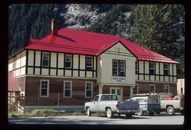
Image depicts numerous houses in Prince Rupert, B.C.
Image depicts the main street of Prince Rupert, B.C.
Image depicts an old building on the main street of Prince Rupert, B.C. Only half of the business name is visible: "Skeena Color [sic]."
Image depicts a view of what is possibly a shipping yard in Prince Rupert, B.C. The slide is labelled "superport."
Image depicts a view of the port in Prince Rupert, B.C. The slide is labelled "superport."
Image depicts the Provincial Government Building located in Stewart, B.C.
Image depicts the flows from a pulp mill in Prince George, B.C.
Image depicts an old, pyramid shaped wooden frame somewhere near Miworth, B.C.
Image possibly depicts the Fraser River from Highway 97 near Quesnel, B.C.
Image depicts the Fraser River from Highway 97 near Quesnel, B.C.
Image depicts a sawmill somewhere in Quesnel, B.C.
Image depicts numerous wood piles near the sawmill somewhere in Quesnel, B.C.
Image depicts numerous old and ruined cabins in Quesnelle Forks.
Image depicts numerous abandoned and ruined cabins at Quesnelle Forks.
Image depicts an old building which has collapsed into a pile of wood, possibly in Quesnelle Forks.
Image depicts a collapsed wooden structure, possibly a bridge, which is likely located somewhere near Quesnelle Forks.
Image depicts a dirt road and power-lines running through the woods, possibly near Quesnelle Forks.
Image depicts the forest surrounding Quesnelle Forks.
Image depicts a rail road construct from Highway 97 at Mile 126; the slide is also labelled "McAlister."
Image depicts rail road tracks at an uncertain location.
Image depicts rail road tracks west of Takla Landing.
Image depicts a man and woman standing in the mouth of a tunnel from the old Kettle Valley Rail Road.
Image depicts the mouth of a tunnel from the Kettle Valley Rail Road.
Image depicts an unknown figure standing inside a tunnel from the old Kettle Valley Rail Road.
Image depicts a tunnel from the old Kettle Valley Rail Road.
Image depicts a woman standing inside a tunnel from the old Kettle Valley Rail Road.
Image depicts the mouth of a tunnel from the Kettle Valley Rail Road.
Image depicts two merging railway tracks, and what appears to be a frozen river, somewhere near the summit of a mountain.
Image depicts a railway bridge, possibly in the small town of Fraser, located on the Klondike Highway in B.C.
Image depicts a set of railway tracks and a long building located somewhere in the Peace River Region.
Image depicts railway tracks on the right side of the image, and several old houses alongside it. The location is uncertain.
Image depicts a group of individuals who appear to be searching through the rocks near a railway track. It is possibly part of an educational trip.
Image depicts a pair of Rainbow trout from Indianpoint Lake.
Image depicts the ranch house of the Ranch of the Vikings, originally owned and operated by Bjorger Pettersen, a member of the Canadian Ski Hall of Fame, from 1970 until 1985. It is located somewhere west of McBride, B.C.
Image depicts a view of Raven Lake in the background.
Image depicts Raven Lake.
Image depicts a view of Raven Lake.
Image depicts a view of Raven Lake and the surrounding area.
Image depicts a view of the area surrounding Raven Lake.
Image depicts several individuals hiking in the area surrounding Raven Lake.
Image depicts several individuals hiking in the area surrounding Raven Lake; the lake is visible in the background.
Image depicts a view of the area surrounding Raven Lake.