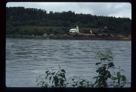
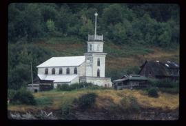
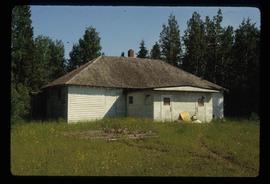
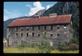
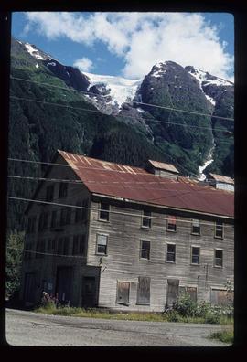
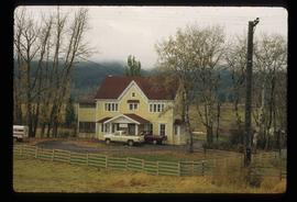
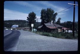
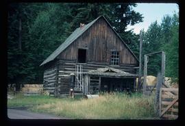
Image depicts an old, abandoned log house somewhere in Quesnelle Forks, B.C.
Image depicts a view of Old Aiyansh.
Image depicts an Anglican church in Old Aiyansh.
Photograph depicts a weathered barn along a body of water, presumed to be in the North Thompson area.
Image depicts an old beehive burner at an uncertain location.
Image depicts an old, boarded-up school building at an uncertain location.
Image depicts several old buildings. The location is uncertain.
Image depicts several old buildings at an uncertain location. The slide is simply labelled "Spring house?"
Image depicts an old cabin in the woods at an uncertain location.
Image depicts several old log cabins, possibly at McLeod Lake.
Image depicts an old, collapsing cabin which is sloped sideways. The location is uncertain.
Image depicts Sue Sedgwick and a dog standing next to an old, collapsing cabin which is sloped sideways. The location is uncertain.
Image depicts an old, boarded up hotel in Stewart, B.C.
Image depicts an old house with a torn up roof. The location is uncertain.
Image depicts an old house missing windows and doors at an uncertain location.
Image depicts an old house in Penny and a woman, possibly Sue Sedgwick, standing in front of it. The location is uncertain.
Image depicts an old house missing windows and doors in the foreground, and a bunkhouse in the background, in Sinclair Mills, B.C. Map coordinates 54°01'17.4"N 121°40'53.0"W
Image depicts what appears to be an old mill at an unknown location.
Image depicts an old trestle along the White Pass railway.
Image depicts an old trestle along the White Pass railway, and the White pass Train on the left of the image.
The item is a photograph of Old West Pawn Shop, Western Union Cashplan financial centre, Tan! and Body Axis Fitness Gear on 3rd Avenue Prince George. There are three men outside the building.
The item is a photograph of Old West Pawn Shop, Western Union Cashplan financial centre, Tan! and Body Axis Fitness Gear on 3rd Avenue Prince George. There are four men outside the building.
Image depicts a bridge over the Omineca River near Germansen Landing, B.C.
Image depicts a cabin on the "west arm" of Takla Lake.
Image depicts the Onward Ranch near Williams Lake, B.C.
Image depicts an open field and numerous buildings, including a church in Giscome, B.C. Map coordinates 54°04'03.2"N 122°22'04.6"W
Image depicts a field in Giscome, B.C. On the right side of the image, in the background, is a grey strip that appears to be a mine, possibly the quarry at Eaglet Lake in Giscome, B.C. Map coordinates 54°03'52.9"N 122°22'10.0"W
Image depicts an open field and Giscome, B.C. in the background. Map coordinates 54°03'52.9"N 122°22'10.0"W
Photograph depicts an open grassy field surrounded by trees in Soda Creek.
Image depicts the original bank building in Wells, B.C.
Image depicts the original steam engine for the White Pass Train, located in Skagway, Alaska.
Image depicts a number of buildings at an uncertain location; the slide labels the older building in the image as potentially being the "original road house."
Image depicts what is likely an outhouse at Island Cache.
Image depicts a group of individuals on the sidewalk outside Spee-Dee Printers on Brunswick Street in Prince George, B.C.
This item is a photograph of a yellow parkade in downtown Prince George. Liquidation World can be seen in the background.
This item is a photograph of a yellow parkade in downtown Prince George.
Photograph depicts a parking lot and alleyway behind the Europe Hotel on 3rd Avenue.
Image depicts a group of people throwing a frisbee in a parking lot at an uncertain location, likely in the Peace River Region.
Image depicts Parkside Intermediate Care Home on Ospika Boulevard in Prince George. Map coordinates 53°55'02.6"N 122°47'41.6"W
Image depicts several eighteen wheelers at the Pass Lake Road and Upper Fraser Road intersection with numerous houses and buildings in the background in McGregor, B.C. Map coordinates 54°04'38.1"N 121°50'00.1"W