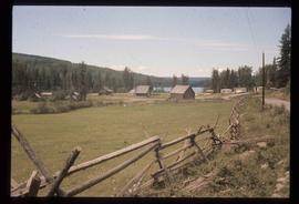
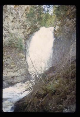
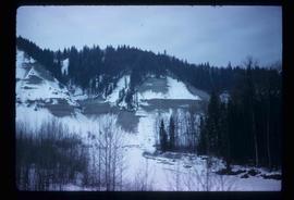
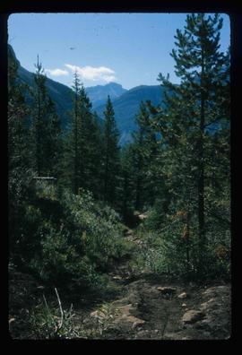
Image depicts Iron Road North, and a creek surrounded by trees. Located north of Woodpecker, B.C.
Image depicts what is possibly an intrusive volcanic landform somewhere near Miworth, B.C.
Image depicts the Inlander Hotel in Hazelton, B.C. The peak of the Rocher de Boule mountain is visible in the background.
Image depicts Indianpoint Lake.
Image depicts a boulder protruding from layers of sediment with a hammer beside it for size reference. It is located somewhere in Soda Creek, B.C.
Image depicts an unidentified individual drilling into the ice.
Image depicts a hand-held ice drill.
Image depicts the old log buildings of the town of Hydraulic, B.C.
Image depicts a small grey building, possibly Raven Cabin, sitting at the foot of a ridge.
Image depicts the Raven Lake Hut on the other side of Raven Lake.
Image depicts a cabin and several other buildings, possibly located in Hudson's Hope, B.C.
Image depicts a view of Howe Sound from the Stawamus Chief Nature Trail to the Stawamus Chief Mountain, which is often incorrectly referred to as "Squamish" Chief.
Image depicts the Britannia Mine, which closed in 1974 and is now a museum. "Anaconda" was the last operating owner.
Image depicts Howe Sound.
Image depicts a number of houses built on stilts over a body of water in an uncertain location.
Image depicts a row of houses in Upper Fraser, B.C. Map coordinates 54°06'51.6"N 121°56'26.3"W
Image depicts several houses, and three goats standing on a narrow dirt road. The location is uncertain, likely Sinclair Mills, B.C.
Image depicts a view of numerous houses and a ballpark at an uncertain location. It is possibly located somewhere in the Peace River Region.
Image depicts numerous houses, and an unknown child standing in a street at Island Cache.
Image depicts a few houses in Island Cache.
Image depicts a number of houses at an uncertain location, possibly Williams Lake, B.C.
Image depicts a number of small houses at Island Cache.
Image depicts a few houses in Island Cache. There are two unknown individuals present.
Image depicts a few houses and a dog on a porch at Island Cache.
Image depicts a number of small houses at Island Cache.
Image depicts a house with ivy growing over it. The location is uncertain.
Image depicts a house on the shore somewhere on Haida Gwaii.
Image depicts and old house and vehicle in Upper Fraser, B.C. Map coordinates 54°07'05.7"N 121°56'38.9"W
Image depicts a small house with brightly coloured door and window frames in Penny, B.C.
Image depicts a house in Giscome, B.C. Map coordinates 54°04'17.6"N 122°22'06.1"W
Image depicts a blue house for sale on Upper Fraser Rd. Location is likely Upper Fraser, B.C.
Image depicts a house with a vehicle in a garage and the number 40 on it; location is uncertain.
Image depicts what is possibly Hospital Beach in Kitimat, B.C. The facility in the background is possibly the Alcan smelter.
Image depicts several horses near a camper somewhere in Quesnelle Forks, B.C.
Image depicts the town of Horsefly, B.C.
Image depicts several people standing near the Hixon Falls in Hixon, B.C.
Image depicts the Hixon Falls in Hixon, B.C.
Image depicts an area of placer mining at Hixon Creek in Hixon, B.C.
Image depicts a view of the scenery near Hixon, B.C.
Image depicts a hill and some power lines in Kettle Valley, B.C.
Image depicts a hill in kettle Valley B.C.
Image depicts a group of hikers hiking up a slope.
Image depicts a hiking trail through the trees.
Image depicts a group of people hiking through trees somewhere in Mt. Robson Provincial Park.
Image depicts a group of people hiking up a glacier, possibly the Robson Glacier.
Image depicts a group of people hiking on a glacier, possibly the Robson Glacier.