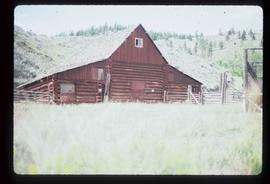
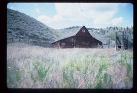
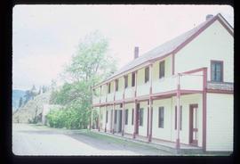
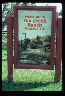
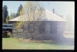
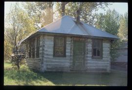
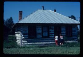
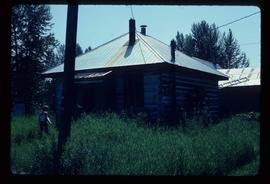
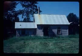
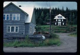
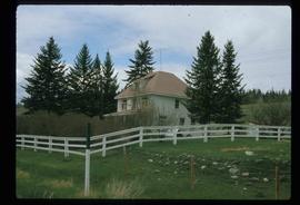
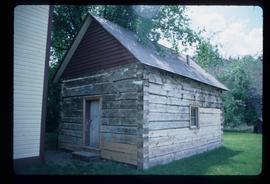
Print preview Close

Showing 2383 results

Archival description
1595 results with digital objects Show results with digital objects
2012.13.1.58.05 · Item · June 1987
Part of J. Kent Sedgwick fonds

Image depicts the McLean Cabin, built in 1861, which belonged to a retired Hudson's Bay Chief trader named Donald McLean, who was shot and killed while part of a posse that was searching for the murderers of a survey party. It is located at the historic Hat Creek Ranch site north of Ashcroft, B.C.

Hat Creek Ranch - Road
2012.13.1.58.12 · Item · June 1987
Part of J. Kent Sedgwick fonds

Image depicts the road leading to the historic Hat Creek Ranch site north of Ashcroft, B.C. Several individuals are sitting on the front porch of the Ranch house.

Highway 97
2012.13.1.3.021 · Item · Oct. 1975
Part of J. Kent Sedgwick fonds

Image depicts Highway 97 at 15th Ave. looking north. Map coordinates 53°54'36.0"N 122°46'55.5"W

Highway 97
2012.13.1.3.022 · Item · Oct. 1975
Part of J. Kent Sedgwick fonds

Image depicts Highway 97 at 15th Ave. looking north. Map coordinates 53°54'42.1"N 122°46'53.1"W

Highway 97
2012.13.1.3.164 · Item · May 2001
Part of J. Kent Sedgwick fonds

Image depicts a section of Highway 97 looking south. Map coordinates 53°55'10.3"N 122°46'54.9"W

Honey Sales
2012.13.1.91.57 · Item · 1979
Part of J. Kent Sedgwick fonds

Image depicts several unidentified individuals standing in front of a store selling honey.

Horses
2012.13.1.31.04 · Item · 1985
Part of J. Kent Sedgwick fonds

Image depicts several horses near a camper somewhere in Quesnelle Forks, B.C.

Hospital Beach?
2012.13.1.84.43 · Item · 1994
Part of J. Kent Sedgwick fonds

Image depicts what is possibly Hospital Beach in Kitimat, B.C. The facility in the background is possibly the Alcan smelter.

House - Elevated Main Floor
2012.13.1.87.079 · Item · [between 1975 and 1995]
Part of J. Kent Sedgwick fonds

Image depicts a house with the main floor and entrance high off the ground. The location is uncertain, likely Giscome, B.C.

House 40
2012.13.1.84.46 · Item · 1994
Part of J. Kent Sedgwick fonds

Image depicts a house with a vehicle in a garage and the number 40 on it; location is uncertain.

House in Giscome
2012.13.1.87.159 · Item · [between 1975 and 1995]
Part of J. Kent Sedgwick fonds

Image depicts a house in Giscome, B.C. Map coordinates 54°04'17.6"N 122°22'06.1"W

House in South Fort George
2012.13.3.1.50.4 · Item · 2005
Part of J. Kent Sedgwick fonds

The item is a photograph depicting the back of a four-level stucco house in South Fort George. Various appliances are being kept by the house. The house is likely located in the Hazelton Street area, Prince George.

House Interior
2012.13.1.6.027 · Item · May 1974
Part of J. Kent Sedgwick fonds

Image depicts the interior of an old house, possibly the Cottonwood House, and most likely in or near Barkerville, B.C.

2012.13.3.1.07.25 · Item · July 1991
Part of J. Kent Sedgwick fonds

The item is a photograph depicting a house on 12th Avenue before demolition to make room for the Parkwood commercial area. Annotation on back of picture states, "demolished July / 91 for Parkwood expansion. 1734(?) 12th ave."