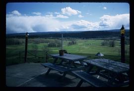
Image depicts a view of the Millar Addition suburb in Prince George, B.C.
Image depicts numerous trees on the bank of a river, possibly in Miles Canyon near Whitehorse, Y.T. The slide is labelled "canyon city."
Image depicts numerous unidentified individuals getting off a boat which bears the name "Schwatka." It is located somewhere in Miles Canyon.
Image depicts the Robert Lowe Bridge, built in 1922, in the Miles Canyon near Whitehorse Y.T.
Image depicts several unidentified individuals on a boat in the Miles Canyon near Whitehorse Y.T.
Image depicts a river in the Miles Canyon near Whitehorse Y.T.
Image depicts a river in the Miles Canyon near Whitehorse Y.T. The Robert Lowe Bridge, built in 1922, can be seen over the canyon.
Image depicts the river which runs through Miles Canyon, located near Whitehorse Y.T.
Image depicts a river at an uncertain location, but possibly in Miles Canyon near Whitehorse, Y.T.
Image depicts a stretch of land from Highway 97 at Mile 231, possibly near Clinton, B.C.
Image depicts the property of an old ranch at Mile 108 of Highway 97.
Image depicts Middle River by Trembleur Lake.
Image depicts the Meziadin Lake and the Bear Pass in the distance.
Image depicts the Meziadin Lake.
Image depicts the fish ladder of the Meziadin Falls, designed to help fish swim upstream.
Image depicts the Meziadin Falls in Meziadin Lake Provincial Park.
Image depicts several salmon somewhere in the Meziadin Lake Provincial Park.
Image depicts several individuals looking down into a closed off section of a river in Meziadin Lake Provincial Park. They are counting fish.
Image depicts buildings in the village community of Metlakatla, B.C.
Image depicts Metlakatla, located near Prince Rupert, B.C.
Image depicts buildings in the village community of Metlakatla, B.C.
Image depicts a house with torn-up siding. The slide is labelled: "Mellos house relocated from Penny." The location is uncertain.
Image depicts part of the McMillan Creek Trail in the McMillan Regional Park in Prince George, B.C.
Image depicts part of the McMillan Regional Park in Prince George, B.C.
Image depicts the McMillan Creek from Northwood Pulpmill Road, in Prince George, B.C.
Image depicts the McLeod River in Carp Lake Provincial Park.
Image depicts a building by the shore of McLeod Lake.
Image depicts McLeod Lake, with the view facing north-west.
Image depicts McLeod Lake.
Image depicts McLeod Lake and several buildings along the shore.
Image depicts McLeod lake.
Image depicts a dirt road and a densely forested treeline, possibly in the McGregor Valley.
Image depicts a pass in the McGregor Valley.
Image depicts a view of a section of a pass in the McGregor Valley.
Image depicts a what is possibly the McGregor River in the McGregor Valley.
Image depicts a gravel road somewhere in the McGregor Valley.
Image depicts numerous felled trees somewhere in the McGregor Valley.
Image depicts a red vehicle parked on the side of the road with a view of the McGregor Valley behind it. The slide is labelled "dam site."
Image depicts numerous burned tree stumps somewhere in the McGregor Valley.
Image depicts a view of McGregor Valley from an uncertain location.
Image depicts a view of McGregor Valley.
Image depicts a view of the McGregor Valley.
Image depicts a view of McGregor Valley.
Image depicts a view of McGregor Valley from an uncertain location.