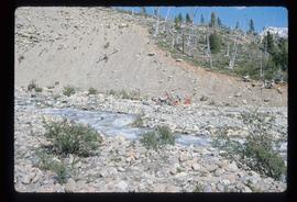
Print preview Close

Showing 2001 results

Archival description
1985 results with digital objects Show results with digital objects
PGE Grade - View South
2012.13.1.41.03 · Item · 2001
Part of J. Kent Sedgwick fonds

Image depicts a view of the south direction of the grade for the British Columbia Railway, which was formerly known as the Pacific Great Eastern until 1972. It is at an uncertain location, possibly near Woodpecker or Prince George.

P.G. Logging
2012.13.1.122.01 · Item · June 1975
Part of J. Kent Sedgwick fonds

Image depicts an aerial view of areas that have been used for logging around Prince George, B.C.

Person by a Tree
2012.13.1.78.37 · Item · 1982
Part of J. Kent Sedgwick fonds

Image depicts an individual, possibly Sue Sedgwick, standing next to a very thick and tall tree somewhere on Haida Gwaii.

People and Mountains
2012.13.1.56.36 · Item · 1973
Part of J. Kent Sedgwick fonds

Image depicts a man talking to a group of hikers, with what is possibly Mt. Robson and the Robson Glacier in the background.

Penny - Fraser River?
2012.13.1.88.02 · Item · 1975
Part of J. Kent Sedgwick fonds

Image depicts four unidentified individuals standing on the bank of a river, possibly the Fraser, somewhere in or near Penny, B.C.

Peace River
2012.13.1.91.12 · Item · Oct. 1978
Part of J. Kent Sedgwick fonds

Image depicts the Peace River, possibly near Clayhurst or Hudson's Hope, B.C.

Peace River
2012.13.1.91.13 · Item · Oct. 1978
Part of J. Kent Sedgwick fonds

Image depicts the Peace River, possibly near Clayhurst or Hudson's Hope, B.C.

Peace River?
2012.13.1.91.06 · Item · Oct. 1978
Part of J. Kent Sedgwick fonds

Image depicts what is possibly the Peace River running parallel to a road, possibly Highway 29.

Peace River
2012.13.1.93.27 · Item · 1978
Part of J. Kent Sedgwick fonds

Image depicts the Peace River and visible layers of sediment deposits in the surrounding cliffs.