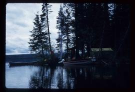
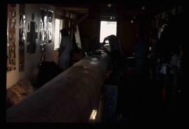
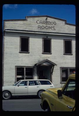
Image depicts the Centennial Hall in Wells, B.C.
Image depicts an individual crouching in an old cemetery located somewhere in the coastal forest on Haida Gwaii, B.C.
Image depicts the Barkerville Cemetery.
Image depicts a cemetery at an uncertain location, possibly in Fort St. James, B.C.
Image depicts a road in Cayoosh Valley.
Image depicts a view of Cayoosh Valley.
Image depicts a view of Cayoosh Valley. Cayoosh Creek is visible in the bottom left corner of the image.
Image depicts Cayoosh Valley.
Image depicts a view of the scenery surrounding Cayoosh Creek.
Image depicts a bridge over Cayoosh Creek.
Image depicts Cayoosh Creek.
Image depicts Cayoosh Creek from a bridge in Cayoosh Valley.
Image depicts the Catholic Church in Penny, B.C.
Image depicts a Catholic Church in Stewart, B.C.
Image depicts a Catholic church at an unknown location.
Image depicts a truck parked on the side of the Cassiar Highway.
Image depicts several unidentified individuals inside a building, one of which is carving a totem pole. The location is uncertain.
Image depicts the Carter Industrial Area in Prince George, B.C.
Image depicts a close-up of the carriage step. It is possibly located in Kamloops, B.C.
Image depicts a red carriage labelled in yellow "B.C. Express Co. No. 20." It is possibly located in Kamloops, B.C.
Image depicts a low rain cloud over Carp Lake, and a man on a boat on the lake.
Image depicts a low rain cloud over Carp Lake.
Image depicts a man holding a chain of fish on the shore of Carp Lake.
Image depicts a green canoe sitting in the water on the shore of Carp Lake.
Image depicts Carp Lake at dusk.
Image depicts a campsite on the shore of Carp Lake.
Image depicts two boats on the shore of Carp Lake.
Image depicts Carp Lake.
Image depicts a small slope on Carney Hill in Prince George, B.C.
Image depicts the abandoned Cariboo Rooms, and a liquor store in Wells, B.C.
Image depicts an old, boarded up building labelled as "Cariboo Rooms" in Wells, B.C.
Image depicts the Cariboo Road in Soda Creek, B.C.
Image depicts the Cariboo Road passing through the Cottonwood House Historic Site.
Image depicts the old, grown-over Cariboo Road at an uncertain location.
Image depicts the Cariboo Road south of Williams Lake.
Image depicts the Cariboo Road at Hat Creek Ranch, near Highway 99 on the way to Lillooet.
Image depicts the Cariboo River.
Image depicts a Cariboo Ranch style house at College Heights in Prince George, B.C.
Image depicts the Cariboo Lake, with the roof of an old log cabin visible.
Image depicts the Cariboo Falls.
Image depicts a log house at an uncertain location; the slide is simply labelled "Cariboo."
Image depicts the train station in Carcross, Y.T.