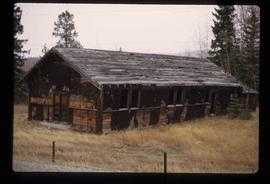
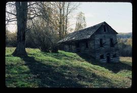
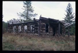
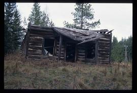
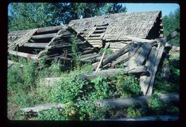
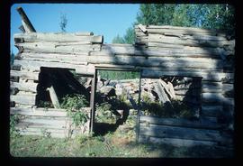
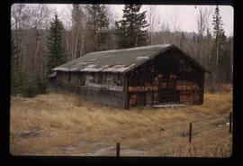
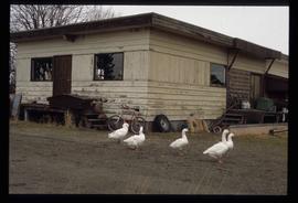
Image depicts a cookhouse at an uncertain location.
Image depicts a construction area somewhere in Tumbler Ridge, B.C.
Image depicts a condominium, possibly in Prince Rupert, B.C.
Image depicts several unidentified concrete structures that are badly damaged and cracking, located on old mill site in Giscome, B.C. Map coordinates 54°04'18.0"N 122°22'04.7"W
Image depicts what appears to be a computer room at an uncertain location, possibly in Fort St. John, B.C.
Image depicts what appears to be a small community on the shore of a lake. The location is uncertain.
Image depicts the old community hall in Woodpecker, B.C.
Image depicts the Columbus Hotel in Prince George, which was destroyed by a fire in 2008.
Image depicts College Heights, particularly along Gladstone Drive, in Prince George, B.C.
Image depicts a collapsing shack somewhere in the Seton Portage area.
Image depicts an old, collapsing cabin somewhere in the Fort George Canyon Provincial Park, B.C.
Image depicts a collapsed shack somewhere near Woodpecker, B.C.
Image depicts a collapsed cabin in Quesnelle Forks, B.C.
Image depicts numerous trees in the coastal forest of Haida Gwaii, B.C.
Image depicts the coastal forests on the shores of Haida Gwaii, B.C.
Image depicts the coastal forests on the shores of Haida Gwaii, B.C. An unknown individual is crouching on the beach in the image.
Image depicts the coastline of Haida Gwaii, B.C.
Image depicts a view of the coast of Haida Gwaii.
Image depicts an aerial view of the coastline of Haida Gwaii, B.C.
Image depicts a view of the coast of Haida Gwaii.
Image depicts the coastline of Haida Gwaii, B.C.
Image depicts a view of the coast of Haida Gwaii.
Image depicts a number of trains in the CNR train yard taken from River Road in Prince George, B.C. Map coordinates 53°54'51.5"N 122°43'29.6"W
Image depicts the CN Building in Prince George, B.C.
Image depicts Upper Fraser residential area during demolition of town site. Map coordinates 54°06'51.6"N 121°56'26.3"W
Image depicts a view of the scenery near Clinton, B.C.
Image depicts a climbing either up or down a rock face.
Image depicts a camper passing under an overhang as it drives along a narrow road near a cliff; located somewhere near Bralorne, B.C.
Image depicts a camper parked on the side of a narrow road along a cliff as another car approaches; located somewhere near Bralorne, B.C.
Image depicts a clearing at Island Cache.
Image depicts a highway, and a section of mountain in the background which is bare due to clear-cut logging. It is possibly somewhere near Prince George, B.C.
Image depicts a logging area, and a section of mountain in the background which is bare due to clear-cut logging. The slide is also labelled "logging show." It is possibly somewhere near Prince George, B.C.
Image depicts the Clayhurst Ferry on the Peace River.
Image depicts the Prince George Civic Centre.
Image depicts City Hall in Prince George, B.C.
Image depicts Prince George City Hall. Map coordinates 53°54'46.3"N 122°44'41.9"W
Image depicts a church on a hill somewhere in Seton Portage, B.C.
Image depicts a church located near Mapes, B.C.