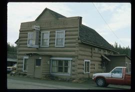
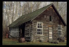
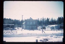
Image depicts the Lone Butte Hotel in Lone Butte, B.C.
Image depicts a pile of old logs on the bank of the Fraser River with mountains in the background. In the foreground, a set of railway tracks run through an uncertain location, likely Upper Fraser, B.C.
Image depicts numerous piles of logs, and two unidentified individuals operating an excavator with a "thumb" attachment during the demolition of the Upper Fraser town site. Map coordinates 54°06'51.6"N 121°56'26.3"W
Image depicts an area undergoing logging somewhere in Prince George, B.C.
Image depicts a logging area somewhere near Prince George, B.C.
Image depicts the balcony of a log house, likely somewhere in or near Prince George B.C.
Image depicts a log house at an uncertain location.
Image depicts a log cabin and an orange truck somewhere in or near Longworth, B.C.
Image depicts a log cabin, possibly in Beaverly.
Image depicts numerous fallen trees and two unknown individuals somewhere in the Crooked River Provincial Park, near the Livingston Springs.
Image depicts the Livingston Springs in the Crooked River Provincial Park.
Image depicts the Livingston Springs in the Crooked River Provincial Park, with an unknown individual present.
Image depicts what is possibly the Lillooet River, full of driftwood.
Image depicts the Lillooet River delta at the head of Lillooet Lake.
Image depicts the Lillooet River at the head of Lillooet Lake.
Image depicts an area around Lillooet, B.C. It is possibly the Fraser River running through the Moran Canyon.
Image depicts three unknown individuals in a kitchen somewhere in Lillooet, B.C. They are possibly archaeology students.
Image depicts an old church located somewhere in Lillooet, B.C.
Image depicts a view of the Fraser River and the mountains surrounding Lillooet, B.C.
Image depicts a view of the mountains surrounding Lillooet, B.C.
Image depicts rows of water, possibly being irrigation ditches, somewhere in Lillooet, B.C.
Image depicts some farmland in Lillooet, B.C.
Image depicts two bridges over the Fraser River, located somewhere in Lillooet, B.C.
Image depicts Lillooet, B.C.
Image depicts a view of Lillooet, B.C.
Image depicts a hotel in Likely, B.C.
Image depicts numerous vehicles and individuals outside a hotel in Likely, B.C.
Image depicts a bridge, and the town of Likely on the the other side of a river.
Image depicts the Lheidli T'enneh Burial Grounds in Fort George Park.
Image depicts a grave-marker in the Lheidli T'enneh Burial Grounds in Fort George Park.
Image depicts the Lheidli T'enneh Burial Grounds in Fort George Park.
Image depicts a building, possibly an office building, next to a set of rail road tracks in Leo Creek, B.C. An unknown individual is present, and a number of barrels and culverts are visible in the foreground.
Image depicts a few piles of culverts in Leo Creek, B.C.
Image depicts the BCR station in Leo Creek, B.C.
Image depicts a view of the Fraser Lake from Lejac, B.C.
Image depicts several individuals seated on a ferry as it possibly departs from a dock somewhere in Prince Rupert, B.C. It is most likely headed for Haida Gwaii, B.C.
Image depicts numerous boats docked by the Prince Rupert Fishermen's Co-operative Association from the deck of a ferry, possibly as it's leaving Prince Rupert, most likely for Haida Gwaii.
Image depicts a formation of rock; presumably solidified lava, as the slide is simply labelled "lava." The location of the image is uncertain.