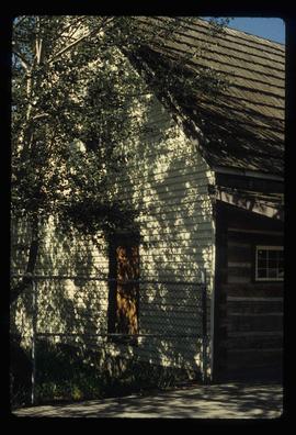
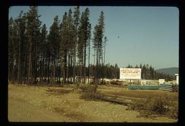
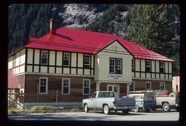
Image depicts the original main street of Quesnel, B.C.
Image depicts the Hudson Bay Store in Quesnel, B.C.
Image depicts the Hudson Bay store in Quesnel, B.C. It was built in 1859.
Image possibly depicts the Fraser River from Highway 97 near Quesnel, B.C.
Image depicts the Fraser River from Highway 97 near Quesnel, B.C.
Image depicts the Bohanon House in Quesnel, B.C.
Image depicts numerous unknown individuals at the Bohanon House in Quesnel, B.C.
The item is a photograph of the industrial area off of Queensway in Prince George.
Image depicts Quadra Ventures Industrial Lodge in Tumbler Ridge, B.C.
Image depicts an old, pyramid shaped wooden frame somewhere near Miworth, B.C.
The item is a photograph depicting the old site of Pylot Mountain school. Sign in front of the field reads, "Nukko Lake." Annotation on reverse side of the photograph states, "Pylot Mtn school site."
Image depicts a pulpmill, likely Northwood, in Prince George, B.C.
Image depicts the flows from a pulp mill in Prince George, B.C.
Image depicts the Prince George Public Library from 7th Ave.
Image depicts the Prince George Public Library.
Image depicts the Provincial Government Building located in Stewart, B.C.
The item is a slide depicting a white house from the front. House is a proposed heritage building.
Image depicts a view of the port in Prince Rupert, B.C. The slide is labelled "superport."
Image depicts a view of what is possibly a shipping yard in Prince Rupert, B.C. The slide is labelled "superport."
Image depicts the rail yards in Prince Rupert.
Image depicts an old building on the main street of Prince Rupert, B.C. Only half of the business name is visible: "Skeena Color [sic]."
Image depicts the main street of Prince Rupert, B.C.
Image depicts numerous houses on the cliff-sides in Prince Rupert, B.C.
Image depicts numerous houses in Prince Rupert, B.C.
Image depicts several houses in Prince Rupert, B.C.
Image depicts numerous houses in Prince Rupert, B.C.
Image depicts numerous buildings and a small dock somewhere in Prince Rupert, B.C. One of the buildings is labelled "Fishermen's Supply."
Image depicts a view of the downtown core of Prince Rupert, B.C.
Image depicts the City Hall of Prince Rupert, B.C.
Image depicts the Bank of Nova Scotia located on "Besner Block" in Prince Rupert, B.C.
Image depicts a view of Prince Rupert, B.C.
The item is a photograph and negative of a survey map of the Prince George townsite surrounding Connaught Park.
The item is a photograph negative of a survey map of the Prince George townsite surrounding Connaught Park.
The item is a photograph and negative of a survey map of the Prince George townsite South of the Nechako River and West of the Fraser River.
The item is a photograph and negative of a survey map of the Prince George townsite surrounding Connaught Park.
The item is a photograph and negative of a survey map of the Prince George townsite South of the Nechako River and West of the Fraser River.
The item is a photograph and negative of a survey map of the Prince George townsite surrounding Connaught Park.
The item is a photograph and negative of a survey map of the Prince George townsite surrounding Connaught Park, South of the Grand Trunk Pacific railway.
The item is a photograph and negative of a survey map of the Prince George townsite surrounding Connaught Park.
Image depicts the Four Seasons Leisure Pool, and the Centennial Fountain in Prince George, B.C. Map coordinates 53°54'48.5"N 122°44'49.2"W
The item is a photograph depicting the rear side of the Prince George Snowmobile Club. The building was originally Buckhorn school. The building is wooden with a metal roof. Sign on the door reads, "Alarmed."