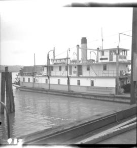
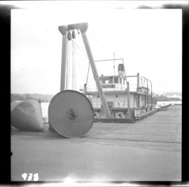
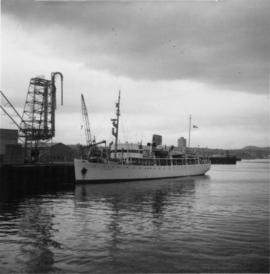
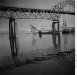
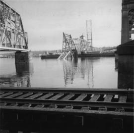
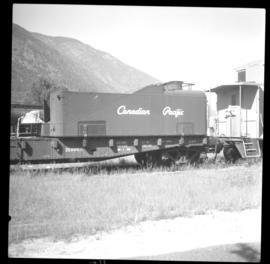
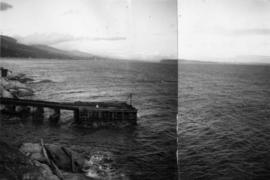
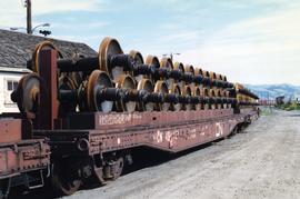
Photograph depicts the north bank of False Creek in Vancouver, B.C. The photograph was taken from the Cambie Bridge, with a view looking west.
Photograph depicts a house and barns on River Rd. in Surrey, 1 mile east of Deas Island Tunnel.
Photograph taken in the KVR Princeton Subdivision. Depicts the Faulder loop/siding, showing its west switch at the centre of a tree edge. Located on mile 16, but in a timetable said to be on mile 15.5. Siding took 70 cars and was 2/3 of a mile, which made the east switch on mile 15.3. This made mile 15.5 at the small wayside depot/waiting room. Beyond the level twin tracks of Faulder, the railway climbed upgrade towards the west.
Photograph depicts the federal government paddle steam sternwheeler "Samson V" at New Westminster. It is used daily on the Fraser River to lift and move buoys etc. It was built in 1937 at New Westminster. It operates between the mouth of the Fraser and Mission. Its crew of 10 is made up of a captain, mate, bosun, two deckhands, cook, steward, chief engineer, greaser, and engineer. It is kept in excellent shape, inside and out.
Photograph depicts the stern wheel of the federal government steamer "Samson V," tied up at New Westminster.
Photograph depicts the federal government paddle steam sternwheeler "Samson V" at New Westminster. The boiler room is the fore part of the lower deck.
Photograph taken at Nanaimo's lumber and general cargo wharf. Displayed is a federal government survey vessel, "W.M. J Stewart," that was registerd in Ottawa, but was built in Ontario. Davies suggests that it may have been surveying shallow and coastal river waters about 2 miles south of Nanaimo since survey stakes were visible.
Photograph depicts the Federal Railway Bridge in New Westminster. Its span had been knocked down by an unmanned scow. New span was to be floated in on by April 22, 1976.
Photograph depicts the Federal Railway Bridge in New Westminster. It had been knocked down by a runaway scow. The new span was to be built and installed by April 22, 1976.
Photograph depicts a "Feldkanone," dated 1917. It is an adaptation of the German 77 mm field gun, a stationed short range gun of the First World War.
Photograph depicts a fence at Nicola village, 7 miles northeast of Merritt.
Photograph depicts the Fernie CPR station, located at mile 34.7 on the Cranbrook Subdivision, which runs from Crowsnest to Cranbrook. In coal mining days this was a busy place but now it has sidings for 153 cars and nothing else. The view is looking east.
Photograph depicts a ferry barge and tug operated by the Department of Highways.
Photograph depicts a ferry barge and tug that was docked on the maindland side of Barnston Island.
Photograph depicts ferry equipment.
Photograph depicts a field being cleared near Miracle Beach, 20 minutes south of Campbell River, on Vancouver Island.
Postcard depicts Field Hill at Yoho National Park.
Photograph depicts a field roller made out of logs.
Postcard depicts Mt. Stephen and Field, BC
Postcard depicts Field, BCand Mt. Stephen in the Canadian Rockies. "The gateway to the wonderfuk Yoho Valley. Here is situated the spacious and comfortable Mount Stephen House of the CPR."
Photograph depicts fields recently cleared from virgin bush on Miracle Breach on Vancouver Island.
Photograph depicts a fire float at False Creek. It is one of the two operated by the Vancouver Fire Department in Vancouver.
Photograph depicts a fire hall for fire float VFD "J.H. Carlisle" at False Creek. It is on the north shore and in line with Willow St., Vancouver.
Photograph depicts the fire hall at Lillooet, including an old hand drawn hose reel carrier.
Photograph depicts a former fire hall that was now preserved.
Photograph depicts the fire hall in Moyie, 20 miles south of Cranbrook. When the photo was taken there were 2 hose reel carts inside, a hose, and huge log stove under the hose drying tower (partially seen through window). Moyie was a prosperous village about 1900-1910.
Photograph depicts a west end fire hall in Vancouver on Nelson and Nicola St.
Photograph depictsa fire hydrant that was still in active use in the town of Fernie. Made by Pratt and Cady.
Photograph depicts one of the three remaining fire hydrants on location of the former Chinatown in Nanaimo, BCIt was provided and installed by the Chinese and not the city of Nanaimo. The hydrant had no identification marks.
Photograph depicts a fire hydrant that had lettering that read "McAvity and Sons Western Ltd."
Photograph depicts a fire in the second floor bedroom of a house on Nelson Street.
Photograph depicts "Fireboat" that was built for the Nanaimo-Vancouver Bath-Tub Race. The race had terminated at Fisherman's cove on the same day.
Photograph depicts a CPR firefighting water tank placed on a flatcar, which was the ex tender of a steam locomotive. The service car is #415391 and the pump is at the left, beyond the photo.
Postcard depicts the first crossing from Golden B.C., over the Kicking Horse River.
Postcard depicts the first crossing of the Kicking Horse.
Photograph depicts the First Narrows looking east from the base of Point Atkinson lighthouse.
Photograph depicts a First Nations dugout canoe at Lillooet, BCIt is about 10 ft. long.
Photograph depicts a First Nations graveyard that overlooked Anderson Lake. The cross in the foreground was dated 1918. A post with carving, near the fourth grave, was dated 1904.
Photograph depicts a road crossing (to Jura and Osprey Lake), northeast of Princeton.
Photograph depicts a road crossing (to Jura and Osprey Lake), northeast of Princeton. Looking downgrade into Princeton Valley.
Photograph depicts fisheries protection and examination vessels.
Photograph depicts a fisherman's house, lived in and owned by a First Nations man (?), on the south bank of the south arm of the Fraser River. It is about 5 miles southeast of New Westminster at approximately 9000 block of River Road.
File consists of research material regarding fixed span bridges, which predominantly consist of photocopy reproductions, excerpts from books, and clippings from periodicals. Includes definitions of bridge types; building guides from model railroad magazines; listings of BC Rail, CNR, and GTPR bridges. Also includes pieces by Davies on covered rail bridges in B.C., "Combined Rail and Road Bridges in B.C.", and the "Kamloops-Armstrong CNR Branch Railway Over-Bridge at Campbell Creek".
Photograph depicts a flat car on the CPR line at Rock Creek, located about mile 11.7 from Midway, which is east of Osoyoos. The flat car had a temporary roof to carry work train supplies. The sidings capacity is 70 cars.
Photograph depicts a flat car wheel set carrier not related to Kamloops Auxiliary Trains.
File consists of research material regarding flat cars. Predominantly consists of photocopy reproductions, excerpts from books, and clippings from periodicals.
Photograph depicts the repairing of a float plane. The tug was used as a ladder.
Photograph depicts a float plane landing at Gold River on west Vancouver Island.
Photograph depicts a Gruman Goose float-amphibian plane on a ramp of the lake. Side base was owned by Forest Industries Flying Tankers Ltd.