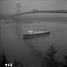
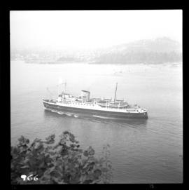
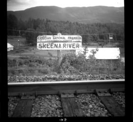
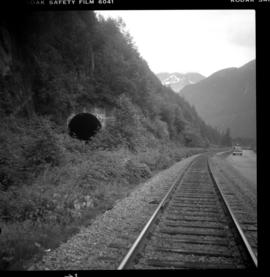
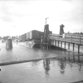
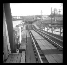
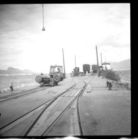
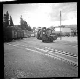
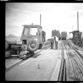
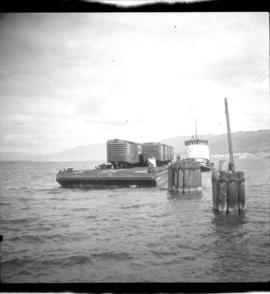
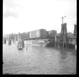
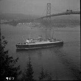
Photograph depicts the C.N.R. ship "Prince George" passing under the Lions Gate Bridge in Vancouver.
Photograph depicts the C.N.R. ship "Prince George" outward bund passing under the Lions Gate Bridge in Vancouver.
Photograph depicts the C.N.R. ship "Prince George" outward bound from Vancouver, passing Prospect Point.
Photograph depicts the Skeena Crossing Bridge on the Bulkley Valley Subdivision. The Skeena River is visible below.
Photograph depicts the Skeena Crossing Bridge on the Bulkley Valley Subdivision. This area was part of an old Grand Trunk Pacific Railway line to Prince Rupert. The Skeena River is visble below. During the construction of the railway, stern wheelers came up river with supplies to this point.
Photograph taken at on mile 62 (from Smithers) on the Bulkley Valley Subdivision which is nearly the mid-point between Smithers and Terrace. The visible sign is for the benefit of train tourists sighted on the southern bank of the Skeena River.
Photograph taken about halfway between Terrace and Prince Rupert. The Skeena Subdivision (from Terrace) was about 400 yards long and was used for avalanche protection. It was abandoned in the 1950's as it was deemed too expensive to maintain.
Photograph depicts a CNR slip of the northern arm of the Fraser River, Lulu Island. Visible is a 9 car barge that porvided shuttle services to the two plywood mills on the opposite shore of the river.
Photograph depicts a CNR slip of the northern arm of the Fraser River, Lulu Island. Visible is a wooded area on the opposite bank that was part of the Fraser View Gold Course. The middle car on the outer side of the barge was a flat car filled with high stanch
Photograph depicts a CNR slip of the northern arm of the Fraser River, Lulu Island, facing the Fraserview Golfcourse.Visible is a 9 car capacity rail barge owend by the Gulf of Georgia. It was named the "Gulf Railroader."
Photograph depicts a CNR slip of the northern arm of the Fraser River, Lulu Island, opposite the Fraserview Golfcourse.
Photograph depicts a CNR slip in Penticton on Okanagan Lake. It shows a general view of the slip and unloading operations, plus a road and rail tractor.
Photograph depicts a CNR slip in Penticton on Okanagan Lake. It shows a general view of the sidings leading from the barge slip . The tractor could move two cars on the level, but did not move cars to and from the barge. The winch was used to pull all cars, including tank cars, onto the barge.
Photograph depicts a CNR slip in Penticton on Okanagan Lake. The two gentleman are conferring as to where the cars are to be switched.
Photograph depicts a CNR slip in Penticton on Okanagan Lake. It shows two rail sets being bolted together.
Photograph depicts a CNR slip in Penticton on Okanagan Lake. The first two cars are being removed from a barge. There is a gas driven winch on the after port of the barge. A cable is taken around a pulley (white in the middle ground) and then attached to the frame of the 1st car- as shown in this photo. This gets the cars moving and gravity plus the brakes does the rest.
Photograph depicts tug #6 closing the gap on Okanagan Lake.
Photograph depicts a tug preparing to run alongside pilings. It propels the barge along Okanagan Lake in thi position.
Photograph depicts CN tug #6 (built in 1948) with a rail barge, empty cars (used for fruit), and one returned empty explosives car from Peachland.
Photograph depicts an example of a CNR 'Buffet-Parlour' car #885 "Quesnel." It was built in 1929 and used mainly in the Montreal-Toronto area. The car was modernized in 1957 and then retired in 1974. It was installed by the Smithers Chamber of Commerce in 1975 and not connected to CNR trackage.
Photograph depicts a CN snow plow, spotted at the Kamloops Junction. Built June 1939. Rated "Heavy Duty." CN, at the time, had 63 snow plows and this was the 12-18th youngest of them. Latest one built was in 1959.
Photograph depicts an inspection trolley chained to trackage at the rear of a work train on the side of the track at the Spences Bridge depot.
Photograph depicts a train making a "Y" train on the west side of the Thompson River.
Photograph depicts a CNR spur adjacent to the South Thompson River and at the northwest end of Red Bridge. Northwest Metal Recycling Ltd., Indian Reserve used the spot to load gondola cars with steel scraps.
Photograph depicts the C.N.R. S.S. Canora rail car carrier between Victoria and Tilbury on the lower Fraser River. It carries 18 rail cars but in practice only 16, as 2 tank cars are kept forward and connected to the oil fuel tanks of the ship.
Photograph depicts the C.N.R. S.S. Canora rail carrier between Victoria and the mainland. It had just been in for and 18 day refit at Burrard Dry Dock and looked good. It carries a crew of 20, which seemed excessive. It ran to Port Mann until 1961 when the slip at Tilbury was built. It is difficult to navigate the swing bride at New Westminster in darkness and freshnets.
Photograph depicts the C.N.R. S.S. Canora at Tilbury, an isolated rail slip in Delta on the south Fraser River, 1 1/2 miles east of Deer Island Tunnel. The ship was built in 1918 at Levis, Quebec and has Quebec as its port of registry. It has oil burning, 4 boiler reciprocating engines and 4 cylinders (1 H.P. exhausting to 1 lesser H.P., then exhausting in parallel to 2 L.P.). It has 2 screws and 2 rudders, 1 pair at the bow and stern.
Photograph depicts a C.N.R. rail car ferry, the S.S. Canora, docked at Tilbury, Fraser River, Delta. Note the sailor in bosun's chair on the foremast cleaning the paintwork. This was about 2 weeks before the announcement that the ship would be taken out of service by C.N. at the end of May 1966.
Photograph depicts the C.N.R. S.S. Canora tied up at Tilbury dock, Fraser River, Delta. The bow is facing downstream.
Photograph depicts the C.N.R. S.S. Canora rail car ferry tied up at Tilbury, Fraser River, Delta. This is after her daily run.
Photograph depicts a Canadian National Railway (CN) steam pile driver and steam generator used to make pile bridge over Mosquito Creek in North Vancouver, to increase the Pacific Great eastern trackage by one more set of tracks.
Photograph depicts a C.N.R. swing bridge over the north arm of the Fraser River, approximately 5 miles southeast of New Westminster, looking northeast.
Photograph depicts a C.N.R. swing bridge over the north arm of the Fraser River, approximately 5 miles southeast of New Westminster, looking north.
Photograph depicts the C.N.R. rail swing bridge on the north arm of the Fraser River, approximately 5 miles southeast of New Westminster, looking north.
Photograph depicts a Hillcrest Lumber Co. steam crane that was acquired by Terry Fergusan and was moved from Mesachie Lake, Cowichan. It was put to use on the tourist attraction railway, the "Victoria-Pacific," that was created in 1971.
Photograph depicts a VIA Rail westbound Prince Rupert train.
Photograph depicts a westbound VIA train of 4 passenger cars and 1 baggage car.
Photograph depicts the arrival of a westbound Prince Rupert train.
Photograph depicts a VIA Rail westbound Prince Rupert train that ran daily in the summer.
Photograph taken on about mile 8 or 10 on the Tete Jaune Subdivision, on the line to Prince George. Located on the north side was the CNR line to Kamloops on the upgrade that passed through a snow tunnel.
Photograph depicts a bridge on the north Thompson River in Kamloops.
Photograph taken at about 8 1/2 miles south of Barriere. Davies notes that this was a rare image because there was a single gondola standing on the main track during an average day when it was normally attached to a work train. Men were seen working nearby.
Photograph depicts the Canadian National Railway (CN) Tilbury dock at Delta on the lower Fraser River. The view is looking east, upstream.
Photograph depicts the Canadian National Railway (CN) track at Milnes Landing,, looking north and about 17 miles west of Victoria.
Photograph depicts Canadian National Railway (CN) track crew sheds on Lulu Island at the south end of the Fraser St. road-vehicle bridge, near the intersection of #5 Rd. and Vulcan Way. The track is well used. The view is looking west.
Photograph depicts the Canadian National Railway (CN) track on Lulu Island leading to the swing bridge that crosses the north arm of the Fraser River. The view is looking northeast.
Photograph depicts the Canadian National Railway (CN) track at the east end of Lulu Island. It originally led to a peat plant but now continues southwards to the Lafarge Cement Plant on the south bank of the island. The view is looking due north and there is a whistle board at the left for the Westminster Highway behind the camera.
Photograph depicts the Canadian National Railway (CN) track on Lulu Island, about 4 miles west of the eastern tip of the island. The track to the right runs along the northern edge of the island and the left-hand track goes to the Lafarge Cement Plant on the south bank of Lulu Island.
Photograph depicts a CPR track tramper in the Kamloops yard.
Photograph depicts a CNR tractor, an old piece of Maintenance of Way equipment coverted to haul equipment required to run at low speeds. It also saved switchers.