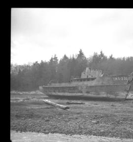
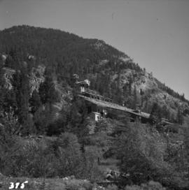
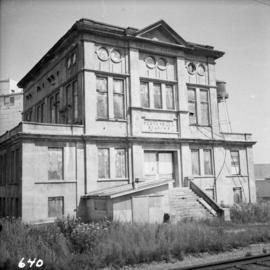
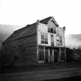
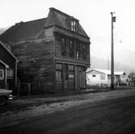
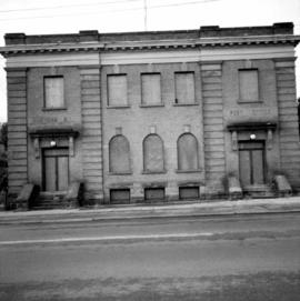
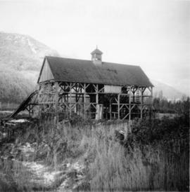
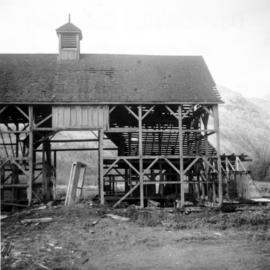
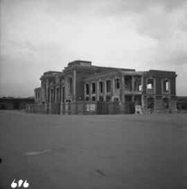
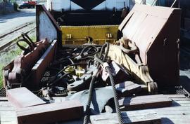
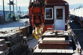
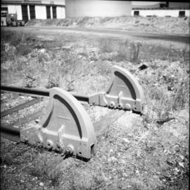
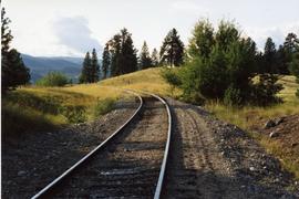
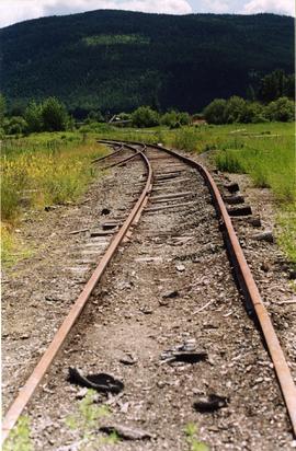
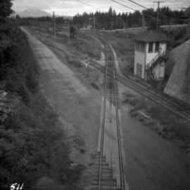
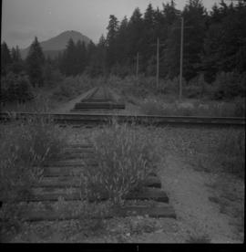
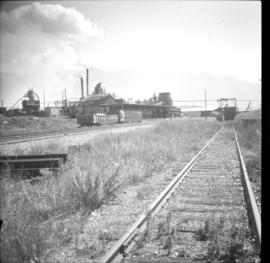
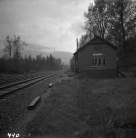
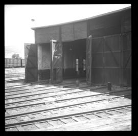
Photograph depicts an abandoned wharf with rail trackage that formerly led to the Esquimalt & Nanaimo Railway.
Photographed depicts part of a deserted roundhouse in the CPR Penticton yard. It is a 5 bay house, which all lead to the turntable that is still in use. The view is looking northeast.
Photograph depicts a deserted cannery at Nootka, on west Vancouver Island.
Photograph depicts a deserted cabin on the Indian Reserve above the PGE track at the northwest corner of Seton Lake. It probably had been occupied up until the last 5 years.
Photograph depicts the Deroche post office that was well patronised for mail and newspaper distribution.
Photograph depicts a derelict shop on what was the Main St. of Slocan City.
Photograph depicts a derelict pump in the middle of a pasture field adjacent to Kettle River. Made by "Jas Smart Mfr. Co. Ltd., Brockville, Ontario."
Photograph depicts a derelict naval vessel at Wolfson Creek, in the booming grounds of Mahood Logging Co, about 6 -8 miles southwest of Powell River. There is a second identical vessel downstream about 200 yards away.
Photograph depicts a derelict mine electric railway. Some equipment that was auctioned in August 1975 included locomotive #4, a trolley, and 10 bottom dump hopper cars that were used to carry crushed ore.
Photograph depicts a derelict locomotive shed at Union Bay on Vancouver Island. It is a Canadian Colliery Resources Ltd. shed, last used 15 Aug. 1960. Operations finished that day and disposal of all the equipment followed.
Photograph depicts the derelict Langham Hotel at Kaslo, B.C. on Kootenay Lake.
Photograph taken at Graver's Farm on the northwest port of Sea Island. Visible is a derelict horse drawn drop wagon.
Photograph depicts a derelict gold mine at Hedley, BC.
Photograph depicts a derelict substation on the B.C. Electric Railway at Coghlan, 9 rail miles east of Langley. Though marked "Langley", the building is sited as stated.
Photograph depicts the derelict electricity station of the B.C. Electric Railway at Cloverdale.
Photograph depicts a derelict crane beside the C.P.R. track of the Lake Cowichan branch at Paldy.
Photograph depicts the derelict CPR depot at Hope, part of the former Kettle Valley line. A spur of about 3 miles still exists between the Odlum junction with the main line on the north side of the Fraser River and this depot, and continues southeast to a point near the CNR. It is not abandoned, but little used. The Hope yard has a 47 car capacity.
Photograph depicts a derelict copper smelter at Princeton, BC. The ore comes from Copper Mountain.
Photograph depicts a possibly derelict hotel in Slocan City, 25 miles northwest of Nelson. Slocan City was once famous for its silver, lead etc. mines.
Photograph depicts a derelict building on the old Main St in Slocan City, northwest of Nelson.
Photograph depicts a derelict building in Ladysmith on Vancouver Island built approximately between 1900 and 1905.
Photograph depicts a derelict barn displaying frame construction.
Photograph depicts the cut where gas pipes rolled in and derailed westbound freight.
Photograph depicts a depot and derelict electricity substation at Coghlan, 9 rail miles east of Langley, looking west.
Photograph depicts the Department of National Defence Armoury headquarters of the British Columbia regiment.
Photograph depicts the demolition of a Great Northern Railway depot in Vancouver.
Photograph depicts the demolition of the former CPR Pier A at the foot of Thurlow Street in Vancouver. Vancouver Pile Driving Co. undertook the work.
Photograph depicts the demolished site of Nelson Laundries Ltd. The boiler in the foregorund was having tubes removed by a wrecker. The site was to be occupied by a Ford motor dealer.
Photograph depicts houses being demolished on Beach Ave, West End, Vancouver.
Photograph depicts the demolition of a CN roundhouse at the Kamloops Junction.
Photograph depicts the Delta Municipal Hall on Main St. in Ladner, B.C.
Photograph depicts deck details of an idle car. A small cabin was behind the camera. Side bins appeared to be tender remnants.
Photograph depicts deck details, looking towards the cabin. Taken from the crane deck.
Photograph depicts a dead end stop at the CPR Penticton yard.
Photograph taken in Trout Lake City which had no electricity, so the pumps displayed were hand worked. The car belonged to the Davies family. It was a 1953 Vauxhall Velox.
The David Davies Railway Collection encompasses all facets of railway history specifically in the province of British Columbia and the Yukon territory. The collection consists of research material accumulated over the course of more than fifty years, and includes monographs, periodicals, articles, clippings, railway timetables, photographs, maps and plans, and excerpts. Material covers public, tourist, and private (industrial) railways, including: CPR, KVR, E&N; CNR, CNoR, GTPR; and PGER, BCR. The collection excludes material regarding streetcar systems and rapid transit, but includes long distance electric interurbans.
Photograph depicts curves at the loop ends of the Princeton to Jura track.
Photograph depicts a crosspiece of an unusable "Y" (the reason for it). It appeared that the piece was used to offload items and in time, distorted the track. All 3 switches of the "Y" and total trackage were still in place.
Photograph depicts a railway track crossover. The Comox Logging & Railway Co. tracks (left to right) cross the Esquimalt & Nanaimo tracks (bottom to top). The MacMillan Bloedel & Powell River Logging Railway tracks join the Esquimalt & Nanaimo Railway just above the crossing. The Velco Tower appears to the right of the crossing. This crossing is one mile north of Ladysmith, with the view looking north to Nanaimo.
Photograph depicts the crossing of the CNR mainline over the former CPR Kettle Valley Line at mile 53.6 from Brookmere. The speed restriction was 15 mph and the crossing was controlled by signals that interlocked automatically. The view is looking east.
Photograph depicts the Creston Sawmills Ltd on the CPR line. Here the southern BC CPR mainline passes through the center of trackage, looking eastbound. A chip car is on the spur directly leading from the camera.
Photograph depicts a crane and tugboat docked at an unknown location.
Photograph depicts a water tank that was now part of the Cranbrook Railway Museum.
Photograph depicts locomotive cars waiting for stage two of the Cranbrook Railway Museum's development of artifacts.
Photograph depicts Craigellachie station, a famous spot on the C.P.R. line. The trans-continental line was joined here on November 7, 1885, about 250 yards down the track just beyond the right hand colour aspect signal. The depot house is not manned, used by the line side crews to store equipment. In former days it was a passing point, but there are very few houses in the area now.
Photograph depicts the CPR yards at Drake St. The view is looking east to the Cambie St. bridge in Vancouver. The track behind the camera leads to the Homer St. warehouse complex.
Photograph depicts the C.P.R. yards on Cambie St. in Vancouver, B.C. The view is looking west with False Creek on the left (out of the picture), after a snowfall.