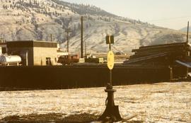
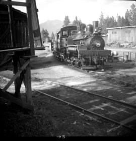
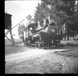
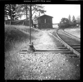
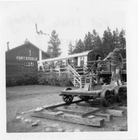
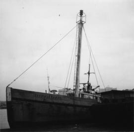
Photograph depicts a former light ship called "Thomas E. Bayard." Visible is a schooner before the ship.
Photograph depicts a former logging railroad trestle west of Port Alberni, BC
Photograph depicts a view 1 mile west of Youbou, Cowichan Lake on Vancouver Island, on a former logging railway (or possible C.N. extension). The "yard limit" sign is still standing.
Photograph depictsa former RCAF hanger. Plane was airworthy, only required engine repairs.
Photograph depicts a former RCAF that is not airworthy. It had lost its tail unit.
Photograph depicts a former RCAF that is not airworthy. Its interior was in shambles.
Photograph depicts a CN roundhouse that was built in 1929 at the Kamloops Junction. It was demolished in November, 1993.
Photograph depicts a CN roundhouse that was built in 1929 at the Kamloops Junction. It was demolished in November, 1993. The prime reason for its demolition was not wanting to pay local taxes on a building rarely used for anything except for motor vehicles, general temporary storage, etc.
Photograph depicts a turntable where behind it a former roundhouse stood.
Photograph depicts a former Sailor's Home at the southeast corner of the intersection at Alexander St. and Jackson St. in Vancouver, B.C.
Photograph depicts a former service station on the main street of Pitt Meadows in the Fraser Valley.
Photograph depicts a former store on main street in Pitt Meadows in the Fraser Valley.
Photograph depicts the former "Terminus Hotel" on 32 Water St., 50 yards from the center of old Vancouver.
Photograph depicts former tram tracks down east Georgia St. in east Vancouver, BC
Photograph depicts former tram tracks still intact at east Georgia St. and Campbell Ave. in the east end of Vancouver, BCThe tracks continued forward and crossed the low ground on a trestle.
Photograph depicts former tram tracks, looking north from the intersection at Campbell Ave and east Georgia St. in Vancouver, BC
Photograph depicts former tram tracks in Vancouver, BCPhotograph taken from the intersection of Fir St. and a piece (in the left hand of photo) leading to First Ave., with the B.C. Electric Railway behind.
Photograph depicts former tram tracks at the north end of Fu St. on the south side of False Creek in Vancouver, BC
Photograph depicts locomotive #115, the "Robert E. Swanson," that was built by Lime Locomotive Works in 1934. It was brought to Forst Steele in 1972.
Photograph depicts a coal tub car that was on display in Fort Steele.
Photograph depicts shay locomotive #115. It was running order, but not in steam on the day the photograph was taken. A rod locomotive was found in a shed towards the left. Rails of the spur found in the foreground that led to the shed.
Photograph depicts shay locomotive #115 in steam and with a working engine for the day. It was about to take on water.
Photograph depicts shay locomotive #115. It was running order, but not in steam on the day the photograph was taken. A rod locomotive was found in a shed towards the left, while the "Dunrobin" lay in disuse (but was still workable) in a shed on the rear right.
Photograph depicts Fort Steele in the Kootenays region of British Columbia.
Postcard depicts the Four Tunnels in Fraser River Canyon, BC
Postcard depicts the Four Tunnels over Fraser River, BC
Photograph depicts a frame house in Vancouver. A high rise apartment on Barclay Street was being built and was just appearing in the background.
Photograph depicts the rear view of Ridgewood Studio, Ltd., furnishers and furniture renovators. The wood shed was used for repair and repolishing of furniture.
Postcard depicts Fraser Canyon. "One can catch thrilling sights through the Canyon such as this. Just a few miles south of Lyton, this view offers one some of the Fraser's best scenery."
Postcard depicts Fraser Canyon, BC"The Saddle Rock view shows some of the rugged grandeur on the Canyon route between Hope and Lytton. It's muddy waters, at this time, gathered fourteen large and many small tributaries as it flows to the great Pacific."
Postcard depicts Fraser Canyon in the Canadian Rockies.
Postcard depicts Fraser Canyon in the Rocky Mountains of western Canada.
Postcard depicts Fraser River Canyon, BC
Postcard depicts Fraser River Canyon, near North Bend, BC
Postcard depicts Fraser River Canyon, showing Cariboo Highway, CPR and CNR Railways, British Columbia, Canada.
Postcard depicts Fraser Canyon near North Bend, BC
Postcard depicts Fraser River in the Canadian Rockies.
Photograph depicts the Fraser St. road bridge over the north section of the north arm of the Fraser River (ie. between Vancouver and Mitchell Island). Shot is looking northeast.
Photograph depicts the Fraser St. road bridge over the north section of the north arm of the Fraser River, looking north from Mitchell Island to Vancouver, BC
Photograph depicts a freight shed at the Nelson CPR depot. There is a terminal spur on the south side of the shed and road trucks on the north side. The road side of the main depot building can be seen in the left rear of the photo. The view is facing east.
Photograph depicts a freight shed located on the north side of the rail line and some 200 yards west of the Mission City CPR depot.
Photograph depicts a freight train at the Pacific Great Eastern yards in Brackendale, as it is about to cross the highway. The view is looking north.
Photograph depicts a westbound freight train near Moyie on the CPR line. This is at about mile 13 on the Nelson Subdivision, which spans 137.8 miles from Cranbrook to Nelson. The line here is adjacent to the Moyie Lake Provincial Campsite. The train is about to enter the portal of a small tunnel that bores through the rocky headland of the lake.
Photograph depicts a Princeton bound freight train passing the old CPR station at Brookmere, located at 30 miles south of Merritt. The freight is passing the summit between Spences Bridge and Princeton. It consisted of 4 locomotives and 38 cars (mainly chip cars). At one time Brookmere was a thriving substation divisional point in the middle of nowhere. Now it is a passing loop to hold 64 cars.
Photograph depicts a southbound freight train passing the old CPR station at Brookmere, located at mile 108.7 on and from the Princeton Subdivision. The freight passed at about 20 mph, after a long grind uphill from Merritt. It consisted of 4 locomotives, 38 cars, and a caboose. Regular freights only pass twice a week, one each on Tuesday and Thursday. It is passing the derelict water tank at the north end of the yards, which are at the summit of this subdivision.
Photograph depicts a freight wagon that stood beside a deserted farm house.
Photograph depicts a freshly painted Canadian National Railway (CN) caboose at Kamloops Junction depot.
Photograph depicts a Gaar Scott traction engine in working order, steamed twice a year at least. It was built by the M. Rumely Co. in Richmond, Indiana, U.S. The engine is a #16541, has 25 horse power, and 2 cylinders. It was photographed at Texaco Station in Nanton, Alberta. It was owned by Jack burrows of Nanton.
Photograph depicts the rear view of the Gaar Scott traction engine parked at Texcoc Station in Nanton, Alberta. The rear wheels have a 2'9" tread. It was used on farms for haulage, threshing, chaff cutting etc., but not plowing.