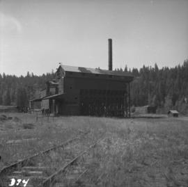
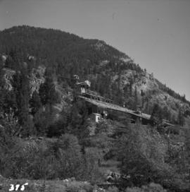
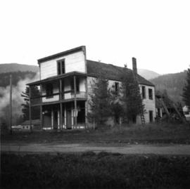
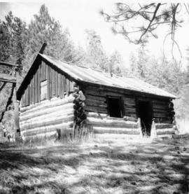
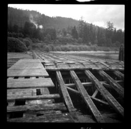
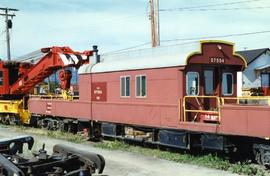
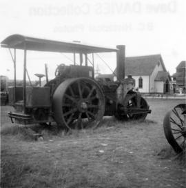
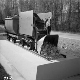
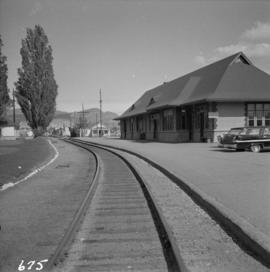
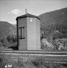
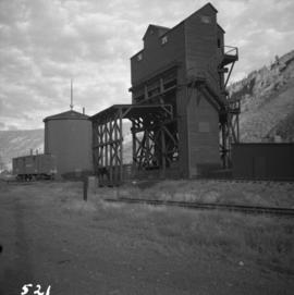
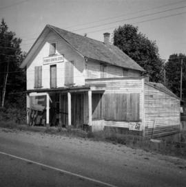
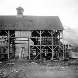
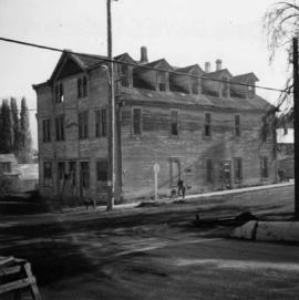
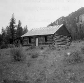
Photograph depicts a derelict barn displaying frame construction.
Photograph depicts a derelict building in Ladysmith on Vancouver Island built approximately between 1900 and 1905.
Photograph depicts a possibly derelict hotel in Slocan City, 25 miles northwest of Nelson. Slocan City was once famous for its silver, lead etc. mines.
Photograph depicts a derelict building on the old Main St in Slocan City, northwest of Nelson.
Photograph depicts a derelict copper smelter at Princeton, BC. The ore comes from Copper Mountain.
Photograph depicts the derelict CPR depot at Hope, part of the former Kettle Valley line. A spur of about 3 miles still exists between the Odlum junction with the main line on the north side of the Fraser River and this depot, and continues southeast to a point near the CNR. It is not abandoned, but little used. The Hope yard has a 47 car capacity.
Photograph depicts a derelict crane beside the C.P.R. track of the Lake Cowichan branch at Paldy.
Photograph depicts the derelict electricity station of the B.C. Electric Railway at Cloverdale.
Photograph depicts a derelict substation on the B.C. Electric Railway at Coghlan, 9 rail miles east of Langley. Though marked "Langley", the building is sited as stated.
Photograph depicts a derelict gold mine at Hedley, BC.
Photograph taken at Graver's Farm on the northwest port of Sea Island. Visible is a derelict horse drawn drop wagon.
Photograph depicts the derelict Langham Hotel at Kaslo, B.C. on Kootenay Lake.
Photograph depicts a derelict locomotive shed at Union Bay on Vancouver Island. It is a Canadian Colliery Resources Ltd. shed, last used 15 Aug. 1960. Operations finished that day and disposal of all the equipment followed.
Photograph depicts a derelict mine electric railway. Some equipment that was auctioned in August 1975 included locomotive #4, a trolley, and 10 bottom dump hopper cars that were used to carry crushed ore.
Photograph depicts a derelict naval vessel at Wolfson Creek, in the booming grounds of Mahood Logging Co, about 6 -8 miles southwest of Powell River. There is a second identical vessel downstream about 200 yards away.
Photograph depicts a derelict pump in the middle of a pasture field adjacent to Kettle River. Made by "Jas Smart Mfr. Co. Ltd., Brockville, Ontario."
Photograph depicts a derelict shop on what was the Main St. of Slocan City.
Photograph depicts the Deroche post office that was well patronised for mail and newspaper distribution.
Photograph depicts a deserted cabin on the Indian Reserve above the PGE track at the northwest corner of Seton Lake. It probably had been occupied up until the last 5 years.
Photograph depicts a deserted cannery at Nootka, on west Vancouver Island.
Photographed depicts part of a deserted roundhouse in the CPR Penticton yard. It is a 5 bay house, which all lead to the turntable that is still in use. The view is looking northeast.
Photograph depicts a deserted wharf and the Esquimalt & Nanaimo Railway, located in the foreground. It had its trackage and ties removed recently. Davies believed it to be a private wharf and railway for the Hartsville Coal Mine that operated in 1920-1941.
Photograph depicts an abandoned 3-track wharf leading to a north running connection with the Esquimalt & Nanaimo Railway. It connected on mile 85. The trackage beyond the wharf had recently been remove while the wharf itself had not been evidently been used for many years.
Photograph depicts an abandoned wharf with rail trackage that formerly led to the Esquimalt & Nanaimo Railway.
Photograph depicts a spare crane and an idler car.
Photograph depicts a spare crane and an idler car. Visible are the details of the rear end of the idle car.
Photograph depicts details of a CN derailment that occurred in Kamloops.
Photograph depicts the details of 3 axle trucks and car steps.
Photograph depicts details of a spout on a preserved water tank.
Photograph depicts a former steam roller that was converted to diesel drive. It was no longer working.
Photograph depicts a diesel switching locomotive, owned and on the premise of the Vancouver Iron and Engineering Works Ltd, at 1155 west 15th Ave. The view is looking north to False Creek.
Photograph depicts a small vessel called "Dinamac." It had a red hull, suggesting that it may have been a Department of Transport tender.
Photograph depicts the dismantling of the KVR Spences Bridge to Penticton. Mileages are those established by the CPR sometime between 1955 and 1965.
Photograph depicts a display item in front of the office of the Nelson Machinery Co. Ltd. located on 1255 Welch St. in North Vancouver. It is a rock car on a 2 ft. gauge track.
Photograph depicts a disused cabin that was perhaps abandoned in the late 1950's.
Photograph depicts a disused Canadian National Railway (CN) passenger depot at Kelowna. The offices still used for parcels, ticket sales, etc. There is still good freight traffic.
Photograph depicts a disused Canadian National Railway (CN) water tower at Spuzzum, 25 miles north of Hope. The view is looking east across the Fraser Canyon.
Photograph depicts a disused coaling stage beside the track that leads to Merritt at Spences Bridge. Coal cars were unloaded by hand or bottom emptied, in covered bay on the left, into metal grating below the track. Coal was then taken by continuous chain hoppers (1 C. powered) to overhead coal bunkers.
Photograph depicts the disused CPR Kettle Valley Railway line in Penticton. The trackage leads from the lakefront to the main yards. All the track was removed by July 1981. The view is looking northeast to the lake and the Incola Hotel.
Photograph depicts the disused CPR Kettle Valley Railway line in Penticton. The trackage leads from the Okanagan Lake CPR wharf to the main yards. All the trackage was obliterated by July 1981. The photo was taken about 1 block away from the lake and near Brunswick St. The view is looking southwest.
Photograph depicts a disused CPR roundhouse and a used turntable at the Port Coquitlam yards. The view is looking east.
Photograph depicts a disused CPR roundhouse at the Port Coquitlam yards. The house had 8 stalls and may be used for other purposes, but not for locomotives.
Photograph depicts a disused depot at Ellis and Clement. Taken from Ellis, looking east. Tracks across Ellis had just been removed. Side walk was inserted and black top had been laid. The removal of the road crossing signals had yet to be done.
Photograph depicts a disused depot at Ellis and Clement. Taken from Ellis, looking east. Track was an isolated piece between St. Paul Street and Ellis and had been subsequently removed. Davies notes the vague talk at the time of converting the building into a railway centre
Photograph depicts a disused general store at Coghlan, 5 miles southeast of Fort Langley in the Fraser Valley.
Photograph depicts a disused lumber storage and rail loading shed beside the Pacific Great Eastern, on the property of the Lions Gate Lumber Co. at the foot of Lloyd St. in North Vancouver.
Photograph depicts a disused rural school in the village of Cormi.