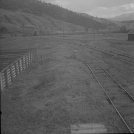
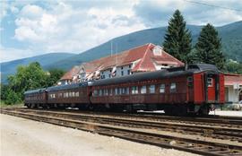
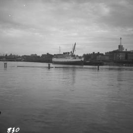
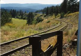
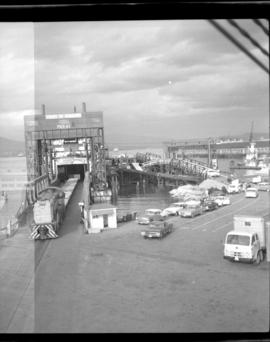
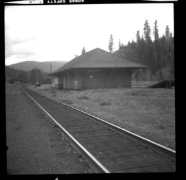
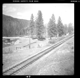
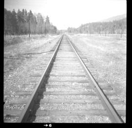
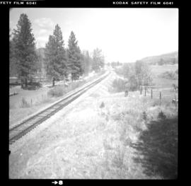
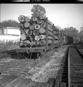
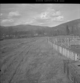
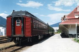
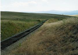
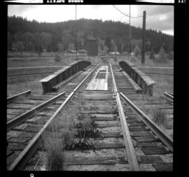
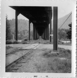
Photograph depicts the CPR Nicola branch line at Nicola, near Merritt. The end of the line is adjacent to 2 fir tree at the right edge of the photo. The photo was taken adjacent to the stock yard with a view looking east.
Photograph depicts the CPR Nicola branch line at Nicola, near Merritt. The view is looking south beside the stock yard. Turning "Y" used to commence at the road track at the right of the photo. The elevation is 2058 ft.
Photograph depicts the northern terminal of barge service on Slocan lake. View of slip looking north. One weekly frieght at this date to Nakus (and return trip). On Thursday, 10 August 1983, south bound return freights consisted of locomotives: 2 flat cars loaded with poles, 2 refrigerators loaded with white pine, and caboose.
Photograph depicts CPR ore cars at Nelson. These cars are as common to Nelson, as lumber and grain cars are too Kamloops. This is due to the Trail smelter. The high-sided ore car is CN #345098 and it has a capacity of 99 tons and was built in January 1966.
Photograph depicts part of the transfer barge #6 and tug ("Iris G") moved to rail pier with line to Nakusp (to right) in the foreground. It is used once a week or every other week.
Photograph depicts the CPR passing loop at Glenfir, 15 miles northeast of Penticton on the Carmi Subdivision. The photo shows a way freight train travelling to Penticton at 1pm on a Tuesday. About 2 way freights pass weekly. The grade here is only falling 2.2% and is 1450 ft. above Penticton. This spot is deep in the bush and has a dirt track nearby, but the nearest house is 3 miles away. The view is looking south.
Photograph depicts the C.P.R. Penticton yards steam wrecking crane #414337. It forms part of a stand-by wrecking train.
Photograph depicts the C.P.R. pier A.1. (now 12A) at Vancouver, B.C., slightly right of the foot of Thurlow St. It was built in 1890 and it is still in use. The view shows its east face.
Photograph depicts the seaward end of C.P.R. pier A1 (now 12A), showing its rotted condition. The pier was built in 1890 and is still in use except at this outer face. C.P.R. pier B1 is in the background.
Photograph depicts the Pitt River swing bridge in an open position. Apparently, it opened up to half a dozen times a day to allow large pleasure crafts to go through. Photograph taken at high tide when little clearance occurred.
Photograph depicts a 3 car train that was ridden by the President of the CPR. Nelson was celebrating its centennial as a municipality and had invited him as an honoured guest. The 3 car train consisted of a sleeper-"Killanney," built in 1916, a Diner-"Assiniboine," built in 1929, and a parlor/observation car-"Mount Stephen," built in 1926.
Photograph depicts the CPR President's train.
Photograph depicts a CPR ship named "Princess Elaine" at the pier opposite the CPR station in Vancouver. The ship was being stripped of its engines and was subsequently towed to Blaine, WA.
Photograph depicts a top deck of a CPR ship named "Princess Louise" awaiting gutting at Lynn Terminals, North Vancouver.
Photograph depicts a CPR ship named "Princess Louise" awaiting gutting at Lynn Terminals, North Vancouver.
Photograph depicts a bridge of a CPR ship named "Princess Louise" awaiting gutting at Lynn Terminals, North Vancouver.
Photograph depicts a CPR ship named "Princess Louise" with CNR "Canadian Prince" at Lynn Terminals, North Vancouver.
Photograph depicts the CPR "Princess Marguerite" in Victoria Harbour.
Photograph taken near Princeton. Looking west, just before dropping into a big loop.
Photograph depicts the CPR Princeton depot. The view is looking east.
Photograph taken east of the CPR depot in Princeton.
Photograph taken looking downgrade at CPR track, east of Princeton.
Photograph depicts one of the CPR loop on the 'big loops' near Princeton, on KVR trackage.
Photograph depicts a CPR spur line (located on the right), running off from the 'main line' that went from Princeton to Penticton. The spur led to a sawmill.
Photograph depicts the C.P.R. Pritchard depot, 25 miles east of Kamloops. The passenger turnstile is unusual though found elsewhere in this area. The depot is long unused for passengers and is now used by a permanent way gang.
Photograph depicts a barge loading slip that was used tri-weekly for Kootenay Lake freight from Riondal, Kaslo, and Lardeau. It was formerly part of the southern B.C. route of the CPR where all traffic had to be barged from Proctor to Sirdor-Kootenay Landing.
Photograph depicts barge #6 after being loaded with 2 pole cars (CP 301595/945, built in 1954 and 1955) and refrigerators (CP 286 442) holding white pine destined for the USA. All "ex." mills at Nakusp. Time: 7:00 p.m. on a Thursday and it is raining. Stern of barge is the nearest to the camera. Tracks diverge to allow captains mounting at the center of the Stern.
Photograph depicts a barge slip on Slocan Lake. This is the northern terminal of lake service. The railway runs north from the lake to Nakusp which is approximately 27 miles. Looking north. Rails in this area weigh 80-85 Ibs. Dated 1901-1911, Algoma, Lorain.
Photograph depicts a C.P.R. rail car slip at Slocan City, on the south end of Slocan Lake, on the line between Slocan and South Slocan. The view is looking north.
Photograph depicts a CPR rail ferry slip in downtown Vancouver.
Photograph depicts the C.P.R. rail ferry transfer #4, registered at Victoria. It is tied to the western side of C.P.R. Pier A! at Vancouver. It holds four tracks and is not self-propelled.
Photograph depicts the CPR rail line at Brookmere, 30 miles south of Merritt. The view is looking north, taken with back to a three stall engine roundhouse, which had been crudely dismantled. A boarded up depot lies about 150 yards to the left of the photo. Brookmere was once a thriving railway town, accessible only by rail. Some of the rail noted was Algoma stall, 85 lbs., and dated to 1910 and 1913.
Photograph depicts the CPR rail line at Brookmere, 30 miles south of Merritt. It shows a general view of the yard. The corner of the depot can be seen at the extreme right edge. Beyond the turntable lies the site of a demolished 3 stall engine house. Most of the yard has been abandoned, with on attempt to clean up the trackage. The photo look south.
Photograph depicts the CPR line at Brookmere, 30 miles south of Merritt. It is a general view of the abandoned yards. The yards were built on a small amount of flat land available right at the summit. A 1956 schedule shows it was quite a busy place; the eastbound passenger train passed through at 0250 hrs. and the westbound at 0425 hrs., via Hope not Merritt. The view is looking north.
Photograph depicts the CPR line at Brookmere, 30 miles south of Merritt (now mile 108.7 on the Princeton Subdivision). Summit point is at 3200 ft. between Spences Bridge, Hope, and Princeton. The Kettle Valley Railway carved out a railway town in the wilderness in 1914/1915 to hold about 300 people. The men were train crews and track a gangs, particularly for the troublesome Coquihalla route. The photo includes the boarded up depot and the view is looking north.
Photograph depicts the CPR line at about mile 50.5 on the Merritt Subdivision. It is south of Glenwalker and south of Merritt. It carries three freights per week. Monday, Wednesday, and Friday is northbound, and Tuesday, Thursday, Saturday is southbound.
Photograph depicts the CPR line at mile 49.2 on the Merritt Substation. This is the site of the Glenwalker depot. The view is looking north.
Photograph depicts the CPR line at about mile 50.5 from Spences Bridge, on the Merritt Subdivision. This point is south of Glenwalker and carries 3 freights per week. Monday, Wednesday, and Friday is northbound, and Tuesday, Thursday, Saturday is southbound. The view is looking north.
Photograph depicts a CPR tug named the "Okanagan" tied to a rail barge. Located on Okanagan Lake.
Photograph depicts a new CPR rail terminal ramp that was being built on the site of the former Pier A, Vancouver Harbour.
Photograph depicts the CPR rail line with an overhead road bridge at Hope. The Kettle Valley Railway track leads to the CPR mainline.
Photograph depicts the outer western limits of the CPR yard at Haney. The car is loaded with poles about 15 to 20 ft. log, 2 sets per car, which had been loaded somewhere else in BC within the previous week.