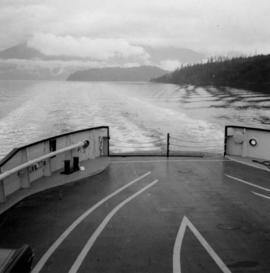
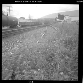
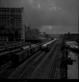
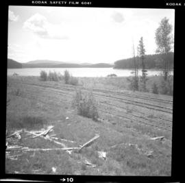
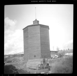
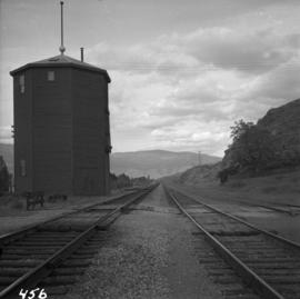
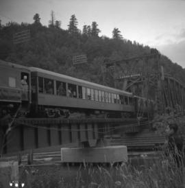
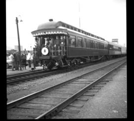
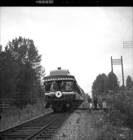
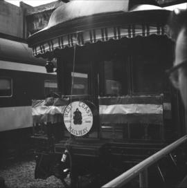
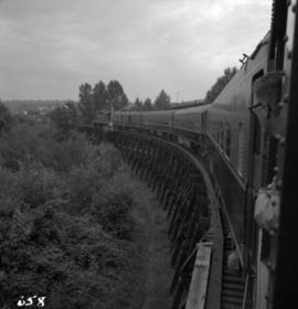
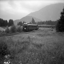
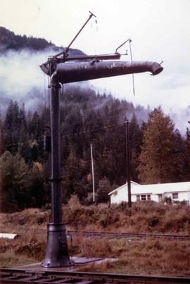
Photograph depicts a view from the Pacific Great Eastern mainline, looking east. A spur for logging is at Creekside, showing either Spetch or Mount Currie. The precise location in the photograph is unknown.
Photograph depicts a view from the ship the Queen of Powell River, en route from Earl Cove to Saltery Bay.
Photograph depicts a view in a lane on the south side of the 1300 block of Richards St. in Vancouver. It includes a Louisville & Nashville car # L&N 109534, that is "paper loading only", has blue paintwork, and was built in June 1953. The end of the spur is at about Drake St. but it is covered in gravel for the last 25 yards. The car was spotted at the Cascade Imperial Mills Ltd. located at #1205 Richards St. Two-thirds of the block is occupied by the Johnston Terminals, Merchandise Storage Division. The building has 6 rail access doors but only 4 are in use. There is usually at least 1 car spotted along the building.
Photograph depicts a view of the town site of Britannia Beach from a copper ore bin, above the concentrator.
Photograph depicts a view of the CPR mainline and siding at Salmon Arm. The view is looking east but the photo was taken from west of the depot. A work train was stored on the siding/spur behind the camera, protected by a metal flag.
Photograph depicts a general view of the C.P.R. yards adjacent to Ballantyne Pier in Vancouver. The sheeted units in the middle distance consist of an export train of 11 locies, travelling dear, just brought in by the G.N.R. switcher. The locomotives were built by General Motors, Electro-Motive Division in La Grange, Illinois. For shipment to Korean National Railways, Pusan. Diverted to Vancouver because of the U.S. Pacific Coast long shoreman strike.
Photograph depicts an unnamed harbour road that runs to the north of , and parallel to Water St. The trackage is connected behind the camera to a CPR depot and at the other end to the mainline. No spurs lead off to the docks. The track is not used but usable.
Photograph depicts a view of the Fraser River from the Albion Ferry from Haney to Fort Langley. The ferry is approaching the south bank of Fort Langley. Gulls sat on logs floating downstream; too heavy to rise after eating candlefish.
Photograph depicts the south tower and a segment of decking of the Lions Gate Bridge in Vancouver, BCPhotograph taken from the east side.
Photograph depicts the southern granite piers of the Lions Gate Bridge in Vancouver, BC
Photograph depicts the Lions Gate Bridge in Vancouver, BCfrom the southeast side.
Photograph depicts the Lions Gate Bridge on the east side looking south from the shore of North Vancouver, BC
Photograph depicts the decking and piers of the northern section of the Lions Gate Bridge, looking north from the shore of North Vancouver, BC
Photograph depicts the south tower of the Lions Gate Bridge looking east with the SS Prince George in the background.
Photograph depicts the piers of the south tower on the Lions Gate Bridge in Vancouver, BC
Photograph depicts the Lions Gate Bridge on west side looking south from the shore of North Vancouver, BC
Photograph depicts a view of four tracks at the McCulloch CPR depot, located at mile 76.6, on the Carmi Subdivision. The four tracks, west to east, are: a passing track, the mainline, a storage track, and a turning "Y". The rail on the passing track and mainline are date 1940, and the others are 1918 or 1919. The view is looking southwest.
Postcard depicts a view of the CPR line in B.C.
Photograph depicts a 4 wheeler vintage 'Scale test Car," built in June 1919. Found in the CPR Kamloops yard.
Photograph depicts a wagon in a field on the south bank of Pritchard, beside a bridge that went over the South Thompson River.
Photograph depicts the washrooms on the west side of the line, about a quarter mile from the McCulloch CPR depot building. The depot is located at mile 76.6 on the Carmi Subdivision.
Photograph depicts water car #415319 standing on a little used spur in Nelson. It consists of a locomotive tender mounted on a flat car. It could be used as a firefighting unit, but it is merely lettered "service."
Photograph depicts a water crane on the southwest side of the Pacific Great Eastern station at Pemberton.
Photograph depicts a water tank at the Pacific Great Eastern yards in Brackendale, near Squamish.
Photograph depicts a static water tank, numbered 415726, at the Coquitlam C.P.R. yards.
Photograph depicts a water tank car on the CPR line at Rock Creek. Rock Creek is located at mile 11.7 from Midway and east of Osoyoos. The water tank car was built in 192, holds 8000 gallons, and forms part of a work train. The sidings capacity here is 70 cars.
Photograph depicts a preserved 2-spouted water tank. It was not on its original site.
Photograph depicts a surviving but disused water tower at Cranbrook. Cranbrook is located at mile 0 on the CPR line of the Nelson Subdivision.
Photograph depicts the water tower at the C.P.R. Savona Depot. The view is looking east towards Kamloops.
Photograph depicts an abandoned water tower on CPR line at Brookmere, 30 miles south of Merritt. The trackage on the right has had the spikes removed but the yard consists of a mixture of completely removed, partially removed, and completely undisturbed track. An elderly couple and 2 elderly bachelors are the only year-round remaining inhabitants.
Contour plan shows layout of a water tunnel near Lyon's Creek in the CNR Clearwater subdivision.
Photograph depicts a weather ship of the Canadian Coastguard called "Vancouver." It was fitting out after launching. This vessel and its sister ship, "Quada," were the largest vessels ever built on the western coast of Canada. "Vancouver" was retired in May 1981 as it was too costly to service.
Photograph depicts decommissioned weather ships. One was named "Stonetown." They were formerly coastguard vessels that were in use until 1968. Prior to that, they were corvettes of the RCN and moored in Vancouver Harbour at the Terminal Pier.
Map depicts the city of Richmond and Lulu Island, including rail trackage.
Photograph depicts a train car that is part of the West Coast Railway Association special trip from Vancouver to Hope on August 8, 1964. It is stopped on the east side of Sumas Bridge.
Photograph depicts one of the two open C.P.R. cars located at Vancouver included in the West Coast Railway Association special trip from Vancouver to Hope. The cars stopped at Sumas Bridge for a photo halt.
Photograph depicts a West Coast Railway Association locomotive and car at C.N. station, ready but not permitted to steam (federal ruling).
Photograph depicts a West Coast Railway Association locomotive and car at a C.N.R. station in Vancouver. The trackage actually belongs to a demolished Great Northern Railway Station.
Photograph depicts a West Coast Railway Association 2-8-2 tank locomotive and tender at a C.N. station in Vancouver, B.C.
Photograph depicts the West Coast Railway Association on a special outing from Vancouver to Hope.
Photograph depicts the West Coast Railway Association special on the Canadian National Railway (CN) trestle, immediately south of the Fraser River bridge at New Westminster, travelling east.
Photograph depicts train cars of the West Coast Railway Association on the reversing triangle at the C.N. station in Hope. The cars are apart of the special trip from Vancouver to Hope on August 8, 1964.
Photograph depicts the west end of a passing loop in Jura. Looking east.
Photograph depicts the west end of a passing loop in Jura.
Photograph depicts the extreme west end of C.P.R. trackage at Coal Harbour, looking east towards the yards and downtown after a snowfall.
Photograph depicts the West Summerland CPR station in the Okanagan. The station often was used but not permanently manned. It was located at mile 9.5 from Penticton. The view is looking south.