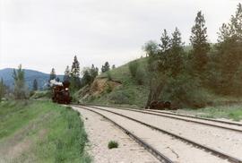
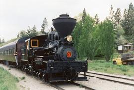
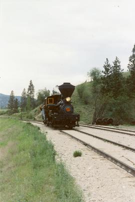
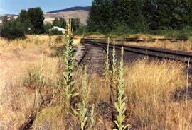
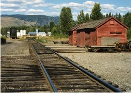
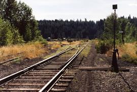
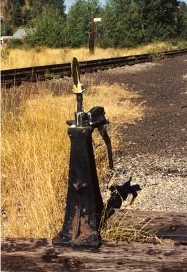
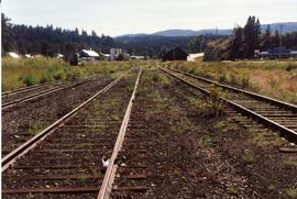
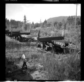
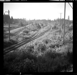
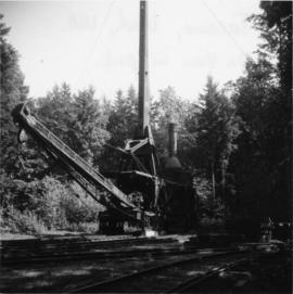
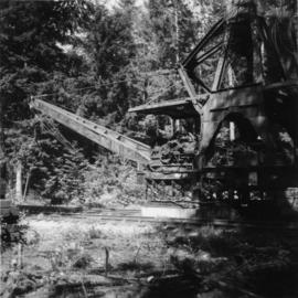
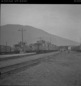
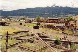
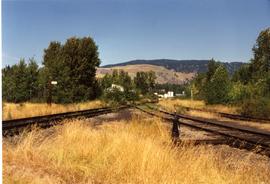
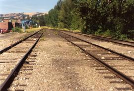
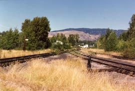
Photograph depicts a part of the KVR yard in Merritt. Looking southeasy, with main line to Penticton bearing away to the right. Jumble of of rails in the foreground was believed to be a rail storage pile.
Photograph depicts a train at the KVR Museum in Summerland.
Photograph depicts a train, labelled "Mayo Lumber," at the KVR Museum in Summerland.
Photograph depicts a locomotive car at the KVR Museum in Summerland.
Photograph depicts a train at the KVR Museum in Summerland.
Photograph depicts a train and two locomotive cars at the KVR Museum in Summerland.
Photograph depicts a train at the KVR Museum in Summerland.
Photograph taken looking east, towards the depot and town of Princeton. Behind the yard lay the beginnings of the former Copper Canyon branch.
Photograph depicts abandoned KVR track. The depot was located just behind the camera.
Photograph depicts the west yards of the KVR.
Photograph depicts a spur that led off on the norst side of the main line between Princeton and Brookmere. The last train seen here was in May, 1989.
Photograph depicts KVR track in Princeton.
Photograph taken in the KVR yard area where there was a ballon in the place of a turning wye.
Photograph depicts details of a switch stand.
Photograph taken looking west towards the depot in Princeton on mile 70.5.
Photograph depicts an open space where former yards of the KVR were located. Visible is a 2 stall engine shed, a turning ballon (in place of a wye), and the connection with the 14 long Copper Mountain Bracnch which conveyed copper concentrate and closed in 1957. Just out of view, on the right, was the Princeton Tunnel built by the GNR in 1910.
Photograph taken somewhere between Thalia and Manning. At this point, Davies caught up with dismantling crews of Pacific Northern Rail Contractors Ltd. Here, rails were removed, but ties were still in place.
Photograph taken east of the KVR depot in Merritt. Trackage on the left was a Nicola spur/branch. Track to the right was part of the main line to Princeton. The two connected behind the trees to form a turning a wye.
Photograph depicts the a sign about 200 yards away from depot aadjacent to the Island highway. It was probably erected within the last 9 months as a result of the Canadian Transport Commission's investigation of the Esquimalt & Nanaimo Railway in late 1970. Amongst the other structures there is a lack of sign posting, dirty and unkept stations, and active discouragement of passenger traffic.
Photograph depicts the tombstone of John Wargo, born January 2, 1868, died October 5, 1909. Killed in an explosion at Extension Coal Mines. At least another 5 men were killed in the same incident and buried in the Ladysmith Cemetary.
Photograph taken at the Ladysmith Cemetary. The column reads "Ici repose Oscar Masset mort accidentellement a Extension le 24 mars 1909 a l'age de 53 ans, native de Bellgique." Davies noted that it seemed a good proportion of the local coal miners were Belgian, Scottish, Welsh, and Central European based on the tombstones.
Photograph depicts disused cars on the CPR spur just north of the crossing between the Esquimalt & Nanaimo Railway and Comox Logging and Railway Company (Division of Crown Zellerbach Canada Ltd.)
Photograph depicts the Ladysmith diamond crossing, looking north from the highway. Esquimalt & Nanaimo Railway is visible on the right and in the centre. On the left are the Comox Logging and Railway Company lines. Strings of disused log cars are on the centre tracks and are owned by CPR.
Photograph depicts the crossing between the Esquimalt & Nanaimo Railway (the camera is facing these tracks) and Comox Logging and Railway Company. The guard tower was manned at 7:00 p.m. and had its roof recently reshingled. It faces southward.
Photograph depicts disused log cars standing on spurs immediately north of the crossing between Esquimalt & Nanaimo Railway and Comox Logging and Railway Company. Both track cars are owned by CPR. Note: protection signals are located on the right. The camera is aimed towards the north.
Photograph depicts Lake Cowichan. Trackage that is unconnected is visible in the foreground. Depot itself is a house and a rail museum combined. It was closed at the same time as the Honeymoon Bay mill. Permission was given to close the 18 mile brand line on November 13, 1984. Track lifting commenced on November 20, 1984.
Postcard depicts the Lake Louise CPR depot.
Photograph depicts a replica of the "SS Beaver" built by the RCN in Esquimalt and moored in Vancouver, open to the public. The original ship left Gravesend on August 29, 1935 and reached Fort Vancouver (Oregon) on April 10. 1936.
Photograph depicts a lake steamer called "Proctor." It was a wood hull steam vessel that was built in Nelson in 1900 and was owned by the CPR. It worked on Kootenay Lake till 1904 and then transferred to Trout Lake. The vessel was sold by the CPR in 1917 when they quit the service and ran privately till it was laid up in 1921.
Photograph depicts land clearance between Monashee Pass and Lumby, B.C.
Photograph depicts "Landing Craft #10," of the B.C. Provincial Forestry Service.
Photograph depicts a large house that was actually the Sunset Beach Lodge. The western end of the block was being demolished. Image captured the last complete block of houses on Beach Ave.
Photograph depicts the last spike at Craigellachie, 15 miles northeast of Sicamous, looking southwest.
Photograph depicts a Lee's Custom Meats box, labelled "Airmail."
Photograph depicts a lidgerwood skidder with its front section visible. Built in 1929 for Wyerhauser.
Photograph depicts a lidgerwood skidder with its rear section visible. Built in 1929 for Wyerhauser.
Photograph depicts a log cabin that was inhabited by an older aboriginal man who is visible in the window. The cabin was perhaps 100 years old.
Photograph depicts a car crossing the Lillooet Suspension Bridge (also known as the Lillooet Old Bridge) over the Fraser River.
Photograph depicts a line of cabooses on the caboose track at Revelstoke. There are rumours that the vehicles are to become obsolete by replacing them with a monitoring device attached to the last car of a train.
Photograph depicts the Lions Gate (suspension) Bridge.
Photograph depicts a liquor store and church on Main St. in Lillooet, B.C.
Photograph depicts loading coal at Buckley Bay. Coal is from Tsable Mine belonging to the Comox Colliery Co. The view is looking north.
Photograph taken on the CPR branch from Vernon to Lumby. Depicts loading poles at Gorman Bros Ltd.
Photograph depicts a loading slip in an unknown location.
Photograph depicts a loading spur on the B.C. Electric Railway at Jackman St. (or nearby), 10 miles east of Langley. The view is looking east.