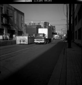
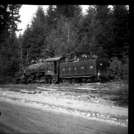
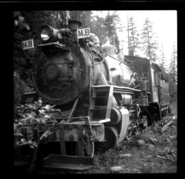
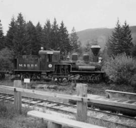
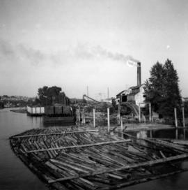
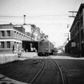
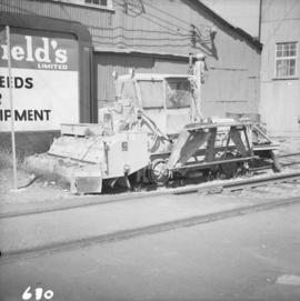
Photograph depicts Mainland St. in Vancouver, B.C. , looking northeast with Helmken St. intersecting.
Photograph depicts the 1500 block of Mainland St. in Vancouver. The boxcar in the view is CN #521160. The switch at Helmcken St. is still in position but not usable because it has been partially black topped and had the rods removed.
Postcard depicts Main Street (Victoria West) Kamloops in 1910.
Photograph taken in front of the 'main line' that led to a pulp mill and river crossing. To the left was a lesser used connector to the CN main line. Behind the camera was a 4-track interchange yard. Beyond that, the CN line to Alberta could be found.
Photograph depicts the M.B. & P.R. Logging Railway Nanaimo River division, which is the only railroad left in the company. The photo depicts locomotive #1077 at the Nanaimo River Camp, 16 miles west of Ladysmith. It is a 2-6-2 tank locomotive built by the Montreal Locomotive Company in December 1923.
Photograph depicts MacMillan, Bloedel, & Powell River Ltd. 90 ton saddle tank #1055, Baldwin built 1928 (max 40 cars). It is located at the Nanaimo River yards.
Photograph depicts locomotive #1077 built by Montreal Locomotive Works in 1923. It was the road engine for log traffic to Ladysmith and had been left on a spur, isolated by three breaks in the tracks. It had been out of service, as had all MacMillan Bloedel traffic, for at least 12 months.
Photograph depicts a stand-by locomotive to the daily log train that went from this point to Ladysmith on a private logging railway.
Photograph depicts a machine for cleaning the track of weeds with loose roots. It belongs to the B.C. Electric Railway and is located at Langley.
Postcard depicts Macdonald Range, near Glacier B.C.
Photograph depicts an M. & B. R.R. locomotive. Location and details unknown.
Photograph depicts the Lytton CPR depot in the Fraser Valley. The view is looking north and upgrade.
Photograph depicts the Lynn Terminals wharf in Vancouver Harbour. The view is looking east with the Second Narrows bridge in the background. The photo also shows a steam dredger at work.
Photograph depicts a Lutheran Church on River Rd. in north Surrey, opposite from Annacis Island.
Photograph depicts Lund Harbour, looking north, 12 miles north of Powell River. It is the most northerly point on the mainland accessible by car, on this part of the coast. Lund is 92 car miles north of the ferry terminal at Langdale.
Photograph taken at the Lumby Branch that commenced with a timber trestle on Vernon Suburbs Road.
Photograph depicts all that remained of Lumberton Spruce Mills Ltd, circa 1912-1939.
Photograph depicts a lumber yard on the north side of Porpoise Bay in Sechelt on the Sechelt Peninsula. The tank in the photograph is about 8 to 10 feet in diameter.
Photograph depicts a lumber wagon.
Photograph depicts a lumber sledge on an Indian Reserve. It was horse drawn and looked abandoned.
Photograph depicts a lumber mill probably in the Lower Mainland.
Photograph depicts a mill on the north stream of the north arm of the Fraser River, looking east from the Fraser St. bridge.
Photograph depicts a lumber mill for Evans Wood Products Ltd. In Savona. It shows filling chip cars that are taken to Weyerhaeuser Pulp Mill in Kamloops, 25 miles to the east. And loading, the cars run down grade to the spur end. The total capacity of the spur is about 6 cars.
Postcard depicts a lower spiral tunnel along the CPR line near Field, BC
Postcard depicts a train exiting a tunnel along the CPR line.
Postcard depicts lower Kicking Horse Canyon, on the CPR line.
Postcard depicts lower Kicking Horse Canyon near Golden, B.C,
Postcard depicts lower Kicking Horse Canyon.
Postcard depicts lower Kicking Horse Canyon, Golden B.C.
Photograph taken in the ghost town of Ferguson. About 8 deserted buildings remained, of which two appeared to be used as summer cabins. This building was the Lardeau Hotel.
Photograph depicts dumping logs at Gold River on the west coast of Vancouver Island.
Photograph depicts a log cabin with a sod roof that was used as a cow shelter on Dot Ranch. The ranch was probably built by pioneers pior to 1900.
Photograph depicts logging wheels found on the Princeton to Merritt highway at Laird, Dry, or Allison Lakes.
Photograph taken north of Gold River, at the Tahsis Ltd. Tree Farm, on a logging road that led to Port McNiel. Crossing the Muchalat River. The bridge was disused and blocked off.
Photograph depicts logging on a side road on the Sechelt Peninsula about 2 miles southeast of Halfmoon Bay.
Photograph depicts a logging museum in Ladysmith on Vancouver Island.
Photograph depicts logging equipment at Koksilah Station, 2 miles south of Duncan, on the Esquimalt and Nanaimo Railway on Vancouver Island. The view is looking south.
Photograph depicts a primitive logging caboose. Believed to have been built by or for the Esquimalt & Nanaimo Railway in 1898.
Photograph depicts a logging bridge over Lois River between Saltery Bay and Lang bay, south of Powell River.
Photograph depicts a logger's sports competition held in Squamish.
Photograph depicts pole climbing in logger sports probably at Squamish, B.C.
Photograph depicts logger sports at Squamish, B.C.
Photograph depicts log poles on the Esquimalt and Nanaimo Railway flat cars at Ladysmith interchange yard.
Photograph depicts a log on an old trailer bed.