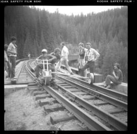
Photograph depicts a lake steamer called "Proctor." It was a wood hull steam vessel that was built in Nelson in 1900 and was owned by the CPR. It worked on Kootenay Lake till 1904 and then transferred to Trout Lake. The vessel was sold by the CPR in 1917 when they quit the service and ran privately till it was laid up in 1921.
Postcard depicts the Lake Louise CPR depot.
Photograph depicts Lake Cowichan. Trackage that is unconnected is visible in the foreground. Depot itself is a house and a rail museum combined. It was closed at the same time as the Honeymoon Bay mill. Permission was given to close the 18 mile brand line on November 13, 1984. Track lifting commenced on November 20, 1984.
Photograph depicts disused cars on the CPR spur just north of the crossing between the Esquimalt & Nanaimo Railway and Comox Logging and Railway Company (Division of Crown Zellerbach Canada Ltd.)
Photograph depicts the Ladysmith diamond crossing, looking north from the highway. Esquimalt & Nanaimo Railway is visible on the right and in the centre. On the left are the Comox Logging and Railway Company lines. Strings of disused log cars are on the centre tracks and are owned by CPR.
Photograph depicts the crossing between the Esquimalt & Nanaimo Railway (the camera is facing these tracks) and Comox Logging and Railway Company. The guard tower was manned at 7:00 p.m. and had its roof recently reshingled. It faces southward.
Photograph depicts disused log cars standing on spurs immediately north of the crossing between Esquimalt & Nanaimo Railway and Comox Logging and Railway Company. Both track cars are owned by CPR. Note: protection signals are located on the right. The camera is aimed towards the north.
Photograph depicts the a sign about 200 yards away from depot aadjacent to the Island highway. It was probably erected within the last 9 months as a result of the Canadian Transport Commission's investigation of the Esquimalt & Nanaimo Railway in late 1970. Amongst the other structures there is a lack of sign posting, dirty and unkept stations, and active discouragement of passenger traffic.
Photograph taken looking east, towards the depot and town of Princeton. Behind the yard lay the beginnings of the former Copper Canyon branch.
Photograph depicts abandoned KVR track. The depot was located just behind the camera.
Photograph depicts the west yards of the KVR.
Photograph depicts a spur that led off on the norst side of the main line between Princeton and Brookmere. The last train seen here was in May, 1989.
Photograph depicts KVR track in Princeton.
Photograph taken in the KVR yard area where there was a ballon in the place of a turning wye.
Photograph depicts details of a switch stand.
Photograph taken looking west towards the depot in Princeton on mile 70.5.
Photograph depicts an open space where former yards of the KVR were located. Visible is a 2 stall engine shed, a turning ballon (in place of a wye), and the connection with the 14 long Copper Mountain Bracnch which conveyed copper concentrate and closed in 1957. Just out of view, on the right, was the Princeton Tunnel built by the GNR in 1910.
Photograph depicts a train at the KVR Museum in Summerland.
Photograph depicts a train, labelled "Mayo Lumber," at the KVR Museum in Summerland.
Photograph depicts a locomotive car at the KVR Museum in Summerland.
Photograph depicts a train at the KVR Museum in Summerland.
Photograph depicts a train and two locomotive cars at the KVR Museum in Summerland.
Photograph depicts a train at the KVR Museum in Summerland.
Photograph depicts the inspection party at the end of their trip at the south end of the Klo Creek crossing. This is located at mile 86.55 on the Kettle Valley Railway in Myra Canyon, and is about 2.75 miles from Myra depot.
Photograph depicts a car (at the left) which is an office and on display. The car on the right was operating equipment. Photograph taken at the KVR Historical Society headquarters.
Photograph depicts a train that was reconditioned at the Forestry Museum in Duncan in 1995/6. At that location, Davies had seen its fire box being rebricked.
Photograph depicts 2 cars in use between Summerland and Trout Creek bridge.
Photograph depicts a terminus of a boundary Subdivision on mile 126.6 from Nelson.
Photograph depicts KVR (CPR) trackage between Boundary Falls and Midway. The line had not yet been officially abandoned, but it was little used, if not at all.
Photograph depicts the Kelowna Pacific Ralway yard in Vernon, near the CNR Okanagan Subdivision.
Photograph depicts Koksilah depot of the Esquimalt and Nanaimo Railway on Vancouver Island. It is 2 miles south of Duncan and the view is looking north.
Postcard depicts Kicking Horse Pass, Golden B.C.
Postcard depicts Kicking Horse Canyon, Field, A.B.. on the CPR line.
Postcard depicts Kicking Horse Canyon, Field, BC on the CPR line.
Postcard depicts Kicking Horse Canyon in the Canadian Rockies.
Postcard depicts the Kicking Horse Canyon. As seen from the Golden-Field Highway. Along the CPR line.
Postcard depicts Kicking Horse Canyon.
Photograph depicts a home built open car of the Kettle Valley Steam Railway.
Photograph depicts a locomotive belonging to the Kettle Valley Railway Heritage Society in Summerland.
Photograph taken at the temporary upper terminus at the Prairie Valley station (near the Rodeo Grounds). The tourist train originally started with 4 kilometers of track, but in September 1996, it increased to 10 kilometers by continuing past Summerland to the Rodeo Grounds. Turn-around siding was also installed beyond the new terminus. The first train went over the new track on August 22, 1996. Summerland was down grade to the right of the photo.
Photograph depicts a shay rounding around its train at the temporary south terminus at Canyon View Road Crossing, 200 yards from Trout Creek Bridge.
Photograph taken from a grade crossing that went into the Rodeo Grounds in Summerland. Locomotive belonged to the Kettle Valley Railway Heritage Society.