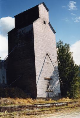
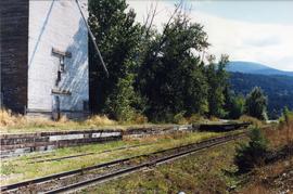
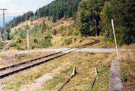
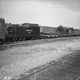
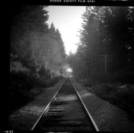
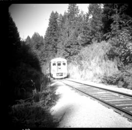
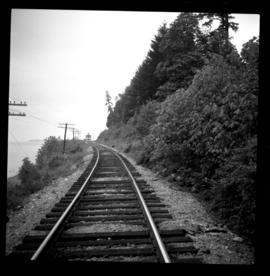
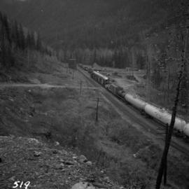
Postcard depicts a CPR streamliner crossing the Canadian Rocky Mountains.
Photograph depicts the crossing of the CNR mainline over the former CPR Kettle Valley Line at mile 53.6 from Brookmere. The speed restriction was 15 mph and the crossing was controlled by signals that interlocked automatically. The view is looking east.
Photograph depicts the Creston Sawmills Ltd on the CPR line. Here the southern BC CPR mainline passes through the center of trackage, looking eastbound. A chip car is on the spur directly leading from the camera.
Photograph depicts a crane and tugboat docked at an unknown location.
Photograph depicts a water tank that was now part of the Cranbrook Railway Museum.
Photograph depicts locomotive cars waiting for stage two of the Cranbrook Railway Museum's development of artifacts.
Photograph depicts Craigellachie station, a famous spot on the C.P.R. line. The trans-continental line was joined here on November 7, 1885, about 250 yards down the track just beyond the right hand colour aspect signal. The depot house is not manned, used by the line side crews to store equipment. In former days it was a passing point, but there are very few houses in the area now.
Photograph depicts the CPR yards at Drake St. The view is looking east to the Cambie St. bridge in Vancouver. The track behind the camera leads to the Homer St. warehouse complex.
Photograph depicts the C.P.R. yards on Cambie St. in Vancouver, B.C. The view is looking west with False Creek on the left (out of the picture), after a snowfall.
Photograph depicts the CPR yards in Vancouver, adjacent to Centennial Pier. The view is looking west.
Photograph depicts the C.P.R. yards just west of downtown passenger station and in front of Pier B, owned by the C.P.R. The view is looking northwest from Burrard St.
Photograph depicts the C.P.R. yards in Vancouver, just west of railway station in the downtown area. The view is looking east from Burrard St.
Photograph depicts a general view of the C.P.R. yards at False Creek in Vancouver, B.C.
Photograph depicts the CPR locomotive yards at Drake St. in Vancouver. The disused winch in shack is used for moving cars into the repair shed. There is bushes growing out of the track.
Photograph depicts lumber mill yard at the end of the 31st mile. A brand line is beside Slocan Lake. Shows flat chip and E bulkhead cars of C.P's as well as 500 flat cars.
Photograph depicts mechanized tie replacements.
Photograph depicts a ballast car filled with gravel, not track ballast.
Photograph depicts the rear view of an elevator showing its name. Track was on the far side.
Photograph depicts a grain elevator which Wynndel was famous for.
Photograph depicts a grain elevator that had a 7 car spur to service it. Davies doubted if grain traffic ever moved by rail near Wynndel. Two flat cars appeared to have used the platform to overload machinery and vehicles.
Photograph taken looking north, with a spur in the foreground. It was used by ore mixed freight daily. It was believed that at the bottom of the grade was a junction with a GNR branch that ran from the US border south of Creston to Kootenay Lake (built in 1904, then was hardly used, finally ceased in 1910).
Photograph depicts a C.P.R. wrecking train unit at Vancouver station.
Photograph depicts a C.P.R. wrecking crane at the Vancouver station.
Photograph depicts CPR wreck crane #414475 and reach car # 402093. The crane has a 200 ton capacity and was manufactured in 1929 by the Industrial Brownhoist Corp. in Cleveland, Ohio. It's a type 2, steam crane #5162. Freestanding it is 30ft. The radius equals a 17 ton lift and outrigged at 17ft , 200 ton lift. Nelson lies 138 miles to the west.
Photograph depicts a CPR wreck crane stationed in Kamloops. It had just come from a crash site about 7 miles south from a hauling hopper car on a makeshift set up. Nearest set of tracks belonged to the car and were properly placed. Rear set of bogies were taken from the wreck site and the end of the wrecked car was placed on them.
Photograph depicts a CPR work train at Princeton. It shows passenger car #411375, used as cook, dinner, and sleeper. It was built in May 1929. The LT weight is 178, 000.
Photograph depicts a CPR work car at Princeton. It is #42238 and originally marked "Auto Mobile." It was built in June 1923. The length is 40'6", width 8'6", and height 10'. The weight LT is 46, 200.
Photograph depicts mile 18.5 on Slocan Subdivision looking North. Terminal at Slocan is at mile 31.3. Rails weighed 85 Ibs and were dated 1902 and 1910-1912.
Photograph depicts the C.P.R. wharf-scow approach ramp at Kelowna, looking east. Okanagan Lake is behind the camera.
Photograph depicts a CPR wharf building at Okanagan Landing, Okanagan Lake. It was presumably used as a covered slipway and as a store. It was was now boarded up and the rail track between Vernon and Okanagan Landing was removed in 1940.
Photograph depicts the C.P.R. wharf at Kaslo on Kootenay Lake. The wharf is used to load/unload cars from vehicles or lake scows. The ferry slip itself is beyond the tank cars, at the center middle distance of the photo.
Photo was taken approximately five minutes north of Duncan, Vancouver Island. Steel passenger car #411292 is visible and has been converted to a bunk and mess car as part of a work train on a stations spur. There are 6 wheel trucks. There is no date indicated for the building.
Photo was taken approximately five minutes north of Duncan, Vancouver Island. A track crane is visible.
Photo was taken approximately five minutes north of Duncan, Vancouver Island. A work train on the siding, including a steel passenger car #411292 are visible.
Photograph depicts the C.P.R. westbound freight train at passing loop at Illecillewaet, between Rogers Pass and Revelstoke. The April 25, 1965 CPR Employee timetable lists the mileage at Illecillewaet as 98.2 with a siding capacity of 85 cars.
Photograph depicts a C.P.R. way-freight at the disused Wellington Depot on the Esquimalt and Nanaimo Railway, 4 miles north of Nanaimo.
Photograph depicts the CPR way freight about 1 mile west of Dot (mile 20.3 from Spences Bridge) on the Spences Bridge-Merritt line, travelling east. There are about 20 cars in the train.
Photograph depicts the CPR waterfront yards in Vancouver Harbour. Roil was on the displayed flat car in order to build a new spur the led to a recently constructed rail-ferry slip.
Photograph depicts CPR waterfront trackage in Vancouver.
Photograph depicts CPR water service car #415222 at Ashcroft. The car was attached to a work crew train.
Photograph annotation states that image depicts a CPR warehouse located about 1/4 mile east of the Revelstoke depot, on the north side of the track. The view is looking east. Additional information provided by railway historian Tom W. Parkin: This building is the CPR icehouse at Revelstoke after a partial tear-down. The structure was built after 1929, when a similar facility near the locomotive shops was removed between 1920-29, possibly to make room for a larger turntable. The location is on the northwest edge of the CPR yards. Icehouses once made and stored blocks of ice for refrigeration of passenger coaches and (when crushed) for cooling fresh produce in "reefer cars" en route to market.
Photograph depicts the CPR Victoria yards. Picture displays former tender as (fire) water carrier #415740.
Photograph depicts the Victoria rail yards. The photograph faces east at the turntable and locomotive shed/roundhouse. 3 or 4 stalls are occupied.
Photograph depicts possibly the Esquimalt & Nanaimo Railway train shipment sheds. They do not look to be in regular use. The photograph faces towards the east.
Photograph taken at the CPR Vernon station. Way freight visible.
Photograph depicts way freight in use after the removal of cabooses on the main lines in January and February, 1990.
Photograph depicts the Langford Flag Stop on the northern outskirts of Victoria at mile 7.9. The photograph looks toward the terminal at Courtenay. Two passenger trains pass here daily, except on Sundays. 0745 north bound, 1543 southbound, and 3 freights daily, 0257 hrs. south, 0550 hrs. north, and 1819 hrs. north.
Photograph depicts a daily passenger train north bound passing Goldstream Provincial Park between Goldstream and Niagara at about mile 12 or 13 (from Victoria). The train is reflecting a diesel fume cloud.
Photograph depicts a daily Budd car passenger train north bound passing edge of Goldstream Provincial Park between Goldstream (mile 10.7 from Victoria) and Niagara (about mile 14). It is an upgrade.
Photograph taken on mile 85 which is about 15 miles north of Nanaimo and on the edge of Nanoose Bay. Image captured looking towards the south. The retreating "Dayliner" can be seen in the distance.