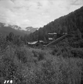
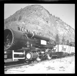
Postcard depicts Mt. Stephen and Field, BC
Postcard depicts Mt. Stephen.
Postcard depicts Mt. Stephen near Field, BC
Postcard depicts Kicking Horse Canyon near Mt. Field.
Postcard depicts Mt. Field and Kicking Horse River near Yoho National Park.
Postcard depicts Mt, Begbie with railway and traffic bridges.
Photograph depicts Moyie Lake, 15 miles south of Cranbrook, and Moyie Station. The tailings are from a lead and zinc mine directly to the right of the photograph on the hillside. The view is looking north.
Photo depict Movat's store where you could buy food, dry goods, and hardware among other things. Located beside the original pier on Salt Spring Island, now little used for general and commercial traffic.
Postcard taken at the Laggan Subdivision, the most famous photograph location on the CPR system due to its official photographer, Nicholas Morrant, 1910-1986. Possibly a 1920's view. From 1978, this location became known as 'Morant's Curve.' This view was a rarity in showing no train on the track.
Postcard depicts engine #154 on Mountain Creek Bridge in 1885. Bridge-164 ft, in height, 1086 ft. in length.
Postcard depicts Mt. Stephen in Field, BC
Postcard depicts Mt. Stephen and the CPR's hotel in Field, BC
Photograph depicts the rear end of the car labelled "Mount Stephen."
Photograph depicts close up of the car named "Mount Stephen," built in 1926. It was one of the cars that comprised the President's train that stayed in Nelson for the first weekend of August, 1997 during the city's centennial celebrations.
Photograph depicts Mount Pleasant Elementary School in Vancouver. Date over doorway was 1892.
Postcard depicts Mount Field from a CPR hotel in Field, Canadian Rocky Mountains.
Postcard depicts Mt. Bonny near Glacier, BC.
Photograph depicts a motor trolley travelling east and dropping off ties at the Canadian National Railway (CN) track side about a half mile east of Fort Langley/
Postcard depicts Morant's Curve which was the most famous photograph location on the Canadian Pacific Railway. Here it was seeen with the Bow Range on the Continental Divide in the background.
Photograph depicts the moorings in front of the Bayshore Hotel in Coal Harbour, Vancouver.
Photograph depicts the mooring on south side of Coal Harbour and 100 yards east of the Bayshore Hotel, looking northwest to north.
Photograph depicts the Monte Creek reaction ferry that was closed on August 6, 1972.
Photograph depicts a monoplane in Tofino Harbour, near Longbeach, on Vancouver Island.
Photograph depicts Moha Bridge which crosses the Yalakon River. Taken at the side of a derelict mining village.
Photograph depicts a one-tenth scale model of a Fairmont track vehicle. Presented to Giovanni Marra in 1973.
Photograph depicts a model of a Fairmont track motor of the 1960's.
Photograph depicts a model of a Fairmont track car that was presented to Giovanni Marra in 1973 and built by L.G. Snowden.
Photograph depicts a model of a 2 man track car presented to Giovanni Marra in 1973 upon his retirement as a CPR Kamloops road master. Model made by L.G. Snowden (modeller and then locomotive engineer for CPR).
Photograph depicts a mobile transformer of the B.C. Hydro Railway in use at the freight yard below the Georgia Viaduct.
Photograph depicts mixed freight with 5 ballast cars at the rear, running east through the former New Westminster depot, which is just to the left of the photo. The view is looking southwest.
Photograph depicts the Mission City rail and road bridge. It is owned by the CPR and was opened in 1891. It was used by road vehicles between 1 July 1927 and the 23 June 1973, using a one way flow system. On the latter day, a new high level road bridge was unofficially opened. By early July 1973, the CPR had removed the wooden deck planking.
Photograph depicts the Mission City CPR depot located at mile 87.3 from North Bend in Cascade Substation. It was built in 1902 and add onto in 1909. It has living quarters on the 2nd floor that are still in use, which is quite rare for BC in 1973.
Photograph depicts the Mission City CPR depot located at mile 87.3 from North Bend in Cascade Substation. It was built in 1902 and add onto in 1909. It has living quarters on the 2nd floor that are still in use, which is quite rare for BC in 1973. It is 41.7 miles from Vancouver and 2, 839.6 miles from Montreal.
Photograph depicts a mineral ore (lead or zinc?) mines near the ghost town of Sandon, on the road between Kaslo and New Denver.
Photograph depicts four mine sweepers crewed by officer cadets from Royal Roads that were undergoing navigational instruction. The sweepers were tied up for the night.
Photograph depicts four mine sweepers crewed by officer cadets from Royal Roads, Esquimalt.
Photograph depicts a public display erected in Slocan. Visible is a mine shaft ore hauling donkey engine of 1921.
Photograph depicts a mine ore car exhibited on the site of the Granby Mine at the ghost town of Phoenix, near Grand Forks.
Photograph depicts a mine 200 yards south of Moyie village, which is 20 miles south of Cranbrook. It produced silver, zinc, and lead from 1900-1910 and had a smelter a quarter mile away. The shaft was 900 ft. deep, with levels going under Moyie Lake. The head gear dates from 1925-1935 and has electric winding.
Photograph depicts a narrow gauge mine locomotive built bu Hunslet Engine Company Ltd., Leeds, England in 1949. It was used by the Elk River Colliery until about 1965.
Photograph depicts a mine car at Moyie mine, at Moyie, 20 miles south of Cranbrook. The mine produced silver, zinc, and lead, and worked principally from 1900-1910. It is now disused.
Photograph depicts the mine buildings of the mine at Coal Creek that closed in 1959. The newer buildings date to circa 1930. Much of the standard gauge trackage of Morrissey, Fernie, and Michel railway (subsidiary of the Great Northern Railway) in mine area remains. The track between Coal Creek and Fernie has not been lifted.
Photograph depicts a mine building at the copper mine in Britannia Beach. The mine was still in use and well maintained.
Photograph taken on the CPR branch from Vernon to Lumby. Depicts a mill just west of Lumby (Possibly Lavington Planer Mills or Riverside Forest Mill). Daily way freights by CN and CP.
Photograph depicts a mill and beehive burner.
Photograph depicts the Midway CPR depot located at the eastern terminus of Kettle Valley Railway. It was a subdivisional point with way freights originating at Nelson and Penticton, and running west and east respectively to Midway. There are two to 3 freights weekly from Nelson and 1 to 2 from Penticton. It lost its agency in June 1969 and all small freight [
Photograph depicts the middle section of C.P.R. Pier A1 at the foot of Thurlow St., which was built in 1890. The pier is in regular use though its seaward face is in very poor shape.
Photograph depicts a compressed air locomotive that was built in 1901 for Michel underground coal mine work. It was removed from workings in 1965.
Photograph depicts a compressed air locomotive that was built in 1901 for Michel underground coal mine work. It was removed from workings in 1965 and was purchased by the present owner as an exhibit.