Showing 1029 results

Archival description
529 results with digital objects Show results with digital objects
Landslides
2000.1.1.3.06 · File · 1979 - 1989
Part of Cassiar Asbestos Corporation Ltd. fonds

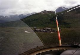
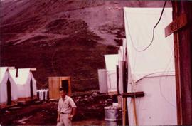
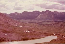
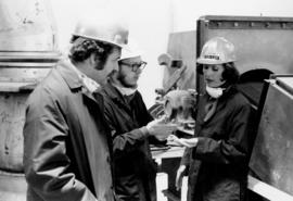
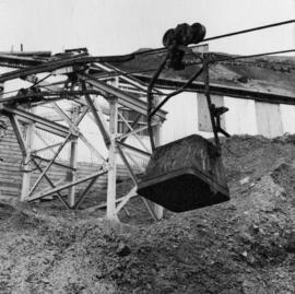
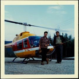
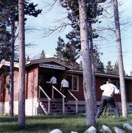
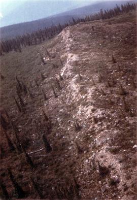
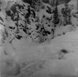
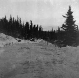
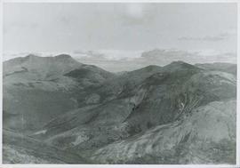
File contains images depicting various landslides near Cassiar BC. Set of 20 photographs (with 9 corresponding negative strips) date stamped June 1987 depict landslide near creek and dirt road with a Cassiar company truck. Set of 5 black and white photographs found in envelope marked "D. Stewart" are likely from 1988-1989 and depict a rockslide on the south western side of the pit mine, near the tramline. Album entitled “6200 DUMP SLIDE / SPRING, 1979” contains 34 photographs depicting aerial shots of a massive rockslide on the eastern slope of McDame Mountain, originating from the mine waste dump. Several images from album show greenish water pooling in the toe of the slide.

2000.1.1.1.06.02 · Item · 1966
Part of Cassiar Asbestos Corporation Ltd. fonds

Photograph depicts man believed to be Matt Bell standing in Kutcho Creek exploration camp. The camp was set up by a crew led by Cassiar's Chief Geologist Bill Plumb. Tents on either side, wood structure in background. Sign on wood post: "PLUMB BLVD."

2000.1.1.1.06 · File · 1966 - 1991
Part of Cassiar Asbestos Corporation Ltd. fonds

This collection is of Kutcho Creek Camp that was set up by a crew led by Cassiar's Chief Geologist Bill Plumb in 1966.

There are six photographs showing the temporary buildings, paths and barrels. These photos were taken from a high hill looking down at the camp. Two photographs depicts the valley of Kutcho Creek area, and the exploration camp is in the distance at foot of hill. One photograph depicts valley of Kutcho Creek area with a body of water in foreground, and mountains in background.
Another photograph depicts man believed to be Matt Bell standing in Kutcho Creek exploration camp. There are tents on either side, a wood structure in background and a sign on wood post: "PLUMB BLVD."
One photograph believed to have been taken near Kutcho Creek, during the initial exploration trip led by Cassiar's Chief Geologist Bill Plumb. Bill stands to left of man believed to be Matt Bell in right foreground. Bulldozer works along talus slope in left foreground.
Another photograph of this initial trip shows a bulldozer working along talus slope in centre of image.

2000.1.1.3.15.25 · Item · 1961
Part of Cassiar Asbestos Corporation Ltd. fonds

Photograph depicts ore haul truck at dump in mine, driver visible, mountain range in background. Handwritten annotation on recto of photograph: "Kenworth - Model 802 dumping stripping waste at 6565 Elevation", on verso: "1961".

Keno Hill - Transport Truck
2000.1.1.1.09.06 · Item · [196-?]
Part of Cassiar Asbestos Corporation Ltd. fonds

Photograph depicts a transport truck owned by United Keno Hill Mines Ltd. in mill yard at Elsa, preparing to haul to Whitehorse. It is speculated that this photograph may have been kept for research purposes.

2000.1.1.1.09.05 · Item · [196-?]
Part of Cassiar Asbestos Corporation Ltd. fonds

Photograph depicts tramline that runs from Hector and Calumet mines to Elsa Mill (all owned by United Keno Hill Mines Ltd.) Single staff residence on right, single workmen residence in middle. It is speculated that this photograph may have been kept for research purposes.

2000.1.1.1.09.04 · Item · [196-?]
Part of Cassiar Asbestos Corporation Ltd. fonds

Photograph depicts miner tramming ore in mine shaft at Hector-Calumet Mines (owned by United Keno Hill Mines Ltd.), Mayo Mining District, Y.T. It is speculated that this photo may have been kept for research purposes.

2000.1.1.1.09.07 · Item · [196-?]
Part of Cassiar Asbestos Corporation Ltd. fonds

Photograph depicts a transport truck being loaded with concentrates of silver-lead and zinc ores at Elsa Mill, Mayo Mining district, Y.T (owned by United Keno Hill Mines Ltd.). It is speculated that this photograph may have been kept for research purposes.

Keno Hill - Calumet Townsite
2000.1.1.1.09.09 · Item · [ca. 1960]
Part of Cassiar Asbestos Corporation Ltd. fonds

Photograph depicts the Calumet townsite owned by United Keno Hill Mines Ltd. Photograph faces east, tramline beneath mine tailings pile runs to the Elsa mill. It is speculated that the photograph may have been kept for research purposes.

2000.1.1.4.2.1 · Item · 1962
Part of Cassiar Asbestos Corporation Ltd. fonds

Typed annotation on caption adhered to recto of photograph: "Presentation of Open Pit Mines and Quarries Annual Safety Award by W.K. Kiernan, Minister of Mines, British Columbia to J.G. Berry, General Superintendent, Cassiar Asbestos Corporation. Cassiar Asbestos Corporation won the trophy for the year 1962 with a compensable accident frequency of 7.19." Photograph depicts J.G. Berry shaking hands with Mr. Kiernan as he accepts a plaque from the "DEPARTMENT OF MINES AND PETROLEUM RESOURCES." A man and woman are partially visible at table behind them. Curtains on wall in background.

2000.1.1.3.15.24 · Item · 1961
Part of Cassiar Asbestos Corporation Ltd. fonds

Photograph depicts ore haul truck at dump in mine, mountain range in background. Photo also features driver and a second unidentified man standing in front of truck. Handwritten annotation on recto of photograph: "Int. Harvester Payhauler Model 95 dumping stripping waste at 6565 Elevation", on verso: "1961".

Infrared dryer
2000.1.1.1.10 · File · 1963
Part of Cassiar Asbestos Corporation Ltd. fonds

Two large black and white prints of infrared dryers annotated on recto "Thompson Pipe and Steel Company Bulk Material Dryers Van Dorn Iron Works Company" and bearing on verso the ink stamp of a photographer from Cleveland, Ohio.

Incoming Bucket, Station #1
2000.1.1.3.17.004 · Item · 1962
Part of Cassiar Asbestos Corporation Ltd. fonds

Photograph depicts bucket hanging from tramline in foreground. Support tower stands in midground in front of station building. Another building can be seen at top of mountain in background. Handwritten annotation on recto of photograph: "INCOMING BUCKET #1 STATION". Photograph was glued to cardboard backing with the annotation: "1962".

House - Small Business File
2000.1.1.3.12 · File · 9 June 1992
Part of Cassiar Asbestos Corporation Ltd. fonds

File contains images depicting room by room view of a house in Cassiar identified as house 288. Handwritten annotation on verso of photographs: "288 June-9-1992". Photographs originally found in file labeled "TOWN ADMINISTRATION Small Business 1981"; it is likely that these images form part of the process documentation for a small business license.

Hospital and Dental Clinic
2000.1.1.3.07 · File · 25 July 1980
Part of Cassiar Asbestos Corporation Ltd. fonds

File contains photographs of a report completed in 1980 depicting the ambulance garage, as well as the interior and exterior of the hospital building in Cassiar, B.C. Each room is captured, as well as medical equipment such as the X-ray, audiometer, lung function apparatus, and autoclave. A doctor, two nurses, and several patients are shown. Accompanying report contains a description of the medical facilities in Cassiar including a detailed budget, description of staffing and utility requirements, and a floor plan of the facilities.

In addition there are two albums of Cassiar Hospital and Pharmacy Staff engaging in social functions. These photographs appear to be informal and depict staff parties, people at work and some of the patients, including their thank you notes to the Cassiar Hospital staff.

2000.1.1.3.19.101 · Item · [ca. 1975]
Part of Cassiar Asbestos Corporation Ltd. fonds

Photograph depicts the West Peak of the Cassiar mine on McDame Mountain. Pit area visible between West Peak and road in foreground. Mine valley and north mountain range in background. Photo speculated to have been taken from a point on or near the South or North Peak.

Hammer at Excavated Wall
2000.1.1.1.07.03 · Item · [1963?]
Part of Cassiar Asbestos Corporation Ltd. fonds

Photograph depicts a geologist's hammer, believed to belong to Cassiar's Chief Geologist Bill Plumb. The hammer provides a scale for the exposed asbestos, indicating the percent of fibre in the rock as well as the expectation of grade.

Hammer at Excavated Wall
2000.1.1.1.07.07 · Item · [1963?]
Part of Cassiar Asbestos Corporation Ltd. fonds

Photograph depicts a geologist's hammer, believed to belong to Cassiar's Chief Geologist Bill Plumb. The hammer provides a scale for the exposed asbestos, indicating the percent of fibre in the rock as well as the expectation of grade.

Gravel Pit
2000.1.1.3.18.013 · Item · June 1987
Part of Cassiar Asbestos Corporation Ltd. fonds

Photograph depicts close up view of gravel pit, ruler displayed for scale. Photograph speculated to have been taken at the plant or near the Cassiar airstrip. Stamped annotation on recto of photograph: "JUN. 1987".

Glacier on McDame Creek Road
2000.1.1.1.03.09 · Item · 24 December 1951
Part of Cassiar Asbestos Corporation Ltd. fonds

Photograph depicts McDame Creek Road, snow-covered and taken from center of road 1.5 miles from the early construction camp at Cassiar. Two stakes in foreground, one on either side of road. Glacier is believed to be crossing road between two stakes. Trees on either side of road, trees and hills in background.

Geology rock samples
2000.1.1.1.12 · File · 1977 - 1991
Part of Cassiar Asbestos Corporation Ltd. fonds

The file contains eight photographs depicting close up images of three rock samples, some photographed with a ruler for scale. One of the rock samples is speculated to be obsidian and the other two are likely serpentine. The images where originally found in an envelope titled "ROCKS" and are likely dated around 1991.

Included in this file are an five photographs of rocks on a shelf, which may be asbestos sample rocks. There are five accompanying negatives to these photographs and are likely dated around 1977. The photographs and negatives were found in an envelope labelled "Negatives - CIMM Photos."

Additionally two negative strips of geology maps of Canada. These negatives were found in an envelope labelled "Negatives - CIMM Papers, Mining, Planning, Geology."

General Operations Albums
2000.1.1.3.19 · File · 1961 - [ca.1985]
Part of Cassiar Asbestos Corporation Ltd. fonds

File includes six aggregations of photographs which have been assembled in this file in order to maintain the integrity of each group by keeping the photos arranged together, though each group features operations pertaining to multiple files in this subseries. Includes groups featuring photos from 1961, 1965 1971, a helicopter trip, a community album, and a workplace album. Photographs depict images pertaining to the following operations at Cassiar, B.C.: mining, milling, maintenance, labratory tests, and tramline and town operations. Images featuring operations of the company town include the grocery store, bank, churches, school, library, lounge, pool, theater, community center, outdoor recreation, hospital, dentist, cafeteria, bus route, residences, air strip, firehall, laundromat, park, police, and newspaper.

2000.1.1.3 · Subseries · [between 1952 and 1992]
Part of Cassiar Asbestos Corporation Ltd. fonds

Subseries consists of photographic material pertaining to the following subject areas: mine operations; plant operations;labour strike 1970s images; townsite operations of the company towns of Cassiar and Clinton Creek (including community activities associated therein and townsite development); as well as, images of mines not owned by Cassiar Asbestos Corporation, but which are believed to have been used for operational research purposes.

Furnace Pad at Crusher Site
2000.1.1.2.03.12 · Item · 25 August 1964
Part of Cassiar Asbestos Corporation Ltd. fonds

Handwritten annotation on recto of photograph: "FURNACE PAD AUG 25/64." Photograph depicts construction worker standing on elevated wood platform. Three other men can be seen working in construction area. This location is believed to be under the conveyor to crusher building, retaining wall in midground.

2000.1.1.2.03.04 · Item · 4 July 1964
Part of Cassiar Asbestos Corporation Ltd. fonds

Handwritten annotation on recto of photograph: "FORMING FOOTING RETAINING WALL JULY 4/64." Photograph depicts construction workers
standing in forms for cement laid against mountain wall on high elevation of construction site. A retaining structure made with wood planks and rebar separates mountainside dirt from cement forms. A front end loader can be seen in midground, near unidentified building. Mountain range in background.