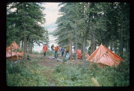
Image depicts an aerial view of the BC Rail, in Prince George, B.C. It is now known as CN Rail.
Photograph depicts Buchanan Benson Real Estate and Insurance at 1276 4th Avenue.
Image depicts a vehicle parked beside a small, wooden house in Upper Fraser, B.C. Map coordinates 54°07'05.7"N 121°56'38.9"W
Image depicts an unknown building under construction at the corner of 6th Avenue and Dominion Street in Prince George, B.C.
Image depicts numerous buildings and a dock on the shore of Haida Gwaii, B.C..
Image depicts several old buildings in a field, one of which has a caved-in roof, in Newlands, B.C. Map coordinates 54°06'28.2"N 122°12'01.0"W
Image depicts a row of buildings in Upper Fraser, B.C. with the store (titled "Paradise") with a Pepsi sign. Map coordinates 54°07'09.1"N 121°56'47.0"W
Image depicts the Bulkley River.
Image depicts the Bulkley River near Moricetown, B.C.
Image depicts numerous unknown individuals standing by the Bulkley River near Moricetown, B.C.
Image depicts a small group of people standing near the Bulkley River at Moricetown, B.C.
Image depicts a section of forest in the Bulkley Valley.
Image depicts a view of Bulkley Valley.
Image depicts a stretch of road through the Bulkley Valley.
Image depicts a bulldozer and truck in an unknown location.
Image depicts an old, half-collapsed house in Likely, B.C.. The slide labels it as "Bullion house."
Image depicts the upper end of the Bullion Pit in Likely, B.C.
Image depicts bunkhouse, restaurant and store in Sinclair Mills, B.C. Map coordinates 54°01'17.4"N 121°40'53.0"W
Image depicts Burns Lake, B.C.
Image depicts a stretch of road somewhere at Burns Lake, B.C.
Image depicts a street in Burns Lake, B.C.
Image depicts the welcome sign in Burns Lake, B.C.
Image depicts a street of businesses, possibly 3rd Avenue, in Prince George, B.C.
Photograph depicts various businesses along 3rd Avenue. The businesses include the Europe Hotel and The Bay in the background. Annotation on verso: "left Europe Hotel, right shearer bldg".
Photograph depicts Businesses in downtown in the North Thompson region, including a business 'Something Old & Something New'.
Photograph depicts Businesses in downtown in the North Thompson region, including a business '5 seasons, Sports Excellence'.
Photograph depicts Businesses in downtown in the North Thompson region, including a business called 'Something old & Something new'.
Photograph depicts Businesses in downtown in the North Thompson region, including a sign reading "Welcome to historic George Street" and a business called "Lizard River".
Photograph depicts Businesses in downtown in the North Thompson region, including a sign reading "Welcome to historic George Street" and Levi's jeans store.
Image depicts a cabin at an unknown location.
Image depicts a cabin somewhere in Mud River, B.C.
Image depicts a cabin at an uncertain location.
Image depicts a cabin somewhere in Mud River, B.C.
Image depicts a nature trail along the Nechako River at Island Cache looking west with the cutbanks in the background. Map coordinates 53°55'36.2"N 122°45'11.8"W
Image depicts some cacti somewhere near Soda Creek, B.C.
File contains slides depicting places in California, USA.
Image depicts an unknown individual eating in a camp somewhere in South Tweedsmuir Provincial Park.
Image depicts a campsite somewhere near Berg Lake.
Image depicts group of people at a camp somewhere in Mt. Robson Provincial Park.
Image depicts a camp on the shore of a lake in South Tweedsmuir Provincial Park. The man sitting in the bottom right corner is possibly Kent Sedgwick.
Image depicts a group of individuals at camp somewhere in Mt. Robson Provincial Park.
Image depicts a camp and what is likely Mt. Robson in the background.
Image depicts a camp of people with Mt. Robson and the Berg Glacier in the background.