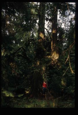
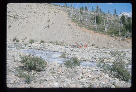
Image depicts a group of people on the rocky bank of a river somewhere near Mt. Robson.
Photograph depicts people sitting on chairs in a circle in a backyard.
Image depicts an individual, possibly Sue Sedgwick, standing next to a very thick and tall tree somewhere on Haida Gwaii.
Image depicts an individual standing on a trail in the coastal forest on Haida Gwaii, B.C.
Image depicts an individual ducking under a tree branch somewhere in Haida Gwaii, B.C.
Image depicts an individual walking on a a log bridge in a forest somewhere on Haida Gwaii.
Image depicts an individual walking on a path through a forest somewhere on Haida Gwaii.
File contains slides depicting the Peyto Glacier.
Image depicts two trains in Prince George, B.C.
File contains slides depicting aerial views of Prince George.
File contains slides depicting landforms at various locations.
File contains slides depicting the growth of Prince George.
Image depicts an aerial view of areas that have been used for logging around Prince George, B.C.
Image depicts an aerial view of the Ahbau area somewhere near Prince George, B.C.
Image depicts the Prince George Multiplex.
File contains slides depicting maps and site plans for the city of Prince George.
File contains slides depicting images of Prince George ranging from 1975 to 2003.
File contains slides depicting the grade for what was formerly the Pacific Great Eastern, and is now known as British Columbia Railway.
Image depicts a view of the south direction of the grade for the British Columbia Railway, which was formerly known as the Pacific Great Eastern until 1972. It is at an uncertain location, possibly near Woodpecker or Prince George.
Image depicts an unknown woman taking pictures. Nearby are the skeletal remains of an unknown animal. The location is somewhere near the upper Fraser Canyon.
File consists of a printed email correspondence between Ramona Rose, Florence Smith, and Sue Sedgwick regarding an additional donation of photographic negatives. The file includes photographs depicting photographs of Knox United Church and historic Prince George.
File contains slides depicting physical landscape features at various locations, most are from outside Northern B.C.
Image depicts a pile of dead trees in a forest somewhere on Haida Gwaii.
Image depicts Pine Centre Mall in Prince George, B. C. Map coordinates 53°53'53.2"N 122°46'36.4"W
Image depicts an aerial view of Pine Centre Mall and Masich Place Stadium in Prince George, B.C.
Image depicts a view of Pine Pass.
Image depicts an unidentified individual standing near a drop-off in the Pine Pass between Alberta and British Columbia. The sign behind the individual reads: "Pine Pass - 2,868 FT. Here the great barrier of the Rock Mountains is breached by the lowest highway pass. Once the remote route of the trapper, it now links the commerce of the north and markets of the south. The John Hart Highway was completed in 1952 and followed by the P.G.E. in 1958. Gas and oil lines also take advantage of this convenient natural feature."
Image depicts a view of what is possibly the Pine Pass located near the Murray Ridge.
File contains slides depicting places in or near Pine Pass and along the Peace River.
Image depicts the Pine Tree Restaurant in Atlin, B.C. It is possibly part of the Atlin Museum.
Image depicts what is either the Peace or Kiskatinaw River in Pine Valley, B.C.
Image depicts Pineview on Buckhorn Lake Road, Prince George, B.C.
Image depicts an old barn somewhere in the Pineview subdivision in Prince George, B.C.
Image depicts an old Swedish style house somewhere in the Pineview subdivision in Prince George, B.C.
Image depicts a pipeline at Shelley, B.C.
Image depicts the mostly frozen Place Creek Falls.
Image depicts the Place Glacier.
Image depicts two unknown individuals at the Place Glacier.
Image depicts the Place Glacier. There are two unknown individuals present.
Image depicts the Place Glacier.