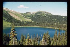
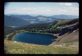
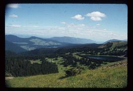
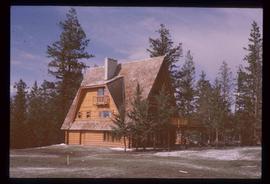
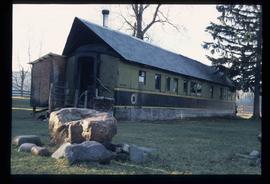
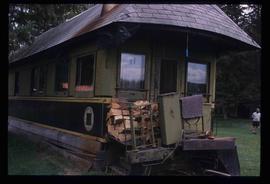
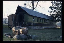
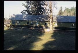
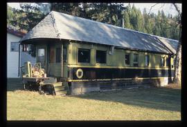
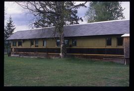
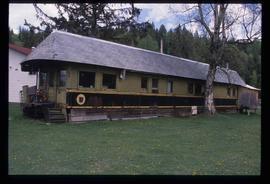
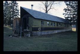
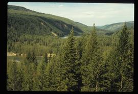
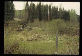
File contains slides depicting Raven Lake and its surrounding areas.
Image depicts a view of Raven Lake.
Image depicts a view of Raven Lake and the surrounding area.
Photograph depicts the graves of Seward Rankin, Gerald Rankin, and James Rankin at the Soda Creek Cemetery.
Image depicts the ranch house of the Ranch of the Vikings, originally owned and operated by Bjorger Pettersen, a member of the Canadian Ski Hall of Fame, from 1970 until 1985. It is located somewhere west of McBride, B.C.
Image depicts a wooden Ranch House at an uncertain location.
Image depicts the Ramada Hotel in Prince George, B.C.
File contains slides depicting the Ram Glacier.
Image depicts a pair of Rainbow trout from Indianpoint Lake.
Photograph depicts an octagonal railway water tower at an unknown location.
Image depicts a group of individuals who appear to be searching through the rocks near a railway track. It is possibly part of an educational trip.
Image depicts railway tracks on the right side of the image, and several old houses alongside it. The location is uncertain.
Image depicts a set of railway tracks and a long building located somewhere in the Peace River Region.
Photograph depicts a landscape, with mountains in the background and trees in the foreground.
Photograph depicts railway tracks, surrounded by trees on both sides.
Photograph depicts a section of railway trackage, presumed to be located within or nearby Sinclair Mills, BC.
Photograph depicts a section of railway trackage, presumed to be located within or nearby Sinclair Mills, BC. There is a man on the other side of the railway tracks.
Photograph depicts a section of railway trackage, presumed to be located within or nearby Sinclair Mills, BC.
Photograph depicts a section of railway trackage with a pile of locks stacked beside the rail line, presumed to be located within or nearby Sinclair Mills, BC.
Photograph depicts a section of railway trackage, presumed to be located within or nearby Sinclair Mills, BC with an old truck parked beside the tracks and the forest.
Image depicts a railway bridge, possibly in the small town of Fraser, located on the Klondike Highway in B.C.
Image depicts two merging railway tracks, and what appears to be a frozen river, somewhere near the summit of a mountain.
Image depicts a man and woman standing in the mouth of a tunnel from the old Kettle Valley Rail Road.
Image depicts the mouth of a tunnel from the Kettle Valley Rail Road.
Image depicts an unknown figure standing inside a tunnel from the old Kettle Valley Rail Road.
Image depicts a tunnel from the old Kettle Valley Rail Road.
Image depicts a woman standing inside a tunnel from the old Kettle Valley Rail Road.
Image depicts the mouth of a tunnel from the Kettle Valley Rail Road.
Image depicts rail road tracks west of Takla Landing.
Image depicts rail road tracks at an uncertain location.
Image depicts a rail road construct from Highway 97 at Mile 126; the slide is also labelled "McAlister."
Image depicts a house made from a rail car in an uncertain location. It could be in Hixon, Red Rock, or Woodpecker, B.C.
Image depicts a general store in Quick, B.C.
Image depicts Kent Sedgwick standing in front of a sign with a dog in Quesnelle Forks, B.C. The sign describes the history of the site, which began as a mining camp in 1859, but was later completely abandoned after a fire in 1866. It is now managed as a Forest Service Recreation Project.
Image depicts the forest surrounding Quesnelle Forks.
Image depicts a dirt road and power-lines running through the woods, possibly near Quesnelle Forks.
Image depicts a collapsed wooden structure, possibly a bridge, which is likely located somewhere near Quesnelle Forks.
Image depicts an old building which has collapsed into a pile of wood, possibly in Quesnelle Forks.
Image depicts numerous abandoned and ruined cabins at Quesnelle Forks.