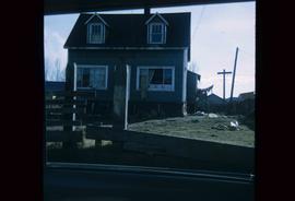
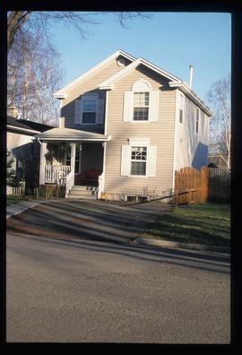
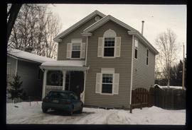
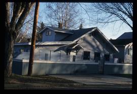
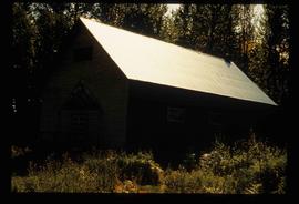
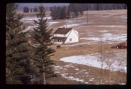
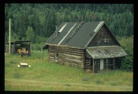
Photograph depicts an abandoned and worn out wooden building in a flat field.
Photograph depicts an abandoned and worn out grain elevator, with three buildings in a row and the elevators going down towards the ground.
Photograph depicts an abandoned and worn out grain elevator from the side.
Photograph depicts an abandoned and worn out grain elevator, with three buildings in a row and the elevators going down towards the ground.
Image depicts a street in Wells, B.C.
Image depicts a street in Wells, B.C. The Sunset Theatre and Gold Country Food Market are both present in the image.
Image depicts a street in Wells, B.C. The Wells Hotel is present in the image.
Image depicts a street in Wells, B.C.
Image depicts a street in Wells, B.C. The Sunset Theatre is located on the left of the image, and the Jack O' Clubs Hotel is the building with the green roof on the right. The hotel burned down on February 14th in 1994.
Image depicts a street in Island Cache.
Image depicts what appears to be a shed at an uncertain location.
Image depicts what appears to be a type of log bridge crossing a river somewhere on Haida Gwaii.
Image depicts what appears to be a motel somewhere near Bralorne, B.C.
Image depicts the interior of a kitchen at an uncertain location.
Image depicts three people standing at the front door of a house at an uncertain location.
Image depicts a house on the corner of 12th Ave and Vancouver Street in Prince George, B.C.
Image depicts a house on the corner of 7th Ave and Vancouver Street in Prince George, B.C.
Image depicts a house at an unknown location. It is possibly an old, Australian styled home.
Image depicts a house at Island Cache.
Image depicts a house which is possibly in Prince Rupert, B.C.
Image depicts a house in Island Cache.
Image depicts a house in disrepair, and possibly abandoned, in Island Cache.
Image depicts a house somewhere in Prince George, B.C.
Image depicts a house in Island Cache. There are several cars parked outside it.
Image depicts a hotel in what appears to be a small community, possibly an outlying area of Bralorne, B.C.
Image depicts a horse near a camper somewhere in Quesnelle Forks, B.C.
Image depicts the interior of a classroom at an uncertain location.
Image depicts a church in Wells, B.C.
Image depicts a church at an uncertain location.
Image depicts a building somewhere in Wells, B.C. There is a sign in one window which reads "Lon Oddfrey Insurance Realty LTD."
Image depicts a truck on a bridge, possibly crossing over the Peace River.
Image depicts 411 Patricia Boulevard in Prince George, B.C.
Image depicts a view of the corner of 3rd Avenue and Brunswick Street in Prince George, B.C.
Image depicts the Europe Hotel on the south side of 3rd Ave in Prince George, B.C.
Image depicts the south side of 3rd Ave in Prince George, B.C.
Image depicts a view of 3rd Avenue with the Columbus Hotel prior to the fire that destroyed it in 2008.
Image depicts an old log cabin at an uncertain location.
Image depicts 1690 Dogwood Street, on the corner of 17th Ave and Dogwood St. in Prince George, B.C. Also depicts a portion of 1670 Dogwood Street at left.
Image depicts 1650 Dogwood Street and 1670 Dogwood Street in the Millar Addition neighbourhood in Prince George, B.C.
Image depicts the intersection of 15th Ave and Highway 97 in Prince George, B.C.
Image depicts 1598 Fir Street in Prince George, B.C.
Image depicts 1590 Fir Street in Prince George, B.C.