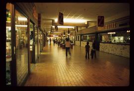
Image depicts the Prince George Public Library (Bob Harkins Branch). Map coordinates 53°54'44.6"N 122°45'01.7"W
File contains slides depicting maps for land use in Prince George.
Image depicts Prince George near the Airport Road.
Image depicts the Prince George Hotel.
Image depicts a Prince George residential area from the viewpoint of the Ginter Property.
Image depicts a view of Prince George from the cutbanks on the Nechako river.
Image depicts a view of Prince George from the cutbanks.
Image depicts Prince George from the view of Peden Hill.
Image depicts the Courthouse in Prince George, B.C.
Image depicts a clearing in Prince George, B.C., possibly in the Pineview area.
Image depicts a clearing in Prince George, B.C.
Image depicts Prince George at night from the cutbanks.
Image depicts Brunswick Street at 3rd Ave in -35 degree weather. Map coordinates 53°55'03.0"N 122°44'51.7"W
Image depicts 3rd Ave at Brunswick Street in -35 degree weather. Map coordinates 53°55'03.0"N 122°44'51.7"W
Image depicts an uncertain street in Prince George, B.C.
Image depicts a sawmill in Prince George, B.C.
Image depicts Prince George, with the picture looking North-Northeast from University Way.
Image depicts Prince George from University Way, with the P.G.I pulp mill in the distance.
Image depicts Prince George from University Way, with the P.G.I. Pulp Mill in the distance.
Image depicts a view of Prince George from City Hall looking northeast along George Street. Map coordinates 53°54'46.3"N 122°44'41.9"W
Image depicts downtown Prince George looking northwest. Map coordinates 53°54'48.7"N 122°44'45.6"W
Image depicts a view of Prince George from City Hall looking northeast along George Street. Map coordinates 53°54'46.3"N 122°44'41.9"W
Image depicts Prince George, possibly with the Northwood Pulpmill in the background.
Image depicts a view of Prince George from an uncertain location.
Image depicts a view of Prince George.
Image depicts Prince George, B.C.
Image depicts an aerial view of what is possibly an outlying area of Prince George, B.C.
Image depicts a view of Prince George.
Image depicts downtown Prince George looking northwest across Dominion Street. Map coordinates 53°54'48.7"N 122°44'45.6"W
Image depicts Prince George, possibly with the Northwood Pulpmill in the background.
Image depicts Prince George with numerous trees obscuring most of the view.
Image depicts Prince George.
Image depicts a view of Prince George.
Image depicts the interior of a mall in Prince Rupert, B.C. It is possibly the Pride O' the North shopping mall.
Image depicts the interior of the Pride O' the North shopping mall in Prince Rupert, B.C.
Image depicts the Pride O' the North shopping mall in Prince Rupert, B.C.
Previous site of sawmill in Giscome, B.C. looking northwest. Map coordinates 54°04'19.7"N 122°22'04.7"W
File contains slides depicting scenery at various locations.
Image depicts power lines east of the pulp mills in Prince George, B.C.
Image depicts a powerhouse in Prince George, B.C.
Photograph depicts a post office, presumably in Sinclair Mills.
Image depicts the post office in Wells, B.C.
Image depicts numerous lily pads on the surface of Portal Lake, located near the Yellowhead Pass on the British Columbia-Alberta border, west of Jasper, A.B.