Showing 3172 results

Archival description
3024 results with digital objects Show results with digital objects
Cariboo Road
2012.13.1.6.031 · Item · June 1974
Part of J. Kent Sedgwick fonds

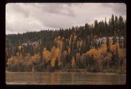
Image depicts the Cariboo Road at Hat Creek Ranch, near Highway 99 on the way to Lillooet.

Canyon Ridge
2012.13.1.15.29 · Item · [1975?]
Part of J. Kent Sedgwick fonds

Image depicts a view of the ridge above the Fraser River which forms the Grand Canyon, B.C.

Campsite
2012.13.1.73.11 · Item · Aug. 1979
Part of J. Kent Sedgwick fonds

Image depicts a man at a campsite somewhere near Murray Ridge.

Campsite
2012.13.1.84.34 · Item · 1994
Part of J. Kent Sedgwick fonds

Image depicts Sue Sedgwick seated in a lawn chair near a campfire and several other unidentified individuals, as well as three dogs. The location is uncertain.

Campground
2012.13.1.135.5.21 · Item · 2010
Part of J. Kent Sedgwick fonds

Photograph depicting a campground with log cabins and an open field surrounded by trees, presumably in Quesnelle Forks.

Campground
2012.13.1.135.5.19 · Item · 2010
Part of J. Kent Sedgwick fonds

Photograph depicting a campground and open field surrounded by trees, presumably in Quesnelle Forks.

Campground
2012.13.1.135.5.20 · Item · 2010
Part of J. Kent Sedgwick fonds

Photograph depicting a campground with log cabins and an open field surrounded by trees, presumably in Quesnelle Forks.

Campground
2012.13.1.135.5.22 · Item · 2010
Part of J. Kent Sedgwick fonds

Photograph depicting a river with rocks lining the shore and trees in the background, presumably at the campground in Quesnelle forks.

Campfire Company
2012.13.1.46.37 · Item · 1980
Part of J. Kent Sedgwick fonds

Image depicts Kent Sedgwick (the man with a pipe in green) and an unknown individual sitting around a campfire somewhere in South Tweedsmuir Provincial Park.

Campers
2012.13.1.45.05 · Item · 1983
Part of J. Kent Sedgwick fonds

Image depicts numerous campers and other vehicles in Tumbler Ridge, B.C.

Campers
2012.13.1.45.04 · Item · 1983
Part of J. Kent Sedgwick fonds

Image depicts numerous campers and other vehicles in Tumbler Ridge, B.C.

Camp ground
2012.13.1.135.5.17 · Item · 2010
Part of J. Kent Sedgwick fonds

Photograph depicting a camp ground, with fifth wheel's and vehicles parked in front of a lake, presumably taken at Quesnelle Forks campground.

Camp Fire
2012.13.1.65.64 · Item · May 1980
Part of J. Kent Sedgwick fonds

Image depicts a group of unknown individuals sitting around a camp fire at an uncertain location.

Camp
2012.13.1.46.44 · Item · 1980
Part of J. Kent Sedgwick fonds

Image depicts an unknown individual eating in a camp somewhere in South Tweedsmuir Provincial Park.

Camp
2012.13.1.56.40 · Item · 1973
Part of J. Kent Sedgwick fonds

Image depicts a campsite somewhere near Berg Lake.

Camp
2012.13.1.56.78 · Item · 1973
Part of J. Kent Sedgwick fonds

Image depicts group of people at a camp somewhere in Mt. Robson Provincial Park.

Camp
2012.13.1.46.35 · Item · 1980
Part of J. Kent Sedgwick fonds

Image depicts a camp on the shore of a lake in South Tweedsmuir Provincial Park. The man sitting in the bottom right corner is possibly Kent Sedgwick.

Camp
2012.13.1.56.50 · Item · 1973
Part of J. Kent Sedgwick fonds

Image depicts a group of individuals at camp somewhere in Mt. Robson Provincial Park.

Cache Walk
2012.13.1.3.035 · Item · Oct. 1976
Part of J. Kent Sedgwick fonds

Image depicts a nature trail along the Nechako River at Island Cache looking west with the cutbanks in the background. Map coordinates 53°55'36.2"N 122°45'11.8"W

Cabin
2012.13.1.87.038 · Item · [between 1975 and 1995]
Part of J. Kent Sedgwick fonds

Image depicts a cabin at an uncertain location.