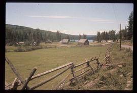
Showing 3172 results

Archival description
3024 results with digital objects Show results with digital objects
Iron Road North
2012.13.1.41.08 · Item · 2002
Part of J. Kent Sedgwick fonds

Image depicts Iron Road North, and a creek surrounded by trees. Located north of Woodpecker, B.C.

Intrusion
2012.13.1.124.01 · Item · 1970
Part of J. Kent Sedgwick fonds

Image depicts what is possibly an intrusive volcanic landform somewhere near Miworth, B.C.

2012.13.1.5.10 · Item · 6 Sept. 1993
Part of J. Kent Sedgwick fonds

Image depicts two mills; the Intercontinental Pulp Mill is on the right in the foreground, and the Prince George Pulp and Paper Mill is on the left in the background. The picture is taken from the South, possibly off Yellowhead Bridge in Prince George, B.C.

2012.13.1.5.01 · Item · Oct. 1975
Part of J. Kent Sedgwick fonds

Image depicts two mills; the Intercontinental Pulpmill is on the left side of the tracks in the image and the Prince George Pulp and Paper Mill is located on the right side in Prince George, B.C. The Northwood Pulp Mill can be seen in the distance.

Inside Machinery
2012.13.1.93.50 · Item · 1978
Part of J. Kent Sedgwick fonds

Image depicts two individuals at work inside what appears to be a piece of machinery. It is possibly located somewhere in Fort St. John, B.C.

Inlander Hotel
2012.13.1.51.060 · Item · May 1973
Part of J. Kent Sedgwick fonds

Image depicts the Inlander Hotel in Hazelton, B.C. The peak of the Rocher de Boule mountain is visible in the background.

Industrial Machinery
2012.13.1.4.14 · Item · July 1980
Part of J. Kent Sedgwick fonds

Image depicts a piece of industrial machinery, likely for either mining or forestry, in an uncertain location near McLeod Lake, B.C.

In Memory Of - Grave-Marker
2012.13.1.87.150 · Item · [between 1975 and 1995]
Part of J. Kent Sedgwick fonds

Image depicts a grave-marker with several names, it reads: "In Memory of Edith Golder, Winnifred Golder, Baby Pelton, Mrs. Nazarek, Baby Nazarek, Baby Wazylyk 1915 - 1929." It is located in the Willow River Cemetery.

Ice Rafted Boulders
2012.13.1.125.22 · Item · [1982?]
Part of J. Kent Sedgwick fonds

Image depicts a boulder protruding from layers of sediment with a hammer beside it for size reference. It is located somewhere in Soda Creek, B.C.

Hydraulic
2012.13.1.69.30 · Item · [1981?]
Part of J. Kent Sedgwick fonds

Image depicts the old log buildings of the town of Hydraulic, B.C.

Houses on Stilts
2012.13.1.6.106 · Item · Nov. 1980
Part of J. Kent Sedgwick fonds

Image depicts a number of houses built on stilts over a body of water in an uncertain location.

Houses on Dogwood Street
2012.13.1.24.34 · Item · 2000
Part of J. Kent Sedgwick fonds

Image depicts houses on Dogwood Street in the Millar Addition neighbourhood of Prince George, B.C. On the left is 1610 Dogwood Street and 1630 Dogwood Street is the middle house; 1650 Dogwood Street is the blue house on the right.

Houses in Giscome
2012.13.1.87.072 · Item · [between 1975 and 1995]
Part of J. Kent Sedgwick fonds

Image depicts the Giscome B.C. townsite from across the railroad tracks looking southeast. Map coordinates 54°04'19.7"N 122°22'04.7"W

Houses and Train in Giscome
2012.13.1.87.073 · Item · [between 1975 and 1995]
Part of J. Kent Sedgwick fonds

Image depicts the Giscome B.C. townsite from across the railroad tracks looking southeast. Map coordinates 54°04'19.7"N 122°22'04.7"W

Houses and Three Goats
2012.13.1.87.021 · Item · [between 1975 and 1995]
Part of J. Kent Sedgwick fonds

Image depicts several houses, and three goats standing on a narrow dirt road. The location is uncertain, likely Sinclair Mills, B.C.