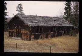
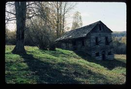
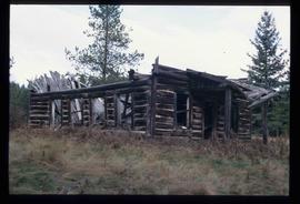
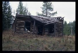
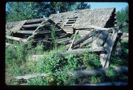
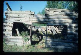
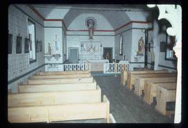
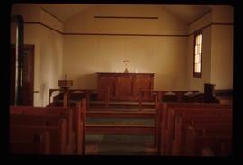
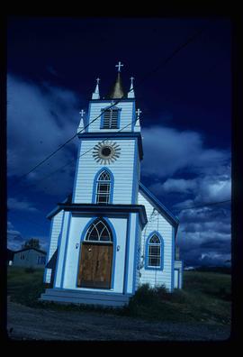
Showing 1706 results

Archival description
1595 results with digital objects Show results with digital objects
Columbus Hotel
2012.13.1.7.033 · Item · Sep. 1979
Part of J. Kent Sedgwick fonds

Image depicts the Columbus Hotel in Prince George, which was destroyed by a fire in 2008.

College Heights
2012.13.1.5.25 · Item · Mar. 2003
Part of J. Kent Sedgwick fonds

Image depicts College Heights, particularly along Gladstone Drive, in Prince George, B.C.

Collapsing Cabin
2012.13.1.13.16 · Item · Oct. 1984
Part of J. Kent Sedgwick fonds

Image depicts an old, collapsing cabin somewhere in the Fort George Canyon Provincial Park, B.C.

CN Train Yard
2012.13.1.3.121 · Item · 12 Oct. 1989
Part of J. Kent Sedgwick fonds

Image depicts a number of trains in the CNR train yard taken from River Road in Prince George, B.C. Map coordinates 53°54'51.5"N 122°43'29.6"W

CN locomotive 2693
2012.13.1.135.3.06 · Item · 2011
Part of J. Kent Sedgwick fonds

Photograph depicts a CN locomotive numbered 2693 with trees along both sides of the railway tracks.

City Hall
2012.13.1.3.165 · Item · May 2001
Part of J. Kent Sedgwick fonds

Image depicts Prince George City Hall. Map coordinates 53°54'46.3"N 122°44'41.9"W

Church
2012.13.1.6.098 · Item · Aug. 1979
Part of J. Kent Sedgwick fonds

Image depicts a church, somewhere between Hazelton and Hagwilget, B.C.

Chimney Lake
2012.13.1.52.01 · Item · May 1979
Part of J. Kent Sedgwick fonds

Image depicts Chimney lake with a number of houses near the shore, and a child in the foreground.

2012.13.1.65.07 · Item · May 1975
Part of J. Kent Sedgwick fonds

Image depicts a sign titled "Chilcotin Wildlife Management Area" somewhere near Riske Creek, B.C. It reads: "This trail has been provided by the Fish and Wildlife Branch in co-operation with Riske Creek Ranching Ltd., as access to the Chilcotin Wildlife Management Area. Please do not leave the the trail as the surrounding land is private property."

Chetwynd
2012.13.1.91.32 · Item · Nov. 1978
Part of J. Kent Sedgwick fonds

Image depicts a view of Chetwynd, possibly from Highway 97.

Chalkboard Snowman
2012.13.1.86.14 · Item · [1976?]
Part of J. Kent Sedgwick fonds

Image depicts a snowman drawn on the chalkboard of what appears to be an unused school, possibly in Lamming Mills, B.C. The slide is labelled "note board school."

Central Street West
2012.13.1.3.115 · Item · 12 Oct. 1989
Part of J. Kent Sedgwick fonds

Image depicts Central Street West, parallel to Highway 97 in Prince George, B.C. looking north. Shown: Prince George Motors and other car dealerships, Burger King, Grama's Inn, and the Spruceland Shopping Mall sign. Map coordinates 53°54'42.1"N 122°46'53.1"W

Central Fort School
2012.13.1.40.07 · Item · 1979
Part of J. Kent Sedgwick fonds

Image depicts an old, boarded up school, possibly the Central Fort George Traditional School in Prince George, B.C.

Central Business District
2012.13.1.3.057 · Item · July 1979
Part of J. Kent Sedgwick fonds

Image depicts the Central Business District of Prince George looking north from Connaught Hill. Map coordinates 53°54'41.4"N 122°44'58.5"W