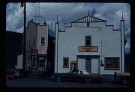
Print preview Close

Showing 1706 results

Archival description
1595 results with digital objects Show results with digital objects
Three People on a Beach
2012.13.1.67.02 · Item · 1979
Part of J. Kent Sedgwick fonds

Image depicts two individuals seated at a picnic table while a third stands closer to the water on a beach somewhere in Kitimat, B.C. What appears to be a harbour can be seen on the water.

Three Children and Two Goats
2012.13.1.87.022 · Item · [between 1975 and 1995]
Part of J. Kent Sedgwick fonds

Image depicts three unidentified children standing in the doorway of a house, with two goats ascending the porch steps. The location is uncertain, likely Sinclair Mills, B.C.

Third Avenue
2012.13.1.3.161 · Item · May 2001
Part of J. Kent Sedgwick fonds

Image depicts 3rd Ave in Prince George, B.C. Map coordinates 53°55'01.9"N 122°44'48.7"W

2012.13.1.135.01.26 · Item · [between 1980 and 2000]
Part of J. Kent Sedgwick fonds

Photograph depicts the old post office and federal government building at 1299 3rd Avenue prior to the coat of arms removal. Annotation on verso: "fed. govt bldg, (post office), c. 1990, before, coat of arms, removal".

The Duchess
2012.13.1.98.05 · Item · 1999
Part of J. Kent Sedgwick fonds

Image depicts the Duchess engine, which was built in 1878 and taken out of service in 1919. It was part of a matched set with the Duke and is now a tourist attraction in Carcross, Y.T.

Terzaghi Dam
2012.13.1.59.22 · Item · July 1980
Part of J. Kent Sedgwick fonds

Image depicts the Terzaghi Dam viewed from the downstream side near Bralorne B.C.

Teepee?
2012.13.1.87.037 · Item · [between 1975 and 1995]
Part of J. Kent Sedgwick fonds

Image depicts what appears to be a teepee at an uncertain location.

Suspended Trailer
2012.13.1.122.09 · Item · Oct. 1975
Part of J. Kent Sedgwick fonds

Image depicts a trailer for a logging truck suspended off the ground by a wooden structure. This is used to load the trailer onto the back of the truck. The name on the truck says "Rormarniewich Trucking Ltd."

Street in Giscome - Before
2012.13.1.87.093 · Item · [between 1980 and 2000]
Part of J. Kent Sedgwick fonds

Image depicts a street in Giscome B.C. The Giscome Store is located on the left side of the image with the church in the background. Map coordinates 54°04'18.5"N 122°21'57.7"W

Street in Giscome - After
2012.13.1.87.094 · Item · [between 1980 and 2000]
Part of J. Kent Sedgwick fonds

Image depicts a street in Giscome. The store was previously located on the left. The church is in the background. Map coordinates 54°04'18.5"N 122°21'57.7"W

Stewart House
2012.13.1.83.09 · Item · 1979
Part of J. Kent Sedgwick fonds

Image depicts the Robert Stewart house, built in 1910 and inhabited by the Stewart family until 1945. It is located in Stewart, B.C.

2012.13.1.51.037 · Item · May 1973
Part of J. Kent Sedgwick fonds

Image depicts an unknown individual leaning against a sign at the Stewart Access Road which warns travellers to pack several days of food. Located in Hazelton, B.C.

Stewart Access Road
2012.13.1.51.036 · Item · May 1973
Part of J. Kent Sedgwick fonds

Image depicts a man, possibly Kent Sedgwick, leaning against a sign forbidding public traffic on the Stewart Access Road from between 5 am to 8 pm. Located in Hazelton, B.C.

Stewart - Houses
2012.13.1.83.10 · Item · 1979
Part of J. Kent Sedgwick fonds

Image depicts several houses in Stewart, B.C. A section of Mt. Shorty Stevenson is visible in the background.