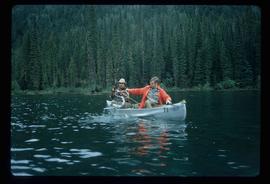
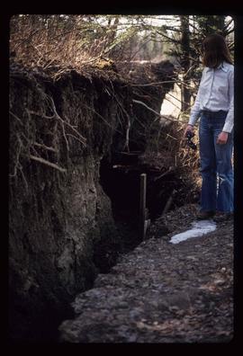
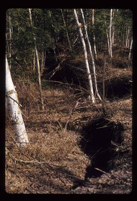
Showing 2133 results

Archival description
1985 results with digital objects Show results with digital objects
Forest
2012.13.1.10.09 · Item · 22 Sept. 1991
Part of J. Kent Sedgwick fonds

Image depicts a few unknown individuals walking through the forest at Cheslatta.

Forest
2012.13.1.41.18 · Item · 2002
Part of J. Kent Sedgwick fonds

Image depicts a forest, possibly somewhere near Woodpecker, B.C.

Forest
2012.13.1.13.14 · Item · Sep. 1984
Part of J. Kent Sedgwick fonds

Image depicts a view of the forest in the Fort George Canyon Provincial Park, B.C.

Foothills Bridge
2012.13.1.3.123 · Item · 12 Oct. 1989
Part of J. Kent Sedgwick fonds

Image depicts the Foothills Bridge over the Nechako river on the Foothills Boulevard in Prince George, B.C. Map coordinates 53°56'52.5"N 122°48'59.9"W

Footbridge
2012.13.1.84.36 · Item · 1994
Part of J. Kent Sedgwick fonds

Image depicts a narrow footbridge suspended over a river at an uncertain location.

Flooded Area
2012.13.1.87.002 · Item · [between 1975 and 1995]
Part of J. Kent Sedgwick fonds

Image depicts a flooded area with an old sawdust pile in the background. Likely near McGregor, B.C.

Fishing on McCleary Lake
2012.13.1.55.19 · Item · 1971
Part of J. Kent Sedgwick fonds

Image depicts two individuals fishing in a canoe on McCleary Lake. The slide is also labelled "dolly," likely meaning the fish in the net is a Dolly Varden trout.

Fishing
2012.13.1.23.15 · Item · 1973
Part of J. Kent Sedgwick fonds

Image depicts two youths fishing from the bank of the Nechako River on Cottonwood Island.

Fishing
2012.13.1.84.39 · Item · 1994
Part of J. Kent Sedgwick fonds

Image depicts a few unidentified individuals fishing in a river at an uncertain location.

2012.13.1.3.149 · Item · Apr. 1999
Part of J. Kent Sedgwick fonds

Image depicts a snow sculpted fire place and couch on a skating rink, possibly during the Winter City Conference, in Prince George, B.C. Taken at the Prince George Civic Center. Map coordinates 53°54'45.6"N 122°44'59.6"W

Finish Line
2012.13.1.129.01 · Item · 1971
Part of J. Kent Sedgwick fonds

Image depicts numerous skiers standing near a finish line somewhere on Tabor Mountain in Prince George, B.C.

Fenced Off Forest Area
2012.13.1.87.149 · Item · [between 1975 and 1995]
Part of J. Kent Sedgwick fonds

Image depicts two unidentified individuals standing outside a small, enclosed area somewhere in a forest. The location is uncertain.

Fence and Power Lines
2012.13.1.78.47 · Item · 1982
Part of J. Kent Sedgwick fonds

Image depicts a fence and power lines near the shore on Haida Gwaii. It is possibly a small community such as Masset.

Fence
2012.13.1.12.18 · Item · Sep. 1983
Part of J. Kent Sedgwick fonds

Image depicts a fence, perhaps somewhere in the Chilcotin region.

Fence
2012.13.1.12.15 · Item · Dec. 1980
Part of J. Kent Sedgwick fonds

Image depicts a fence in the Blackwater River area in the Chilcotin.

Fence
2012.13.1.12.17 · Item · Sep. 1983
Part of J. Kent Sedgwick fonds

Image depicts a fence somewhere in Anahim Lake, B.C.

Fence
2012.13.1.12.11 · Item · Aug. 1978
Part of J. Kent Sedgwick fonds

Image depicts a wooden fence at an uncertain location, perhaps somewhere in the Chilcotin region.

Fence
2012.13.1.12.12 · Item · Aug. 1978
Part of J. Kent Sedgwick fonds

Image depicts a wooden fence at somewhere in Meldrum Creek, B.C.

Fence
2012.13.1.12.16 · Item · Sep. 1983
Part of J. Kent Sedgwick fonds

Image depicts a fence somewhere in Anahim Lake, B.C.

Felled Trees
2012.13.1.56.06 · Item · 1973
Part of J. Kent Sedgwick fonds

Image depicts a large number of felled trees, and an unknown individual standing on the path.

Fault?
2012.13.1.50.050 · Item · 1978
Part of J. Kent Sedgwick fonds

Image depicts an unknown individual standing next to what appears to be a fault at an unknown location.

Fault?
2012.13.1.50.054 · Item · 1978
Part of J. Kent Sedgwick fonds

Image depicts what appears to be a fault at an unknown location.

Farm
2012.13.1.50.067 · Item · 1978
Part of J. Kent Sedgwick fonds

Image depicts a farm on the west side of the Fraser, south of Quesnel, B.C.

Farm?
2012.13.1.50.111 · Item · 1980
Part of J. Kent Sedgwick fonds

Image depicts what appears to be a farm at an uncertain location.

Farm
2012.13.1.72.18 · Item · July 1981
Part of J. Kent Sedgwick fonds

Image depicts a farm at an uncertain location; possibly somewhere in the McGregor Valley.

Farm
2012.13.1.54.65 · Item · July 1980
Part of J. Kent Sedgwick fonds

Image depicts a farm at an uncertain location.

Examining Rocks
2012.13.1.93.21 · Item · 1978
Part of J. Kent Sedgwick fonds

Image depicts three unidentified individuals examining rocks near a set of railway tracks at an uncertain location in the Peace River Region.

Examining a Rock
2012.13.1.91.38 · Item · 1979
Part of J. Kent Sedgwick fonds

Image depicts a group of individuals who appear to be examining a rock. It is possibly part of an educational trip.

Evaporation Pan
2012.13.1.121.10 · Item · July 1970
Part of J. Kent Sedgwick fonds

Image depicts an evaporation pan for water evaporation measurements. The location is uncertain.