Showing 5138 results

Archival description
3026 results with digital objects Show results with digital objects
Separated photographs
2012.13.1.135 · Subseries · 1980-2011
Part of J. Kent Sedgwick fonds

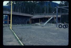
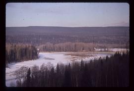
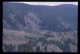
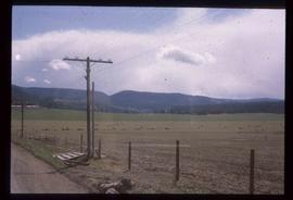
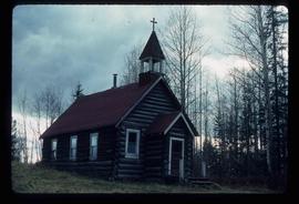
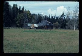
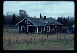
File consists of photographs separated from other boxes and subseries depicting downtown Prince George, historic Prince George, the North Thompson region, Fort St. James historic site, Brooks, Alberta, Sinclair Mills, and Soda Creek.

Sediment Layers
2012.13.1.91.24 · Item · Oct. 1978
Part of J. Kent Sedgwick fonds

Image depicts an unidentified individual standing in front of a rock face with visible sediment layers. Located somewhere in the Peace River Region, possibly near Hudson's Hope.

Sediment Layers
2012.13.1.91.27 · Item · Oct. 1978
Part of J. Kent Sedgwick fonds

Image depicts a wall of rock with visible sediment layers at an uncertain location in the Peace River Region, possibly near Hudson's Hope.

2012.13.2.02.40 · File · 1998-2006
Part of J. Kent Sedgwick fonds

File consists of reproductions and photocopies of articles on the history of city planning in North America. File predominantly consists of printed articles: "Encyclopedia of Urban Planning" by Arnold Whittick; "Radburn and the American Planning Movement: The Persistence of an Idea" by Eugenie Ladner Birch; "The Making of Urban America: A History of City Planning in the United States" by John W. Reps; and "The Story of the Planner's Journal 1915-1980" by Donald A. Krueckberg.

2012.13.2.09.01 · File · 1983-1994
Part of J. Kent Sedgwick fonds

File consists of notes, clippings, and reproductions relating to secondary sources of Prince George's development and historiography. Includes: "Ted Williams Slides" notes by Kent Sedgwick; "Nechako River cutbanks" card with a painting depicting the Nechako River cutbanks in Prince George; "Historic Timeline of Prince George" typed document created by Kent Sedgwick (2009); "Historiography of Northern British Columbia Project" typed document sent out to College Height Secondary School by Ted Renquist regarding a project to develop a historiography of Northern British Columbia (15 Apr. 1991); and "Canadian Encyclopedia" typed letter from Adriana Bryenton with the Canadian Encyclopedia requesting review of the Prince George article for the Canadian Encyclopedia (29 June 1994).

2012.13.3.1.11.131 · Item · [1978 or 1979]
Part of J. Kent Sedgwick fonds

The item is a photograph depicting the exterior view of the front of Scotiabank at 1210 3rd Avenue, Prince George. Part of Royal Dry Cleaners at 1222 3rd Avenue can be seen. Photograph originally taken between 1978 and 1979.

Schools
2012.13.1.040 · Subseries · [between 1979 and 2004]
Part of J. Kent Sedgwick fonds

File contains slides depicting schools in Prince George, B.C.

Scenery
2012.13.1.50.076 · Item · [1978?]
Part of J. Kent Sedgwick fonds

Image depicts a scenic view of a section of land at an unknown location.

Scenery
2012.13.1.47.18 · Item · 1968
Part of J. Kent Sedgwick fonds

Image depicts a scenic view of a mountain and forest at an uncertain location.

Scenery
2012.13.1.50.081 · Item · [1978?]
Part of J. Kent Sedgwick fonds

Image depicts a relatively flat section of land with hills in the distance; the location is uncertain.

Sawmill Town?
2012.13.1.87.106 · Item · [between 1975 and 1995]
Part of J. Kent Sedgwick fonds

Image depicts numerous buildings at an uncertain location. A beehive burner and what appears to be a large pile of wood is visible in the background.

Sawmill - Wood Planks
2012.13.1.122.10 · Item · Oct. 1975
Part of J. Kent Sedgwick fonds

Image depicts numerous blocks of wood planks at a saw mill, possibly Lakeland Mills, somewhere in Prince George, B.C.

Sawmill - Saw
2012.13.1.122.18 · Item · June 1980
Part of J. Kent Sedgwick fonds

Image depicts a saw cutting a log in half at a saw mill in Prince George, B.C.

Sawmill - People and Logs
2012.13.1.122.22 · Item · June 1980
Part of J. Kent Sedgwick fonds

Image depicts numerous stripped logs and several unidentified individuals in hard hats at a saw mill somewhere in Prince George, B.C.

Sawmill - Lakeland Mills?
2012.13.1.122.07 · Item · Oct. 1975
Part of J. Kent Sedgwick fonds

Image depicts a saw mill, possibly Lakeland Mills, with a beehive burner and numerous piles of logs in the foreground, in Prince George, B.C.

Sawmill - Interior
2012.13.1.122.24 · Item · June 1980
Part of J. Kent Sedgwick fonds

Image depicts logs being cut into planks in the interior of a saw mill somewhere in Prince George, B.C.

Sawmill
2012.13.1.3.141 · Item · Dec. 1997
Part of J. Kent Sedgwick fonds

Image depicts a sawmill, possibly Lakeland Sawmill, in Prince George B.C.

Sawmill
2012.13.1.122.15 · Item · [1979?]
Part of J. Kent Sedgwick fonds

Image depicts logs being stripped of their bark at a saw mill in Prince George, B.C.

Sand Beds
2012.13.1.124.17 · Item · Oct. 1975
Part of J. Kent Sedgwick fonds

Image depicts sand beds with a shovel present for size reference. The slide places it at the "BCR site," possibly in Prince George, B.C.

Salvation Army
2012.13.1.3.112 · Item · 12 Oct. 1989
Part of J. Kent Sedgwick fonds

Image depicts the Salvation Army on Ospika Boulevard in Prince George, B.C. Map coordinates 53°55'02.6"N 122°47'41.6"W.

Salvation Army
2012.13.1.3.114 · Item · 12 Oct. 1989
Part of J. Kent Sedgwick fonds

Image depicts the Salvation Army on Ospika Boulevard in Prince George, B.C. Map coordinates 53°55'02.6"N 122°47'41.6"W

Salmon Valley ranch
2012.13.2.17.19.05 · Item · Oct. 2005
Part of J. Kent Sedgwick fonds

The item is a photograph depicting an old, out of use barn, two silos, and two stables at Salmon Valley Ranch.

Salmon Valley Ranch
2012.13.2.17.19 · File · 2005, Mar. 2007
Part of J. Kent Sedgwick fonds

File consists of notes and reproductions relating to the Salmon Valley Ranch. Also includes photographs depicting the Salmon Valley Ranch.

2012.13.2.16.25.1 · Item · [2001?]
Part of J. Kent Sedgwick fonds

The item is a photograph depicting the old, wooden Salmon Valley elementary school. The building is weathered with fading paint, a rusted roof and boarded up windows. Annotation on reverse side of the photograph states, "Salmon Valley."

2012.13.2.16.25.2 · Item · [2001?]
Part of J. Kent Sedgwick fonds

The item is a photograph depicting the old, wooden Salmon Valley elementary school relocated to La Casse farm. The building is weathered with fading paint, a rusted roof and boarded up windows. There is a rusted bicycle, a rusted barrel and other debris in front of the building. Annotation on reverse side of the photograph states, "teacher illegible handwriting La Casse farm."

2012.13.2.16.25.4 · Item · [2001?]
Part of J. Kent Sedgwick fonds

The item is a photograph depicting the old, wooden Salmon Valley elementary school relocated to La Casse farm. The building is weathered with fading paint, a rusted roof and boarded up windows. Annotation on reverse side of the photograph states, "Salmon School - La Casse farm 1951-63."

2012.13.2.16.25.5 · Item · [2001?]
Part of J. Kent Sedgwick fonds

The item is a photograph depicting the rear side of the old, wooden Salmon Valley elementary school relocated to La Casse farm. The building is weathered with fading paint, a rusted roof and boarded up windows. A doghouse with a light coloured dog inside are next to the building. Annotation on reverse side of the photograph states, "Salmon School illegible handwriting is crossed out - La Casse farm 10."

2012.13.2.16.25 · File · [2001?]
Part of J. Kent Sedgwick fonds

File consists of notes relating to the Salmon Valley Elementary School. Also includes photographs depicting the old weathered wooden Salmon Valley school building [2001?].

2012.13.2.16.25.3 · Item · [2001?]
Part of J. Kent Sedgwick fonds

The item is a photograph depicting the old, wooden Salmon Valley elementary school relocated to La Casse farm. The building is weathered with fading paint, a rusted roof and boarded up windows. There is a rusted bicycle, a rusted barrel and other debris in front of the building. Annotation on reverse side of the photograph states, "teacher illegible handwriting La Casse farm." Acompanying note states, "#6 La Casse farm."

2012.13.2.18.04 · File · 2003-2008
Part of J. Kent Sedgwick fonds

File consists of notes, clippings, and reproductions relating to Salmon Valley and Old Summit Lake Road. Also includes photographs depicting a homestead on Old Summit Lake Road (2005).

"Salmon Valley" 1986 map
2012.13.6.81 · File · 1986
Part of J. Kent Sedgwick fonds

Item is an original 1986 map depicting Salmon Valley in British Columbia and was published by the Department of Energy, Mines and Resources Ottawa Canada.