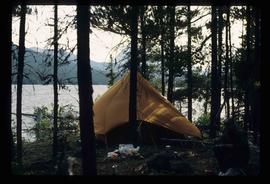
File consists of notes relating to Hixon Elementary School (formerly Canyon Creek Elementary School). Also includes photographs depicting the old Canyon Creek School site (2001).
Image depicts a church and several other buildings in Canoe Creek.
Image depicts a house located somewhere in or near Canoe Creek.
Image depicts a view of Canoe Creek.
Image depicts the BC Packers Ltd. cannery in Prince Rupert, B.C.
File consists of notes and reproductions relating to Brett & Hall landscape architecture and urban planning in Canada. File predominantly consists of photocopies of articles relating to urban planning, including "The Influence of Thomas Adams and the British New Towns Movement in the Planning of Canadian Resource Communities" by Oiva Saarinen; "Thomas Adams and the Commission of Conservation" by Alan H. Armstrong; "The Laying Out of Towns" by W.H. Dorsey; "The Relation of the City Engineer to Public Parks" by John C. Olmsted; "The Planning of Company Communities in the Lake Superior Mining Region" by Arnold R. Alanen; and "Planning the Canadian Environment" by L.O. Gertler.
File contains slides depicting maps of Canada's former boundaries.
File consists of notes and reproductions relating to the land surveys conducted between 1871 and 1876 to find a route across British Columbia for the Canadian Pacific Railway. File contains material regarding surveyor Charles Horetzky; surveyor Sir Sandford Fleming; surveyor Joseph Hunter and the Pine Pass; and the proposed routes for the Canadian Pacific Railway in British Columbia.
File consists of notes and reproductions relating to the Canadian Pacific Railway, colonization and immigration, and the 4th Duke of Sutherland.
File consists of notes and reproductions relating to the Canadian Northern Railway. File contains material regarding the CNR railway station at Boston Bar; the community and railway stop at Basque; development of the CNR; and the CNR in Lucerne, British Columbia.
The item is a map that depicts Canadian National Railway plans along Hammond street and the Fraser River. Includes the railway property, private property, proposed streets, and government owned property in the Prince George area.
Image depicts the Canadian National Railway Yards in Prince George, B.C.
Image depicts numerous piles of wood planks at the Canadian National Railway Yards in Prince George, B.C. The cutbanks are seen in the background.
File consists of clippings relating to the Canadian National lease of the BC Rail line. Includes material on economic benefits of the lease for CN and for the provincial government. Also includes material regarding perceptions of the sale by British Columbia MLA's and the public.
Photograph depicts Canada Trust/ Realtor at 1633 4th Avenue.
The item is a photograph depicting the exterior view of the front of The Health and Welfare Canada Medical Services building at 1294 3rd Avenue, Prince George. There is a grey and red Ford pickup truck parked in front of the building. Part of Household Finance HFC at 1272 3rd Avenue can be seen. Photograph originally taken between 1978 and 1979.
The item is a photograph depicting the exterior view of the front of The Health and Welfare Canada Medical Services building at 1294 3rd Avenue, Prince George. There is a grey and red Ford pickup truck parked in front of the building. Photograph originally taken between 1978 and 1979.
The item is a photograph depicting the exterior view of the front of The Health and Welfare Canada Medical Services building at 1294 3rd Avenue, Prince George. Savers Optical can be seen in the background. Photograph originally taken between 1978 and 1979.
Map depicts to Canadian federal electoral districts for the 1993 federal election.
Image depicts a man at a campsite somewhere near Murray Ridge.
Image depicts Sue Sedgwick seated in a lawn chair near a campfire and several other unidentified individuals, as well as three dogs. The location is uncertain.
The item is a photograph depicting a campground at Likely, BC. There are three camping trailers and Quesnel River can be seen in the background.
Photograph depicting a campground with log cabins and an open field surrounded by trees, presumably in Quesnelle Forks.
Photograph depicting a campground and open field surrounded by trees, presumably in Quesnelle Forks.
Photograph depicting a campground with log cabins and an open field surrounded by trees, presumably in Quesnelle Forks.
Photograph depicting a river with rocks lining the shore and trees in the background, presumably at the campground in Quesnelle forks.
Image depicts Kent Sedgwick (the man with a pipe in green) and an unknown individual sitting around a campfire somewhere in South Tweedsmuir Provincial Park.
Image depicts numerous campers and other vehicles in Tumbler Ridge, B.C.
Photograph depicting a camp ground, with fifth wheel's and vehicles parked in front of a lake, presumably taken at Quesnelle Forks campground.
Image depicts a group of unknown individuals sitting around a camp fire at an uncertain location.
File consists of notes relating to Camp Creek Elementary School.
Image depicts a camp of people with Mt. Robson and the Berg Glacier in the background.
Image depicts a camp and what is likely Mt. Robson in the background.
Image depicts an unknown individual eating in a camp somewhere in South Tweedsmuir Provincial Park.
Image depicts a campsite somewhere near Berg Lake.
Image depicts group of people at a camp somewhere in Mt. Robson Provincial Park.
Image depicts a camp on the shore of a lake in South Tweedsmuir Provincial Park. The man sitting in the bottom right corner is possibly Kent Sedgwick.
Image depicts a group of individuals at camp somewhere in Mt. Robson Provincial Park.
File consists of notes, clippings, and reproductions relating to the Cameron Street Bridge in Prince George. Includes: "Oral History Consent Form" document signed by Kent Sedgwick and researcher Angela Quibell (8 Aug. 2007); "What Price Heritage? The Case of the Cameron Street Bridge in Prince George, British Columbia" typed document by Angela Quibell (2007); "Interview with Kent Sedgwick" typed transcript of an oral interview with Kent Sedgwick and Angela Quibell (8 Aug. 2007); and "Nechako Crossing" typed document by Kent Sedgwick (Nov. 2005). Also includes photographs depicting the Nechako bridge model (2008), the plaque describing the history of the 3rd Cameron Street Bridge built in 2009, and the 1st Cameron Street Bridge built in 1916 (photographic reproduction ca. 2008).
The item is a photograph slide reproduction depicting the Cameron Street bridge in Prince George. The river is flooded with and ice jam reaching the height of the bottom of the bridge. Annotation on the slide states, "Cameron bridge 1916-1931."
The item is a photograph depicting the Cameron Street bridge plaque. The short write up details the construction and significance of the bridge. Annotations on reverse side of the photograph state, "169 words."
The item is a photograph depicting the Cameron Street bridge. The photograph is a reproduction of a photograph taken between 1917 and 1932. The picture depicts an ice jam with snow and ice along the Nechako River reaching the height of the base of the bridge. Annotations on the reverse of the photograph state, "Exp. Pl = 1922 p 986.9.9 Exp Pl = 16 Dec 1917 p 982 " 38.3 P 982.30.68 old bridge - can't be 1932."
The item is a photograph depicting the Cameron Street bridge. The photograph is a reproduction of a photograph taken between 1916 to 1931. The picture depicts the completed wooden Cameron Street bridge over the Nechako River. Annotations on the reverse side of the photograph state, "1st bridge between 1916 - 1934 983.7.13." Attached yellow sticky note states, "Note pilings in swing span. Ted Williams says the span was replaced with extension in 1922. So this photo is post - 1922."
File contains slides depicting places in California, USA.
File consists of notes relating to the Cale Creek Elementary School.
File consists of notes and clippings relating to the take-over of Caitlin Press after the passing of Cynthia Wilson who had owned the publishing company between 1991 and 2005 and had moved it to Prince George. The purchase of Caitlin Press was being considered by Vivien, Barry McKinnon, Lana Coldwell, Jeanette Turpin, and Kent Sedgwick. The file includes email correspondance between them regarding this decision.
The item is a photograph depicting the Caine building in Prince George.