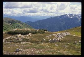
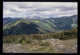
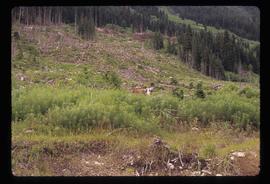
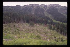
Image depicts what is possibly an irrigation channel somewhere in Seton Portage, B.C.
Image depicts an irrigation ditch in Lillooet, B.C.
Image depicts a pile of irrigation pipes on a dairy farm somewhere near Quesnel, B.C.
Image depicts the Isaac Falls.
Image depicts a log jamb at the Isaac Falls.
Image depicts Isaac Lake.
Image depicts Isaac Lake from the Betty Wendle campsite.
Image depicts a camp at the Betty Wendle campsite at Isaac Lake.
Image depicts the sunset over Isaac Lake from the Betty Wendle campsite.
File contains slides depicting Island Cache on Cottonwood Island in Prince George, B.C.
CD holds 53 JPEG images of Cottonwood Island area.
File consists of notes and reproductions relating to the Island Cache Elementary School.
Image depicts an old, boarded up school in Island Cache, B.C.
Image depicts a grocery store at Island Cache.
The item is a photograph depicting a two story abandoned wooden building. Annotation on reverse side of photograph states, "Isle Pierre 1970s."
Image depicts the ferry at Isle Pierre, B.C.
Image depicts the ferry in Isle Pierre, B.C.
Image depicts the dock for ferries in Isle Pierre, B.C.
Image depicts an old, boarded up store in Isle Pierre, B.C.
Item is an original 1952 map depicting Isle Pierre in British Columbia, published by the British Columbia Department of Lands and Forests. Map includes pen markings.
Item is an original 1952 map depicting Isle Pierre British Columbia, published by the British Columbia Department of Lands and Forests.
Item is an original 1974 map depicting Isle Pierre, published by the Department of Energy, Mines and Resources in Ottawa. Map includes pen markings.
Image depicts an unknown individual in the J. Edwards Camp in South Tweedsmuir Provincial Park.
Image depicts the Jack O' Clubs Hotel in Wells, B.C. It burned down on February 14th, 1994
Image depicts the old Jack O' Clubs Hotel Sign in Wells, B.C. A small label on it reads "The Jack O' Clubs Hotel sign was taken down in April," it is uncertain if the following year listed is 1960 or 1980. The hotel itself burned down on February 14th in 1994.
File consists of notes, clippings, and reproductions relating to James C. Anderson and engineer J. Gill. James Anderson arrived in Fort George in 1912. Anderson did topographical surveys of the Fort George area for the Grand Trunk Pacific Railway between 1912 and 1913. Engineer J. Gill did a topographical survey of the Indian reserve for the Grand Trunk Pacific in 1912. Includes "Grand Trunk Pacific Maps" typescript document by Kent Sedgwick (3 June 1980).
Image depicts a view of James Creek Valley.
File consists of a typed document and a clipped article relating to the house of James Renwick. The house was one of the oldest residences in Prince George and was built for James Renwick, a local MLA and one of the original proprietors of the Prince George Citizen newspaper. Includes: "RE: Proposed Subdivision" typed document from the City of Prince George (22 Sept. 2000) and a clipped article from the Prince George Citizen newspaper "A house worth saving" which discusses the Renwick house, later owned by Bruno and Dorothea Meyer (18 May 1978).
The item is a microcassette containing an oral interview follow up with Janet Kozak.
File consists of clippings, notes, and reproductions relating to Janet Kozak. Includes: "Kent Sedgwick interviewing Janet Kozak" typed transcript of interview conducted by Kent Sedwick (20 Apr. 2010); "Kozak follow up interview notes" typed transcript of a follow up interview conducted by Kent Sedgwick (26 May 2010); and "Notes from telephone interview with Lois Miller" typed notes (23 May 2010). Also includes a microcassette containing an oral interview follow up with Janet Kozak (26 May 2010).
The item is one audiocassette containing a copy of an interview with Janet Kozak regarding the L'heidli T'enneh cemetery. Annotations on the case state, "Janet Kozak re: native cemetery 20 Apr/2010 COPY"
The item is one audiocassette containing an interview with Janet Kozak regarding the L'heidli T'enneh cemetery. Annotations on the case state, "Janet Kozak re: native cemetery side A only - 22 min 20 Apr/2010 - original -"
File consists of notes, clipping, and reproductions relating to Japanese internment camps along the East Line, between Prince George and Tete Jaune Cache, during World War II. Includes material on Japanese internment camps in and around Giscome, Sinclair Mills, Longworth, Penny, and Tete Jaune Cache.
File consists of notes and typed transcripts of various oral interviews relating to a Japanese internment camp between Giscome and Willow River during World War II.
File consists of notes and reproductions relating to Japanese internment and work at Sinclair Mills during World War II. File also includes photographs depicting the pit and field site for the old North Road camp for Sinclair Mills, where Japanese internment workers worked (2010).
File consists of notes and printed emails relating to a Japanese internment camp and sawmill near Penny and Hungary Creek.
File consists of notes and clippings relating to Jasper and the Yellowhead Pass.
File consists of notes and reproductions relating to a field trip to Jasper.
Image depicts the Javva Mugga Mocha Cafe in Prince George, B.C.
Image depicts a deer somewhere at Joffre Creek.
Image depicts a deer in the bottom left corner, as well as a view of a mountain side, somewhere at Joffre Creek.
Image depicts a road, possibly Joffre Creek Road. The slide is simply labelled "Joffre cr."
File consists of a duotang containing a typed document entitled "John Giscome's Country" by Bruce Ramsey originally from 1964, but retyped by the Prince George Citizen newspaper.
File consists of notes and reproductions relating to John Prince Myers, one of the founders of Cranbrook Sawmill, and his house at 1633 Norwood Street that burnt down in 1933. File primarily consists of photocopied newspaper articles relating to the Cranbrook Sawmill and the burning of the house at 1633 Norwood Street, and printed copies of photographs from The Exploration Place Museum database depicting the house and sawmill. Includes printed email chain between Greg Halseth, Kent Sedgwick, and John G . Myers (Sept. 2004).
File consists of notes and reproductions relating to Joseph Hunter, a Scottish-born surveyor, civil engineer and political figure in British Columbia. Joseph Hunter was the first European to find and cross the Pine Pass. He was sent by the Canadian Pacific Railway in 1877 to locate the pass. Hunter later represented Cariboo from 1871 to 1875 and from 1900 to 1904 and Comox from 1890 to 1898 in the Legislative Assembly of British Columbia.
File consists of a photocopy of "Journal and Report of Preliminary Explorations in British Columbia" originally written in 1872 by A.R.C. Selwyn in Geologic Survey Report of Progress for 1871-72.
The item is a photograph reproduction depicting Judge Howay at the unveiling of the original National Historic Monument to Alexander Mackenzie in Prince George on 13 June 1925. The photograph was reproduced in 2009. On the reverse side of the photo there is written either "55" or "SS" in red ink.