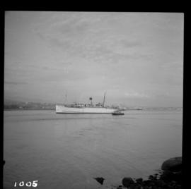
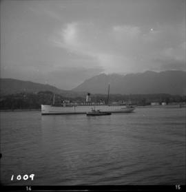
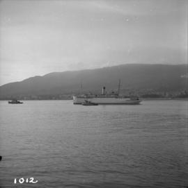
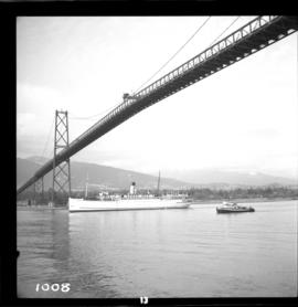
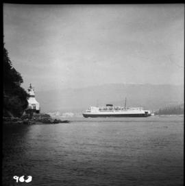
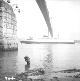
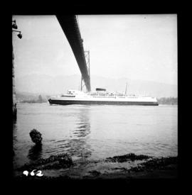
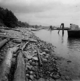
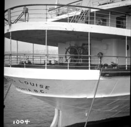
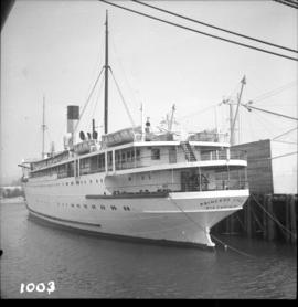
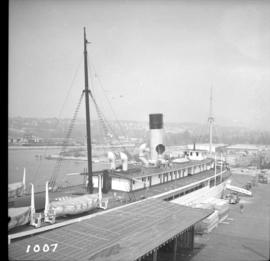
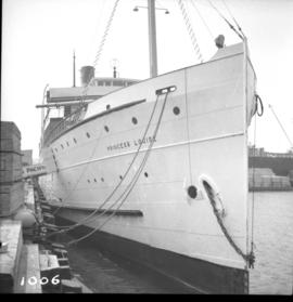
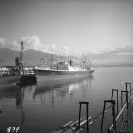
Photograph depicts a ship named "Pacific Northwest", possibly docked in either English Bay or Howe Sound.
Photograph depicts the ship the "Princess Louise" at Lynn Terminals in Vancouver Harbour.
Photograph depicts the ship the "Princess Louise" prior to departure at Lynn Terminals, North Vancouver. She had been tied to this wharf for at least 18 months.
Photograph depicts the ship the "Princess Louise" at Lynn Terminals in Vancouver Harbour before departure for California. It has one poorly applied coat of white paint. The anchors have been removed and the towing tackle placed in position.
Photograph depicts the ship the "Princess Louise" under tow at about 7:30 pm, passing Brockton Point in Vancouver Harbour.
Photograph depicts the ship the "Princess Louise" under tow and just passed under the Lions Gate Bridge in Vancouver.
Photograph depicts the ship the "Princess Louise" under tow by the Vancouver tug "la Pointe", just west of the First Narrows.
Photograph depicts the ship the "Princess Louise" under tow by the Vancouver tug "La Pointe", going through the First Narrows. Just before going through the current took her at 45 degrees to the course and for a moment it looked as if she might run aground.
Photograph depicts the ship the "Princess of Vancouver" emerging westwards from the First Narrows in Vancouver.
Photograph depicts the ship the "Princess of Vancouver" passing Lions Gate Bridge in Vancouver, outward bound.
Photograph depicts the ship the "Princess of Vancouver" outward bound at midday. It is passing below the Lions Gate Bridge in Vancouver.
File consists of documentary photographs taken by David Davies of ferries in British Columbia.
File consists of documentary photographs taken by David Davies of ships in British Columbia.
File consists of documentary photographs taken by David Davies of historical vessels in British Columbia.
File consists of documentary photographs taken by David Davies of naval vessels and government vessels in British Columbia.
File consists of documentary photographs taken by David Davies of various ocean passenger vessels in British Columbia
File consists of documentary photographs taken by David Davies of ships that operated on Okanagan Lake in British Columbia.
File consists of documentary photographs taken by David Davies of the S.S. Canora rail ferry.
File consists of documentary photographs taken by David Davies of tugs, fishboats, and scows in British Columbia.
File consists of documentary photographs taken by David Davies of ships in British Columbia.
Photograph depicts a shop on the north side of Main St. in Cumberland on Vancouver, Island.
Photograph depicts a the shoreline of Vancouver Harbour, looking east from the property line of the Burrard Grain Elevator, 375 Low Level Rd, North Vancouver.
Photograph depicts what Davies noted to be a rare sight, short lengths of rail.
Series consists of articles and clippings regarding short line railways in British Columbia. Includes information about the Southern Railway of British Columbia, the Kelowna Pacific Railway, the Okanagan Valley Railway, the Kaslo and Slocan Railway, the Northern Alberta Railway, the Victoria and Sidney Railway, and the Mt. Sicker Railway, among others.
File consists of research material regarding short line railways in British Columbia. Predominantly consists of photocopy reproductions, excerpts from books, and clippings from periodicals. Includes the following works: "Short Lines in BC in 2011" by Davies; "A Study in Extremes" by Blanchard; "Morrissey Fernie & Michel Railway: Great Northern Coal from Crows Nest Mines" by Burrows; "Locomotives for the Little Guys: From Steam to GE 70-tonners and from SD40-2s to Gensets, it's all Pulling Power for Shortline and Regional Railroads" by Lustig; "Vancouver Harbour Commissioners Terminal Railway and, after 1 Jan. 1936, National Harbours Board" notes compiled by Davies; "Historical Evolution of Rail Network in B.C." draft maps by Davies; "The Canadian North Eastern Railway (Originally The Portland Canal Short Line Railway)" by Mervyn Green and Douglas Smith; "Taku Tramway, 1900 to 1937: BC's Shortest 'Short Line' railway at 2.3 miles" by Davies; and "Stewart, B.C. and the C.N.E.R." by Mervyn Green and Robert D. Turner. Also includes two booklets published by the BCRHA: "The Cordwood Limited: A History of the Victoria & Sidney Railway" by Hearn and Wilkie, and "Shays on the Switchbacks: A History of the Narrow Gauge Lenora, Mt. Sicker Railway" by White and Wilkie.
Photograph depicts a derelict shovel beside the coaling wharves at Union Bay.
Photograph depicts a demonstration of an iron tire being shrunk on a wooden wagon wheel. For the benefit of the Lieutenant Governor of B.C., Walter Owens.
Postcard depicts Sicamous Station and Hotel, circa 1910. "Sicamous became a favorite statring point for fishermen to the Shuswap Lake and junction for the fruit growing Okanagan Valley. The first station in Sicamous, built in 1890, burned down in 1900. A new one was built, modernized in 1908, and torn down in the 1960s."
Postcard depicts Sicamous Hotel. Original built in 1898, but belived to have been burned down in 1908.
Photograph depicts a sign reading "Penticton East" beside a hut in the Penticton CPR depot yard.
File consists of research material regarding train signalling, which predominantly consist of photocopy reproductions, excerpts from books, and clippings from periodicals. Includes information on use of semaphore, searchlights, signal bridges, meanings of signal indications, ball signals, and smash boards.
File consists of research material regarding railway signs, which predominantly consist of photocopy reproductions, excerpts from books, and clippings from periodicals. Includes information on "tell-tales" that mark restricted clearances, blue flags, mileposts, metal crossing signs, culvert markers, speed signs, whistle posts, flanger signs, and other trackside signs.
Photograph depicts "The Mall" at Simon Fraser University.
Photograph depicts Simon Fraser University in Burnaby, B.C., 1 week after the official opening.
Photograph depicts Simon Fraser University in Burnaby, B.C., one week after the official opening.
Photograph depicts Simon Fraser University in Burnaby, B.C. The view is looking northeast towards the northwest corner of the Academic Quadrangle.
Photograph depicts Simon Fraser University in Burnaby, B.C. The view is looking northwest from the science complex towards the gymnasium.
Photograph depicts Simon Fraser University in Burnaby, B.C. The view is looking southwest from the mall towards the gym and sports arena.
Photograph depicts Simon Fraser University in Burnaby, B.C. The view is looking east towards the nearly completed water tower from the west inner face of the Academic Quadrangle.
Photograph depicts Sirdar station belonging to the C.P.R. It is at the south end of Kootenay Lake and 11 miles north of Creston. There is a little used turntable behind the depot. The view is looking south.
Photograph taken at the Northwood Pulp and Timber Ltd, Prince George. Visible is a General Motors switcher, built in 1959. Aqcuired in 1981. Its sister locomotive had just returned from some major servicing at CN shops in P.G. Built in 1954 and acquired in 1989. Would not be used until business picked up. Pulp trade in world doldrums at the time the photograph was taken.
Photograph depicts the site of the first tramway in BC that ran between Anderson Lake and Seton Lake for 1 1/4 miles and was built in 1861. It lasted for 2 years and used wooden rails. The visible piece of track bed was 70 paces southwest of the PGE depot in Seton Portage. Parts of it had been obliterated by bulldozing that took place in the centre of the village.
Photograph depicts the site of the first tramway in B.C., that ran between Anderson Lake and Seton Lake for 1 1/4 miles and was built in 1861. It is located 70 paces southwest of what is now the PGE Seton Portage depot. It was opened for trafic in July 1861 and had lasted for two years.
Photograph depicts the site of a former copper shelter, owned by B.C. Copper Co, of New York, at Anadconda, on the outskirts of Greenwood. It operated from 1901-1918. In 1899, a railway connected the mine and smelter, but no railway connected Greenwood to Nelson until 1901.
Photograph depicts the site of a former C.P.R. connection between the mainline into Vancouver and False Creek yards at West Pender St. In Vancouver. The rails are not used but still appear in the street and on the parking lot on the far side. Another parallel set of tracks 30 yards to the east are in daily use.
Photograph depicts the site of the former Marpole inter-urban depot, looking east.
Photograph depicts the site of former single tram tracks going east up Frances St., near Commercial Dr., in east Vancouver, BC