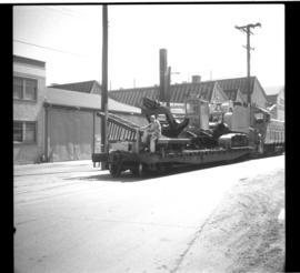
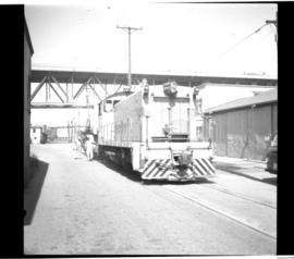
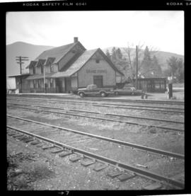
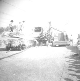
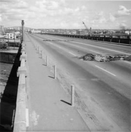
File consists of research material regarding Granville Island street railway operations of BC Hydro Railway. Predominantly consists of photocopy reproductions, excerpts from books, and clippings from periodicals. Includes the following works: "The Granville Island Switching Operations of the British Columbia Hydro and Power Authority Railway" by Sochowski and "BCER Granville Island: Extension of Industrial and Interurban Lines within Vancouver City" by Davies.
Plan depicts Granville Island industrial sites in False Creek, Vancouver. Shows revised trackage from 1955 annotated in colour by Davies.
Photograph depicts a B.C. Hydro Railway locomotive switching a flat car filled with construction equipment.
Photograph depicts a B.C. Hydro locomotive switching a flat car carrying a cat crane. Looking west with Granville road bridge in the background.
Photograph depicts Granite Falls near the Wigwam Inn, Indian Arm, Vancouver, B.C.
Photograph depicts Granite Falls and wharf at Indian Arm, looking west from the top of the falls.
File consists of research material on the progressive opening dates of the Grand Trunk Pacific Railway (G.T.P.R.) for both freight and passenger trains between Edmonton-Prince George and Prince Rupert-Prince George circa 1914-1915. Material predominantly consists of photocopy reproductions, excerpts from books, and clippings from periodicals.
File consists of research material relating to the Grand Trunk Pacific Railway in British Columbia, which ran from Red Pass Junction to Prince Rupert between 1905 and 1920. Predominantly consists of photocopy reproductions, excerpts from books, and clippings from periodicals. Includes the following works: "Charles Melville Hays and the C.R.H.A." by Boles; "Prince Rupert: Gateway to the Pacific Northwest" by Downs; "The East Line Section of the Grand Trunk Pacific Railway in Central British Columbia" by Kent Sedgwick; "Early Days of the Fraser Sub. of the G.T.P.R" by Davies; and "GTPRL: Traffic, 1915-1920" by Patterson. Also includes a hand-drawn map by Davies detailing the Grand Trunk Pacific Railway route.
Photograph depicts the Grand Forks CPR depot, located at mile 94.8 on the Boundary Subdivision, which runs from Nelson to Midway (127 miles). It was originally built by the Columbia & Western Railway in 1899. IT has not seen a passenger train in years but it is still in use for administrative purposes.
Photograph depicts the Grand Central Hotel at the intersection of Marpole Ave and Hudson St. in south Vancouver. The hotel was built in 1912 by J.J. Graver and run from 1913-1915. It re-opened in 1920 as a home for incurables (veterans). In 1937 it became the provincial infirmary and closed in May 1965.
Photograph depicts grain thresher for barley. It was driven by a case traction engine.
File consists of documentary photographs taken by David Davies of a grain elevator in Wynndel, British Columbia.
Photograph depicts the a grain elevator at Wynndel, located at mile 73.8 on the CPR line on the Nelson Subdivision. It is between Creston at mile 67.2 and Kootenay Landing at mile 83.1. Grain elevators are rare in BC and this one belongs to the United Grain Growers. The view is looking east.
File consists of research material regarding gradients, which predominantly consist of photocopy reproductions, excerpts from books, and clippings from periodicals. Includes an article by Donald Purdy entitled "Memories of CPR's Kootenay Switchbacks"; various examples of B.C. switchbacks and gradients; and information on altitudes, grades, and elevations.
Photograph depicts a grader that was working on removing a sharp bend and widening Galena Bay Road.
Photograph depicts a grader at the Cowichan Valley Forest Museum
Photograph depicts the grade of a former railway between Kaslo and New Denver, just on the east side of the summit at Retallack.
Photograph depicts a recently constructed grade that ran parallel to the BC Hydro Railway and led to a new super post. A CPR ballast train is visble on the track. Ownership of the line was vested in the BC government.
Photograph depicts a C.P.R. grade crossing warning device at Haney.
Photograph depicts a Goodyear Blimp cruising over the Centennial Museum near Sunest Beach, False Creek, Vancouver.
Photograph depicts a goodyear Blimp cruising over the Centennial Museum near Sunest Beach, False Creek, Vancouver. It came for the 1973 Abbotsford Air Show.
Photograph depicts a Goodyear airship travelling over Spanish Banks, Vancouver. It took part in the Abbotsford Air Show of 1971.
File consists of research material regarding gondolas, coiled steel cars, and ore cars. Predominantly consists of photocopy reproductions, excerpts from books, and clippings from periodicals.
Postcard depicts the Kicking Horse Canyon. As seen from the Golden-Field Highway and Motor Road. Along the CPR line.
File consists of photocopied excerpts of Great Northern Railway employee timetables from 1909, 1913, 1918, 1924, and 1931. Also includes an original GNR Cascade Division timetable 104 (31 Oct. 1965).
File consists of research material regarding Great Northern Railway (GNR) stations in British Columbia, which predominantly consist of photocopy reproductions, excerpts from books, and clippings from periodicals. Includes information on various GNR stations and a listing by Davies entitled "Railway Stations in B.C. by Railway Company: GNR".
Photograph depicts the Great Northern Railway station on Main Street, Vancouver being demolished.
File consists of Great Northern Railway public timetables. Includes passenger schedules for 1964, 1966, and 1967.
File consists of research material regarding the Great Northern Railway in the British Columbia Lower Mainland. Predominantly consists of photocopy reproductions, excerpts from books, and clippings from periodicals. Includes the following works: "BNSF Sells Vancouver Docks to Southern Railway" by Ian Smith; "Colebrook Section House Meets its Demise" by Ward; "Eastern Extremity of GNR Penetration in Fraser Valley: Cannor and Kilgaard" by Davies; "A Chronology of the Great Northern Railway in the Lower Mainland" by Ewert; "Riding the Guichon Line to Sumas and Back in 1924" by Atkey; "Huntingdon (Canada) and Sumas (USA) Interchange prior to 1970" by Davies; "The Railway History of Delta" by Preddy; "Industrial Spur Gone, Lake City Spur Torn Up" by Ian Smith; "A 1908 Ride on the New Westminster Southern" by Atkey; "The Railway to Port Guichon: 1903-1938" by Atkey; "The Great Northern from Vancouver to the International Boundary" by Grecula; and "90 Years Rail Passenger Service in the Vancouver-Seattle Corridor" by Norris Adams.
File consists of research material regarding the Nelson & Fort Sheppard Railway (Waneta to Nelson). Predominantly consists of photocopy reproductions, excerpts from books, and clippings from periodicals. Includes the following works: "BN Branch Line: Border to Nelson" by Davies; "The Nelson & Fort Sheppard Railway" by Barone; and information about the GNR in the Nelson area by Gerry & Corwin Doeksen.
Photograph taken at the Great Northern Railway connection from its terminal yards to its wharf on Vancouver Harbour or the connection with CPR. Image captured crossing Powell Street, looking southward, north of Glen Drive, Vancouver.
Photograph depicts a bridge over the Similkameen River. When track ran to Hedley, there were 3 of these bridges. All stood still at the time the photograph was captured. The other were on the lifted Keremeos to Hedley section.
Photograph depicts a rail bridge over the Similkameen River.
Photograph depicts a bridge over the Similkameen River. The branch was still in use with very little traffic. One padlocked door on each side of the bridge allows examination of trusses.
Photograph depicts the GNR (later became BN) branch from Kettle Falls to Grand Forks.
Subseries consists of Great Northern Railway employee timetables and schedules. Also includes employee timetables for the Burlington Northern Railway, the BC Electric Railway, and the BC Harbours Board Railway.
File consists of various glossaries and definitions of railway terms excerpted from books and periodicals.
Photograph depicts Glenwalker Ranch. Visible are details of the log construction of a barn that was built between 1890 and 1910.
Postcard depicts Glacier Station.
Postcard depicts Glacier House, CPR, and Hermirt Range, Selkirk Mountains.
Postcard depicts Glacier House and Great Glacier House built in 1886 as one of three similar hotels, the other two being Mt. Stephen House in Field, and Fraser Canyon Hotel in North Bend. Business fell off rapidly in 1916 when tracks were relocated into a new tunnel. Buildings were demolished in 1930.
Postcard depicts Glacier House and Great Glacier.
Photograph depicts a girls' school, Strathcona Lodge, at Shawnigan Lake.
Photograph depicts a covered wooden grider bridge of the former Great Northern Railway spur that ran from north Washington state into B.C. at Keremeos, then west to Princeton. It was now only operating as far north as Keremeos.
Photograph depicts a covered grider bridge of a former railway (subsidiary of the Great Northern Railway, built in 1907-14) that formerly ran between Keremeos and Princeton, but had long since been lifted. The bridge was now used by vehicles going to a nearby ranch.
Photograph depicts an existing girder bridge, in use since 1962. A new concrete bridge was being built on the left.
Photograph depicts an old girder bridge.
Photograph depicts a wooden arch supporting the sagging Georgia Viaduct in Vancouver, BCThe road in the foreground is Taylor Way.
Photograph depicts the Georgia Viaduct in Vancouver. Image taken 5 days after its closure on June 28, 1971.
Photograph depicts a general view, looking north, of Westview Harbour with the Powell River paper plant smoking in the background.