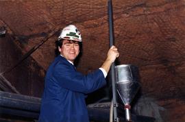
Photograph of bagging rams inside Nordenham Finishing Mill in Germany. Part of trip report.
Handwritten caption beside this photo reads: "Elaborate barricades required due to amount of loose rock falling continuously". Three men work in area confined by barricades made of vertical metal rods and horizontal wood planks. Miscellaneous building material and supplies cover the ground. Rock pile in foreground on right.
Three men work in area confined by barricades made of vertical metal rods and horizontal wood planks (see item 2000.1.1.2.352). Two ladders in foreground, (one being used by construction worker). Lumber and semi-finished walls can be seen at higher level of elevation in background.
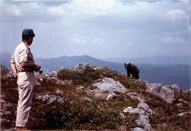
Photograph depicts a cinnamon bear and Andre Beguin with camera on a rocky hill. Mountains in background.
Photograph depicts benches above open pit at Cassiar mine. Drills and haulpaks visible in centre image.
Photograph depicts benches after strip mining at Cassiar. Drill visible in distance, ore haul trucks on road in foreground.
Photographic slides of map of Canada depicting different geology and geography interests such as: mines and reserves, physiographic regions, soil regions, permafrost limits, underdeveloped hydro potential and development corridor.
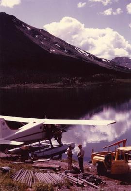
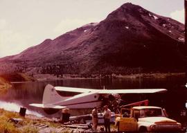
Photograph depicts Cassiar's Chief Geologist Bill Plumb and unidentified man standing on shore by yellow Cassiar supervisor's truck. A third man stands on Airplane parked on lake behind them, and miscellaneous equipment lies on shore at Bill's feet. Photograph speculated to have been taken at Aeroplane Lake, approximately 35 miles east of Cassiar. Bill Plumb led many expeditions for the purposes of Cassiar's outside exploration endeavours.
Photograph depicts Cassiar's Chief Geologist Bill Plumb and unidentified man standing on shore by yellow Cassiar supervisor's truck. Airplane is parked on lake behind them, and miscellaneous equipment lies on shore at Bill's feet. Photograph speculated to have been taken at Aeroplane Lake, approximately 35 miles east of Cassiar. Bill Plumb led many expeditions for the purposes of Cassiar's outside exploration endeavours.
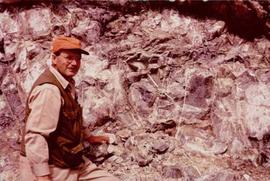
Photograph depicts Bill Plumb at recently excavated wall of serpentinite with cross fracturing filled with asbestos fibre. Handwritten annotation on note attached to photo: "Chief Geologist Wilfred M Plub at Discovery at Clinton Creek 1963 + or -."
Photograph of Cassiar's Chief Geologist Bill Plumb who led many exhibitions for the purposes of Cassiar's outside exploration endeavors. Various photos in this collection depict Bill on some of these exhibitions.
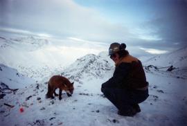
Photograph of man, believed to Bill Pratt, with a fox on top of a mountain.
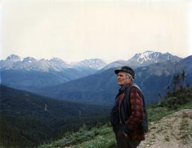
Photograph depicts William (Bill) Storie at location known as Limestone Mountain, southwest of Cassiar, B.C. Photo features profile of Bill, hands in pocket, Cassiar valley and mountains in background. Storie was a renowned prospector in the Cassiar area, and the new school at Cassiar was named for him in 1992.
Four construction workers stand to left of blasthole drill number "604" among many empty cardboard boxes. Mountain range can be seen in background.
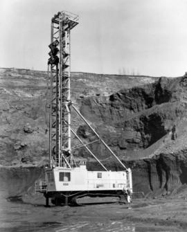
Photograph depicts two blasthole drills on bench in mine, old garage visible in centre background. Snow-covered mountain range in background.
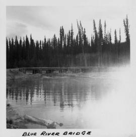
Photograph depicts a bridge at Blue River taken from shore.
File contains photographs featuring members of the Board of Directors of Cassiar Asbestos Corporation Ltd., which was formed on the 17th of May, 1951. Cassiar's forerunner was a company named Conwest, formed in 1534, a consolidation of two companies owned by Fred Martin Connell and his brother W. Harold Connell. The first board of directors included the Connell brothers, George Armstrong, John E. Kennedy, Charles & Arthur Mortimer, and Charles Rainforth Elliot (chartered accountant and secretary-treasurer of Conwest & Cassiar). Directors depicted in this file include F.M Connell, Harold Connell, Charles Elliot, John E. Kennedy, George Armstrong, Ken A. Creery, John Drybrough, Tam Zimmermann, George Washington Smith (president of Bell Asbestos Mines), Nick Gritzuk, Jack Christian (general manager, president, and CEO). Other individuals depicted include Fred Murry, Andre Beguin, Plato Malozemoff from Newmont Mining (co-founder of Cassiar with F.M. Connell), Alfred Lloyd Penhale (founder and CEO of Asbestos Corporation of Canada Ltd.), C.B. Brown, Pierre Marcotte, Francis Parker Smith (brother of George Smith), Bill Oughtred, Bill Johnson, and a Mr. Janitsch. File also includes a portrait of an unidentified director of Cassiar from Turner and Newall in England, taken at the corporate club in Toronto. Group portraits were taken at the Cassiar Valley, the office building, "House 130," fishing outings, and at formal events in unidentified locations.
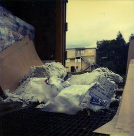
Photograph depicts a torn bag of asbestos sitting on the back of a truck or shipping container.
Photograph depicts a round bucket attached to the main hook line of a crane and suspended over building framework in crusher construction site (crane not visible in image). Men stand around the bucket on high level of crusher building. A dirt road and long building believed to be housing conveyor "B" can be seen in background.
Photograph depicts a round bucket attached to the main hook line of a crane (crane not visible in image) suspended over building framework in crusher construction site. Four construction workers stand around the bucket. Two men can be seen on roof of long building in background believed to be the section of the crusher building which housed conveyor B. Dirt road crosses midground.
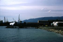
Photograph depicts the Cassiar Asbestos Corporation's wharf being built.
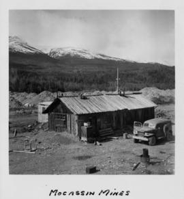
Photograph depicts a wooden structure in a gravel landscape. Truck with open door in foreground, forest and snow capped mountains in background. Mounds of gravel visible behind structure.
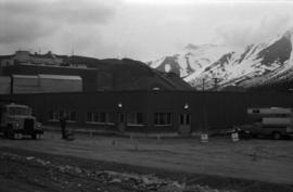
Photograph depicts a building with mountains in teh background. A man wearing a hardhat stands outside.
Photograph depicts man driving bulldozer in front of framework for Crusher building, view facing into the mountain. Excavated dirt in foreground.
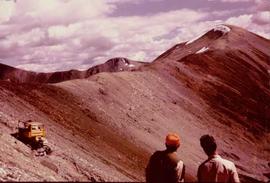
Bulldozer works along talus slope in top right of image. Photograph believed to have been taken during an outside exploration trip led by Cassiar's Chief Geologist Bill Plumb.
Photograph believed to have been taken near Kutcho Creek, BC during an outside exploration trip led by Cassiar's Chief Geologist Bill Plumb. Bill stands to left of man believed to be Matt Bell in right foreground. Bulldozer works along talus slope in left foreground.
Bulldozer works along talus slope in centre of image. Photograph believed to have been taken near Kutcho Creek, BC during an outside exploration trip led by Cassiar's Chief Geologist Bill Plumb.
Stick, boom, and bucket of a "NORTHWEST" cable shovel excavator can be seen left of a steep wall of earth in lower level of construction area. Construction worker is partially visible in foreground on far right. Building materials in background.
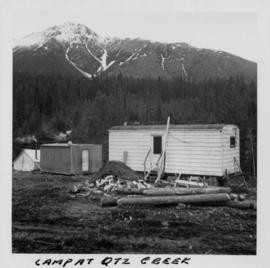
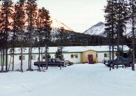
Photograph depicts three small camp structures in dirt landscape: one trailer, one wooden building and one tent building. Logs and wood pile in foreground, forest and snow-capped mountain in background.
Photograph depicts process engineer Carl Kottmeier.
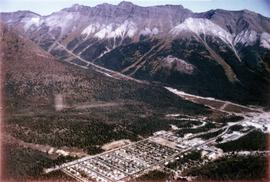
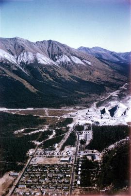
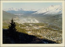
Photograph depicts the Cassiar town in foreground, mine valley and north mountain range in background. Photograph speculated to have been taken during the plane ride of an outside exploration trip.
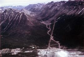
Photograph depicts the Cassiar mine valley in north mountain range. Plant and tailings pile can be seen in right foreground, and the east end of the town is visible in left foreground. Photograph speculated to have been taken during the plane ride of an outside exploration trip.
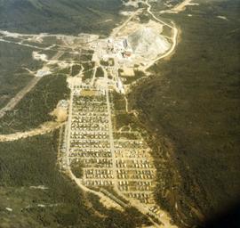
Photographs depict aerial views of the Cassiar townsite, plantsite, tailings pile, mine road, bench and pit mine, mine buildings (tramline loading station, crusher, shop, and garage), and surrounding mountain range. Here "aerial" refers to photos depicting a large area and taken from the air or from a high point of elevation.
Photograph depicts the Cassiar valley, showing the east end of town in foreground. Plant and tailings pile can be seen in right midground. Photograph speculated to have been taken during the plane ride of an outside exploration trip.
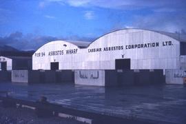
Photograph depicts the Cassiar Asbestos Corporation's warehouse on Pier 94.
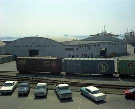
photograph depicts the Cassiar Asbestos Corporation warehouse on the asbestos wharf at Pier 94 near train tracks.
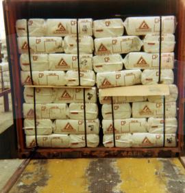
Photograph depicts Cassiar asbestos units in a shipping container at Erich Plant.
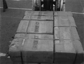
Photograph depicts a unit of grade CT Cassiar asbestos bags.
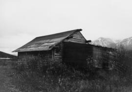
This file contains images of a land dispute around Cassiar. The photographs depict a cabin on a lot, a destroyed cabin, and outhouses. The accompanied documents in the original file refer to the subjects of "Claims, Leases, and Land lots," and it is implied that there were issues of squatters, illegal occupation, and mineral claims.
Photographs of various Cassiar Staff at work. There is extensive annotations on the back of each photo explaining who is depicted and where they are working.
Photograph of Cassiar Towniste with pen annotation on front "Deyo August 1979 - 2 October 1992)."
Photograph depicts the Cassiar townsite behind shadow in foreground. Plantsite can be seen including the mill, dry rock storage building, tailings pile, and many other buildings. Mountains in background. Handwritten annotation on recto: "<- 13 1/2" ->". (This photograph was made into a promotional poster.)
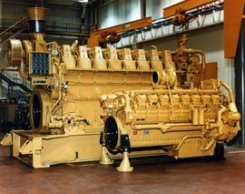
Photograph depicts large Caterpillar engine in large shop with sheeted walls and brick floor. Accompanying note reads: "MTCE 4-01 (b) Cat 3612 Engine".
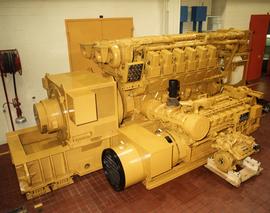
Photograph depicts large Caterpillar engine against painted brick wall in building with brick floor. Miscellaneous equipment in background. Accompanying note reads: "MTCE 4-01 (b) Cat 3612 Engine".
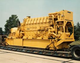
Photograph depicts large Caterpillar engine on flatbed. Road in foreground, trees in background. Accompanying note reads: "MTCE 4-01 (b) Cat 3612 Engine".
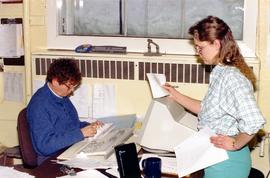
Photograph depicts warehouse clerks Cecile Pratt and Tracy Kellar in an office.
