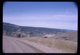
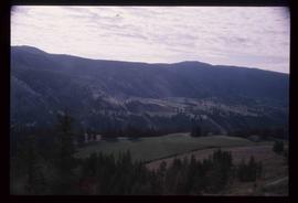
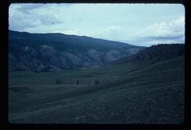
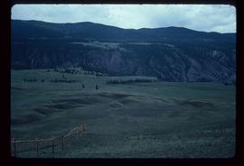
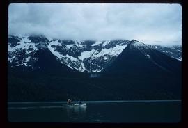
Showing 5139 results

Archival description
3026 results with digital objects Show results with digital objects
Lanezi Lake - Cirque
2012.13.1.55.25 · Item · 1971
Part of J. Kent Sedgwick fonds

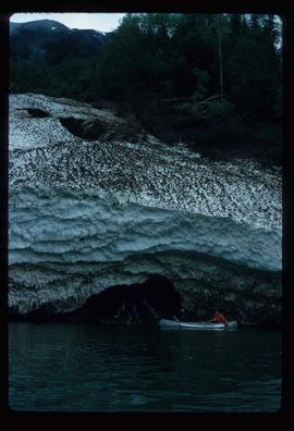
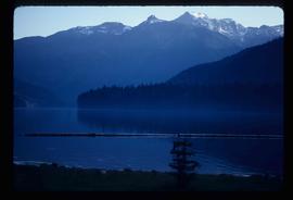
Image depicts a cirque in the mountains surrounding Lanezi Lake. Two individuals can also be seen canoeing on the lake.

Landslide?
2012.13.1.59.15 · Item · July 1980
Part of J. Kent Sedgwick fonds

Image depicts what is possibly the remaining traces of a small land or rock slide; located somewhere near Bralorne, B.C.

Landscape - Fraser River
2012.13.1.65.38 · Item · June 1975
Part of J. Kent Sedgwick fonds

Image depicts an aerial view of the land near the Fraser River. The Fraser River is barely visible on the right side of the image.

Landscape
2012.13.1.135.5.15 · Item · 2010
Part of J. Kent Sedgwick fonds

Photograph depicting a landscape with a lake and a mountain in the background.

Landscape
2012.13.1.65.48 · Item · [1976?]
Part of J. Kent Sedgwick fonds

Image depicts a view of a mountainous landscape at an uncertain location.

Landscape
2012.13.1.65.53 · Item · [1976?]
Part of J. Kent Sedgwick fonds

Image depicts a view of the landscape in an uncertain location, though possibly somewhere near the Fraser River.

Landscape
2012.13.1.65.56 · Item · [1976?]
Part of J. Kent Sedgwick fonds

Image depicts a view of the landscape in an uncertain location, though possibly somewhere near the Fraser River.

Landscape
2012.13.1.65.21 · Item · May 1975
Part of J. Kent Sedgwick fonds

Image depicts a view of the landscape of the Chilcotin Wildlife Area.

Landscape
2012.13.1.65.22 · Item · May 1975
Part of J. Kent Sedgwick fonds

Image depicts a view of the landscape of the Chilcotin Wildlife Area.

Landscape
2012.13.1.65.18 · Item · May 1975
Part of J. Kent Sedgwick fonds

Image depicts a view of the landscape of the Chilcotin Wildlife Area.

Landscape
2012.13.1.65.23 · Item · May 1975
Part of J. Kent Sedgwick fonds

Image depicts a view of the landscape of the Chilcotin Wildlife Area.

Land surveyors
2012.13.2.02.27 · File · 2003-2009
Part of J. Kent Sedgwick fonds

File consists of notes and reproductions relating to land surveyors working in British Columbia. Includes material on Rupert Williams Haggen who became a land surveyor in 1911 and surveyed Prince George, Quesnel, Bowron River, and the Fraser River area below Quesnel; Henry Fry who worked in Victoria between 1871 and 1897; Otto Julius Klotz who surveyed the Alaska-British Columbia boundary and also surveyed for the Canadian Pacific Railway between 1871 to 1927; James Herrick McGregor who worked in the Kootenays and assisted for the survey of the British Columbia Alberta border between 1891 and 1903; and Forin Campbell who came to Prince George in 1908.

Land survey information
2012.13.2.02.25 · File · 1997-2006
Part of J. Kent Sedgwick fonds

File consists of notes, clippings, and reproductions relating to contemporary and historical land surveying in British Columbia, includes material on Hunter Joseph who surveyed Quesnel to Salmon River in 1874; F.P. Burden and the surveying of the Cariboo District; and Mr. J.D. Pemberton, the colonial surveyor in 1851. File primarily consists of Kent Sedgwick's handwritten notes on land surveying in British Columbia and printed search results for the College of New Caledonia and BC Archives on land surveying. Includes: "Owning land: what you should know" pamphlet published by The Canadian Council of Land Surveyors (2004) and "Survey Systems in BC" email chain between Kent Sedgwick and John Whittaker, a B.C. Land Surveyor, discussing past land survey systems and surveyed areas in British Columbia (6 Oct. 2009).

"Land Settlement: A Report"
2012.13.2.02.64 · File · 1941
Part of J. Kent Sedgwick fonds

File consists of a bound typescript book titled "Land Settlement (A report by a C.S.T.A Committee)" produced by the Canadian Society of Technical Agriculturists in 1941.

2012.13.2.02.61 · File · 1989
Part of J. Kent Sedgwick fonds

File consists of notes and reproductions relating to land exploration and surveying in British Columbia by Alfred R.C. Selwyn, who was a British geologist and public servant, director of the Geological Survey of Victoria from 1852 to 1869, director of the Geological Survey of Canada from 1869 to 1894, and President of the Royal Society of Canada from 1895 to 1896. Includes: "Photography: Mirror of the Past" American History magazine special edition (Sept. 1989) and a photocopied article "Ninety Years Later" by F.C. Swannell from The Beaver magazine (1956). File also includes reproduced photographs depicting scenes from Selwyn's exploration around British Columbia (1989).

Lakelse Hot Spring
2012.13.1.67.05 · Item · 1979
Part of J. Kent Sedgwick fonds

Image depicts a large group of people enjoying the Mount Layton Hot springs in the Lakelse Lake Provincial Park north of Kitimat, B.C.

Lakeland Sawmill
2012.13.1.3.130 · Item · 12 Oct. 1989
Part of J. Kent Sedgwick fonds

Image depicts the Lakeland Sawmill in Prince George, B.C, identified by the beehive burners; the one with white smoke belonged to Pas Lumber Co. which was bought out by Lakeland in 1987.

Lake and Railway Tracks
2012.13.1.87.142 · Item · [between 1975 and 1995]
Part of J. Kent Sedgwick fonds

Image depicts an aerial view of a lake, and what appears to be a set of railway tracks running towards the mountains in the distance. The location is uncertain.

Lake and Forests
2012.13.1.87.143 · Item · [between 1975 and 1995]
Part of J. Kent Sedgwick fonds

Image depicts an aerial view of a lake and large, forested areas. The location is uncertain.

Lake
2012.13.1.6.162 · Item · Nov. 1980
Part of J. Kent Sedgwick fonds

Image depicts a lake with numerous buildings along the shore. The location is uncertain.