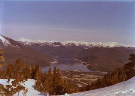
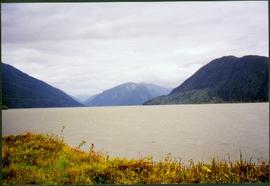
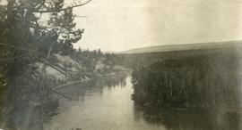
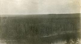
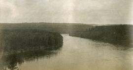
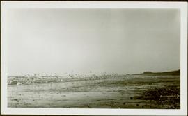
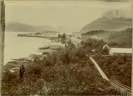
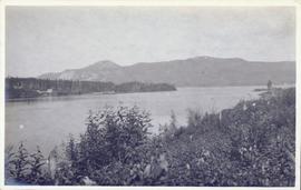
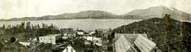
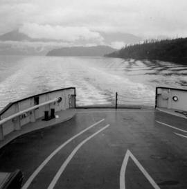
Photograph depicts a view from the ship the Queen of Powell River, en route from Earl Cove to Saltery Bay.
Hand coloured photo of lumber piles and buildings along the edge of the railway. Printed annotation on recto reads: "Prince Rupert, B.C. : View from Wharf Grand Trunk Pacific Railway." Artist's mark in lower left corner reads: "103,110 J.V."
Photograph depicts the view to the north from the terminal building at the Rainbow Lake Ski Club.
Photograph depicts town in distance, believed to be Atlin, B.C. Lake in foreground, hills in background. See also items 2009.5.2.63 & 2009.5.2.64.
Photograph taken during European Sports Tour with Team Canada.
Photograph taken during European Sports Tour with Team Canada. See also item 2009.6.1.241 for image featuring similar content.
Handwritten annotation on verso reads: "Budapest". See also item 2009.6.1.238 for image featuring similar content. Photograph taken during European Sports Tour with Team Canada.
Photograph depicts the confluence of the Cayoosh Creek outflow into the Fraser River in Lillooet, BC. Seton River is visible in the foreground. This area is Cayoose Creek Band (Sekw'el'wás First Nation) territory and includes land currently encompassed within Cayoosh Creek Indian Reserve 1. The Pacific Great Eastern Railway bridge over the Fraser River is also visible in the background.
Men can be seen working on site, building tools and supplies scattered throughout. Handwritten caption beside this photo reads: "View showing various levels of foundations". A chute of some kind extends from high level to men near bottom. Dirt road at site, and tree-covered valley can be seen in background. Construction of a long structure near the edge of the excavation area can be seen in midground; this is believed to be conveyor "B".
View showing various levels of foundations. Men can be seen working on site. Vertically protruding planks from framework in foreground. A long building believed to be housing conveyor "B" can be seen in background, as well as the tree-covered valley.
Image depicts downtown Prince George taken from across the Nechako River looking south. Map coordinates 53°56'00.0"N 122°44'29.7"W
Hand coloured view of early Prince Rupert with row of tents facing large Hotel. Printed annotation in red ink on recto reads: “The Beginning of Prince Rupert B.C.: Grand Trunk Pacific Hotel in foreground”.
Photograph depicts the steep slope of man-made embankment, forest in background at bottom of slope. Small twigs and pant leg of unidentified individual in foreground.
Handwritten caption above this photo reads: "Earth Cut". Photograph depicts the steep slope of man-made embankment, trees in background. Tracks made my machinery are visible in dirt of the cut.
Photograph depicts the steep slope of man-made embankment. Forest in background, level excavated ground in foreground.
Photograph depicts the steep slope of man-made embankment, trees in background. Tracks made my machinery are visible in dirt of the cut.
View of Cluster of buildings with treed hill in the background. Printed annotation on verso reads: “NEAR FORT GEORGE B.C.”
Lofty view of South Fort George, river and treed hills in the background. Printed annotation on verso reads: “South Fort George - 1913.” Handwritten message on recto is addressed to “Ethel M. Heurris Norton Maps Bristol County" reads: "11-1-13 an excellent view of south Fort George taken recently. Power Station at cross near water. This does not give all the south residence view. Population approx 1500”.
Lofty view of Fort George, B.C., river and paddle wheeler on right. Treed hills can be seen in background. Printed annotation on verso reads: “Fort George B. C.”
View of town on shore, from above. Boats docked along piers and buildings. Hills visible on either side of water in background.
Handwritten photo captions with arrows pointing to sections of image read: "General Merchandise", "Fort Wrangell Hotel".
Image depicts a view of Giscome with a train passing through.
Photograph depicts Lheidli T'enneh Nation burial grounds in foreground, Hudson Bay Company buildings in background.
Photograph depicts unknown lake. Grassy shore in foreground, mountains in background.
Image depicts a view of the small town of Likely, B.C.
Photograph depicts a view of the Lillooet Indian Reserve in the foreground; the town of Lillooet and the Fraser River are visible beyond.
Photograph depicts Mount Selwyn rising on opposite shore in right midground. River in foreground, mountains in background. Handwritten annotation on recto of photograph: "Mount Selwyn Peace River."
Photograph depicts a view of Nechako River near junction of Stuart River.
Photograph depicts a view of lot 912 near Nechako River.
Photograph depicts a flock of birds at beach, water and shoreline in background.
Handwritten annotation on verso reads: “North Beach Massett QCIs."
Image depicts a view of Pine Pass on the border between Alberta and British Columbia in the Rocky Mountains.
Town on right, water on left, mountains in background. Forest trees in foreground.
Handwritten photo caption below image reads: "Port ESSINGTON".
Photograph depicts buildings along shore; bridge and boardwalk cross forest in right foreground. Hills visible in distance.
Handwritten annotation below image reads: "Port Essington from bridge"; on verso: "Heading or full page Illustration Chapter XXIII No2".
Photograph depicts shore and village with a treed hill in the background. Water and boats in foreground. Handwritten annotation in ink on verso of photograph: "Port Simpson B.C.". Semi-legible annotation on recto notes the postcard was addressed to London, England.
Photograph depicts Port Simpson in winter. Water crosses midground, hills stand in background.
Handwritten photo caption below image reads: "Port Simpson".
View of pier, cluster of houses and trees with snow topped mountains in background. Handwritten annotation on verso reads: “Hospital” with an arrow pointing to the building. Postage cancelation stamp on verso reads: "PORT ESSINGTON B.C. JUL 7 07". Handwritten annotation on recto reads: “PORT SIMPSON. Mrs. Noble Port Essington B. C. Hope you are feeling better. I am doing splendidly have not felt so well for years. Dr. advises me to stay at least another month A.W.B.”
Image depicts the Grand Trunk Railway bridge across the Fraser River. Map coordinates 53°54'29.0"N 122°42'06.5"W
Winter landscape taken from behind railroad track. Cleared land in foreground, buildings in midground, low hills in background.
Handwritten annotation on recto: “PRINCE GEORGE 3-15-14”.
Winter landscape taken from behind railroad track. Cleared land in foreground, buildings in midground, low hills in background.
Handwritten annotation on recto: “PRINCE GEORGE 3-15-14”.
River crosses midground, hills on distant shores can be seen in background.
Handwritten annotation on verso reads: "No. 32, First Beginning Prince Rupert, showing Church Hall, with cross. Insert Page 136".
Lofty view of Prince Rupert BC. Water crosses midground, hills stand in background. Printed annotation on recto reads: “Prince Rupert BC McRae Bros”.
Lofty view of Prince Rupert BC. Water crosses midground, hills and opposite shore in background. Printed annotation on recto reads: “Prince Rupert BC McRae Bros”.
Photograph depicts a man standing on the deck of a ferry boat. A long row of building line the riverbank in the background.
Image depicts a view of Quesnelle Forks and the nearby river.
Photograph depicts a view of a train crossing the Sallus Creek wooden trestle along the Pacific Great Eastern Railway line near Lillooet, Fountain, and Pavilion. The angle of the photograph is looking north towards the Fraser River.
Photograph depicts a view of Seton Lake and the surrounding area, including the Pacific Great Eastern railway line. The railway grade is visible at left. Also visible is the Seton Lake fish hatchery at the east end of the lake and its employee boarding house, superintendent's cottage, and weir at the head of what was then referred to as "Lake Creek". The road seen in the centre foreground travelled from Lillooet to Seton Lake then to Golden Cache Mine.
Winter scene with buildings, street, and utility poles. Hill in background.
Handwritten annotation on verso: “South Ft. George 1912”.
Photograph depicts a view of St'a7mes village looking north, taken from the original Government Wharf in Squamish (Newport). This wharf was built in 1902 and was temporarily replaced by other docks to the west built by the PGE Railway in 1913-14. This photograph was taken after 1914, since the houses in the photo were built by the PGE Railway Company as part of the 1914 reserves sale deal.
Further details that date this photograph between late 1914 and 1920:
- the Merrill & Ring logging operation beach camp is not depicted (opened in 1926)
- the dock from which the photo is taken fell into disrepair after 1914 and was not rebuilt until 1929.