Item
Part of Cassiar Asbestos Corporation Ltd. fonds
The topographic map shows mine and campsite holdings within the proposed mine site. Asbestos deposits, the tramline and water bodies, such as Troutline Creek, are also included.
Annotations include certain lot titles being crossed out as well as as indication of missing survey information.
This map depicts the generalized pit layout and estimated waste extraction areas for 5810 bench. Annotated details include numerical bench markers, extraction dates and approximate ore extraction amounts. The hand drawn plan consists of solid and dotted lines drawn with green, orange and lead pencil.
This map depicts the generalized pit layout and estimated waste extraction areas for benches 5840 and 5870. Annotated details include numerical bench markers as well as extraction dates. The hand drawn plan consists of solid and dotted lines drawn with green and red pencil.
This map depicts the pit layout and estimated waste extraction areas for 5840 bench for the end of September to November. Extraction dates, approximate extraction tonnages and ore, waste and talus locations are included throughout the plan. Annotated details include numerical bench markers, extraction dates, approximate total tonnages as well as waste and ore tonnage calculations for October. The hand drawn plan consists of solid and broken lines drawn with red, blue, orange and lead pencils as well as black ink.
This map depicts the pit layout and estimated waste extraction areas for 5870 bench for the end of August to November. Extraction dates, approximate extraction tonnages and ore, waste and talus locations are included throughout the plan. Annotated details include numerical bench markers, extraction dates, approximate extraction tonnages, ore, waste and talus locations as well as waste, ore, talus and total tonnage calculations for October. The hand drawn plan consists of solid and broken lines drawn with red, blue, orange and lead pencils as well as black ink.
This map depicts the generalized pit layout and estimated waste extraction areas for 6290 bench for the month of November. Annotated details include numerical bench markers and waste extraction dates. The hand drawn plan consists of solid and dotted lines drawn with green, orange, red, blue and lead pencil.
This map depicts the generalized pit layout and estimated waste extraction areas for 6290 bench for the month of October and November. Extraction dates as well as total unbroken tonnages are included within certain portions of the plan. Annotated details include numerical bench markers, extraction dates, total tonnages to be extracted and approximate waste tonnage calculations for October. The hand drawn plan consists of solid and broken lines drawn with red, green, orange and lead pencils as well as black ink.
This map depicts the pit layout and estimated waste extraction areas for 6320 bench. Extraction dates accompanied by its total tonnages are located within each planned area. Certain extraction dates are labeled with bench numbers. Annotated details include extraction dates, approximate total tonnages per area accompanied by extraction dates, total planned tonnages, total tonnages from December 31, 1971 as well as a rough colored legend depicting extraction month by color. The hand drawn plan consists of solid lines drawn with green, red, orange and lead pencils.
This map depicts the pit layout and estimated waste extraction areas for 6320 bench for the end of September to October. Extraction dates are included within certain portions of the plan. Annotated details include numerical bench markers, extraction dates, and approximate waste tonnage calculation for October. The hand drawn plan consists of solid and broken lines drawn with red, orange and lead pencils as well as black ink.
This map depicts the pit layout and estimated waste extraction areas for 6350 bench. Extraction dates accompanied by its total tonnages are located within each planned area. Annotated details include extraction dates, approximate total tonnages per area as well as extraction dates, total planned and broken tonnages and total tonnages from December 31, 1970 from a survey done in September 30. The hand drawn plan consists of solid lines drawn with red, green and orange colored pencils.
This map depicts the pit layout and estimated waste extraction areas for 6380 bench. Extraction dates accompanied by its total tonnages are located within each planned area. Certain extraction dates are labeled with bench numbers. Annotated details include extraction dates, approximate total tonnages per area as well as extraction dates, total planned and broken tonnages, total tonnages from December 31, 1970 from a survey done in September 1, numerical bench markers as well as a rough colored legend depicting extraction month by color. The hand drawn plan consists of solid lines drawn with green, yellow, red and lead pencils.
This map depicts the pit layout and estimated waste extraction areas for 6410 bench. Extraction dates accompanied by its total tonnages are located within each planned area. Certain extraction dates are labeled with bench numbers. Annotated details include extraction dates, approximate total tonnages per area as well as extraction dates, total planned and broken tonnages, total tonnages from December 31, 1970 and numerical bench markers. The hand drawn plan consists of solid lines drawn with green, yellow, orange and lead pencils.
This map depicts a drawn bench plan for the estimated excavated waste for bench 6440 during the first quarter of 1972. Annotated details include the approximate excavated ore tonnages, broken and planned values for the first quarter and revised calculations from previous years values. Planned excavated areas are drawn with different colors.
Typed annotation on caption below photograph: "General Superintendent A.C. Beguin receiving 1965 Safety Award for Open Pits and Quarries in British Columbia from Mr. R.B. Bonar, Dept. of Mines and Petroleum Resources." Photograph depicts A.C. Beguin shaking hands with Mr. Bonar as he accepts a large plaque. Counter bar and curtains in background.
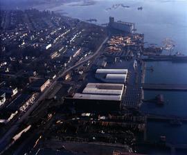
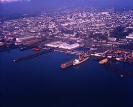
Photograph depicts the asbestos warehouse and warf in proximity to a residential area.
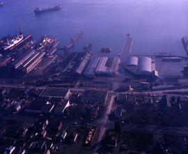
Photograph depicts an aerial view of the asbestos warf from the rear, looking towards the harbour.
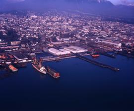
Photograph depicts the asbestos wharf with a large residential area immediately behind.
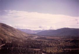
Photograph depicts an aerial view of the Clinton Creek area.
Photograph depicts an aerial view of the Clinton Creek mine.
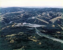
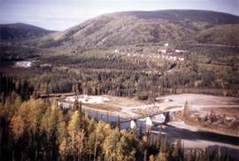
Photograph depicts an aerial view of the Clinton Creek plantsite.
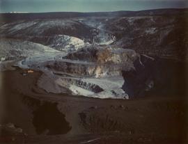
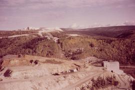
Photograph depicts an aerial view of the Clinton Creek mine quarry site.
Photograph depicts an aerial view of the Clinton Creek quarry site on the mountain.
Photograph depicts an aerial view of the Clinton Creek residential area with autumn colours.
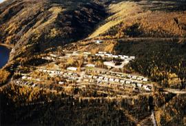
Photograph depicts an aerial view of the Clinton Creek townsite.
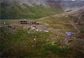
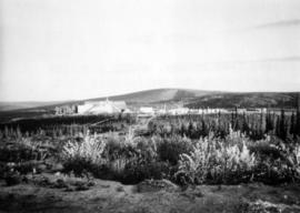
Photograph depicts steel drums and wooden buildings at an exploration camp in the Kutcho Creek valley area of B.C. The camp was set up by a crew led by Cassiar's Chief Geologist Bill Plumb. An arrow points to a possible burial site.
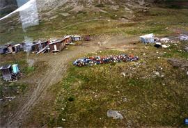
Photograph depicts steel drums and wooden buildings at an exploration camp in the Kutcho Creek valley area of B.C. The camp was set up by a crew led by Cassiar's Chief Geologist Bill Plumb.
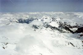
Photograph depicts a view of snow-capped mountains among clouds taken from the air.
Photograph depicts an aerial view if the asbestos warehouse and wharf.
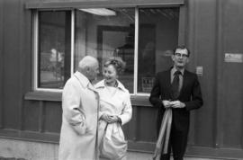
Photograph depicts Alice Gritzuk and two unknown men at a building dedicated by Mrs. Gritzuk.
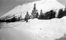
Photograph depicts snow-plowed road lined with trees, valley and mountain in background. Believed to have been taken from vehicle. Handwritten annotation on recto of photograph: "Approach to Quartz Rock Creek".
Photograph depicts the Arctic mine. typed print on reverse states, "Taken from runway, about midnight, outstanding colour in this shot. Autumnal shades."
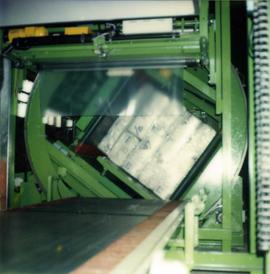
Photograph depicts a test of the asbestos bagging machine.
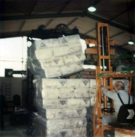
Photograph depicts a packaged asbestos durability test performed with a forklift.
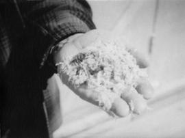
Photograph depicts asbestos being held in a bare hand.
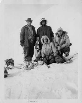
Photograph depicts George Edzerza , R. T. Gilman, Bill Mossoh, and Pete Hamlin with gear and wearing snowshoes in the Asbestos Mountain area. It is believed that the photograph portrays their exploration of the future mine at Cassiar.
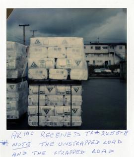
Photograph depicts two pallets of packaged AK-100 asbestos, one strapped in place and one unstrapped.
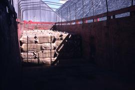
Photograph depicts pallets of packaged asbestos in a semi truck awaiting transportation.
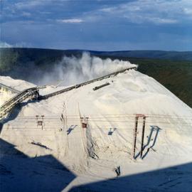
Photograph depicts an asbestos pile at the Clinton Creek mine.
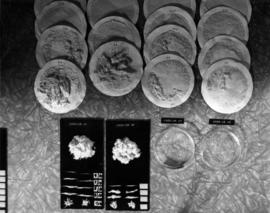
Photograph depicts samples of Cassiar asbestos.
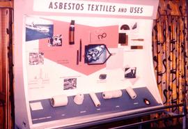
Photograph depicts a posterboard display entitled "Asbestos Textiles and Uses" with carded asbestos fibres.
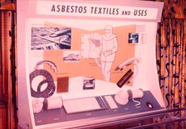
Photograph depicts a posterboard display entitled "Asbestos Textiles and Uses."
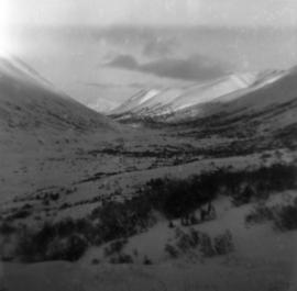
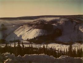
Photograph depicts snow-covered Asbestos Valley from a low altitude point on the mountain road leading to the mine.
Photograph depicts snow-covered Asbestos Valley, taken from mountain road looking northwest.
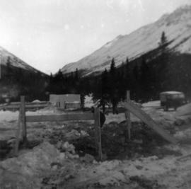
Photograph depicts three men building garage foundation in snow-covered plant site. Truck to right of men, wood fence structure in foreground, Asbestos Valley in background.
Photograph depicts the asbestos wharf with warehouse. Immediately in the background is a large residential area.
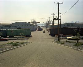
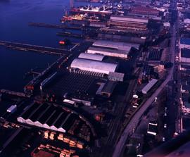
Photograph depicts the asbestos wharf on pier 94 with train tracks.
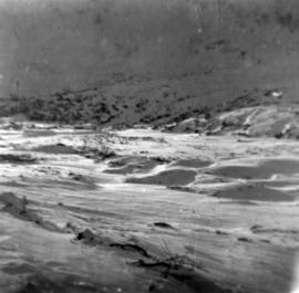
Photograph depicts snow-covered Asbestos Valley, slightly north of asbestos deposit.
Photograph depicts chief engineer for environment and safety Ashley Brown.