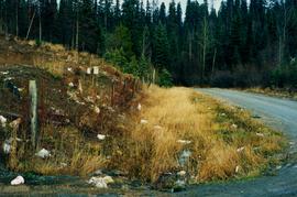
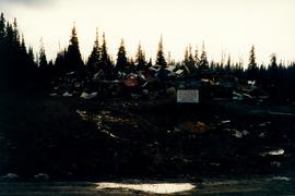
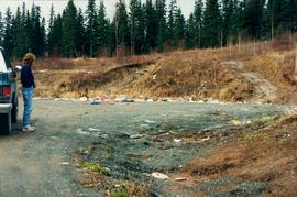
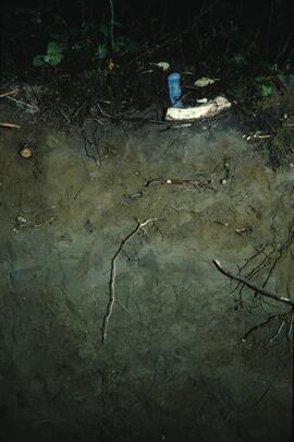
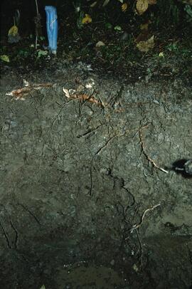
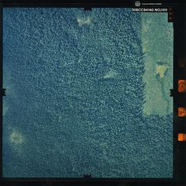
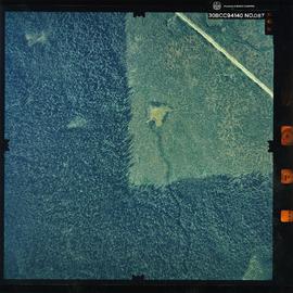
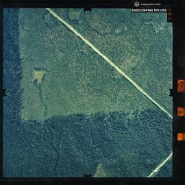
Photograph depicts the Aleza Lake regional district garbage dump in October 1992.
Map is a mylar reproduction of an Aleza Lake Forest Reserve map.
Item is a photocopied Aleza Lake Forest map with forest cover labels, annotated to show 1995 sample transects.
Item is a photocopied Aleza Lake Forest map with forest cover labels annotated to show 1994 RFP study area.
Item is a photocopied and annotated Aleza Lake Forest map with forest cover labels.
Slide depicts the original wooden BC Forest Service sign for the Aleza Lake Forest Experiment Station.
Item is a photograph of a copy print, resulting in a low quality photographic reproduction. Reproduced as a print, slide, and a negative. Location of original photograph is unknown.
Item is a photograph of a copy print that has been reproduced as a slide, resulting in low photographic quality. Location of original photograph unknown.
Back, left to right: Pinker, Rigler, Frank Dickson, Jack Freeborn
Front, left to right: Proste, Eric Garman, John Gerlitsky, Herbert (Ray) Sansom
Item is a photograph of a copy print that has been reproduced as a slide, resulting in low photographic quality. Location of original photograph unknown.
The improvised forest fire "lookout shows up in the background. A small experimental nursery is in the foreground." --from the notes of Ralph Schmidt in accompanying file
Item is a photograph of a copy print, resulting in a low quality photographic reproduction. Reproduced as a print, slide, and a negative. Location of original photograph is unknown.
Item is a copyprint reproduced from the British Columbia Forest Service photographic records held at BC Archives.
Map reflects lot and STL lines, timber sale boundaries, Highway 16, roads, beetle infested areas, and plots X91971 to X91980, and X89946.
Item is a photograph of a copy print that has been reproduced as a slide, resulting in low photographic quality. Location of original photograph unknown.
Map is a photocopy reproduction of the Aleza Lake Experiment Forest working circle timber sale map that was included in the appendix to the 1957 Aleza working plan.
Map is a photocopy reproduction of the Aleza Lake Experiment Forest permanent plot map that was included in the appendix to the 1957 Aleza working plan.
Map reproduction depicts major areas of the Aleza Lake Experiment Forest.
Map reflects reserve boundary, roads, trails, 20 feet contour intervals, air photo centre, declination, swamps, and mile post at the Aleza Lake Forest Reserve.
Map is a photocopy reproduction of the Aleza Lake Experiment Forest development map that was included in the appendix to the 1957 Aleza working plan.
Map is a photocopy reproduction of the Aleza Lake Experiment Forest map that was included in the appendix to the 1957 Aleza working plan.
Map reflects reserve boundary, roads, trails, 20 feet contour intervals, air photo centre, declination, swamps, and mile post at the Aleza Lake Experiment Forest.
Map is a photocopy reproduction of the "Aleza Lake Experiment Forest" map that was included in the appendix to the 1957 Aleza working plan.
Item is a photograph of a copy print, resulting in a low quality photographic reproduction. Reproduced as a print, slide, and a negative. Location of original photograph is unknown.
Item is a photograph of a copy print that has been reproduced as a slide, resulting in low photographic quality. Location of original photograph unknown.
Floppy contains the following files: AL94ENV.DAT, AL94VEG.DAT, ALZZ95.DOC, GISDAT.XLS.
Floppy contains the following files: AL52-55.wk1, AL56-60.wk1, AL61-65.wk1, AL66-70.wk1, AL71-75.wk1, AL76-80.wk1, ALX52-80.wk1
Floppy contains the following files: AL52-55.dat, AL56-60.dat, AL61-65.dat, AL66-70.dat, AL71-75.dat, AL76-80.dat
Floppy contains flag files (AL52-65F.dat, AL66-80F.dat) and Fortran programs (AES.for, AESEXT.for, AESFLG.for).
Photograph depicts an open field with a fence, house and shed in the midground, low treed hills in the background.
Item is a photograph of Alex Moffat dressed as a prospector holding gold nuggets he salted into a gravel bed and later panned out and gave to Princess Margaret.
Photograph is a remote-sensing image of the Aleza Lake Research Forest from 1994.