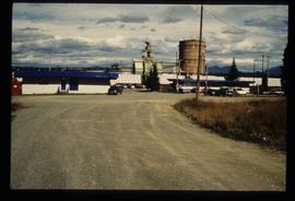
Image depicts the entrance to the Upper Fraser mill yard in Upper Fraser, B.C. Map coordinates 54°07'10.8"N 121°56'51.7"W
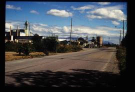
Image depicts the Upper Fraser Road running through Upper Fraser, B.C. A newer style round burner is seen in the background. Map coordinates 54°07'05.7"N 121°56'38.9"W
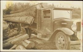
An “Indiana” flatbed logging truck releases logs from its load onto a makeshift log slide at the edge of a road.
Handwritten annotation in pencil on verso: "unloading logs".
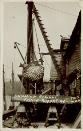
Photograph of a net of halibut being unloaded in a harbour in Prince Rupert, BC. Printed annotation on recto reads: "Unloading Halibut Prince Rupert, B.C. Photo W.W.W."
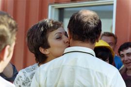
Photograph depicts an unknown woman kissing Trudeau on the cheek in a crowd of people.
Photograph depicts a man and woman standing on what is believed to be an early mining bench. Two men with air track drill can be seen in background, one man father down on left, mountain range in background. Image slightly distorted due to poor quality of negative.
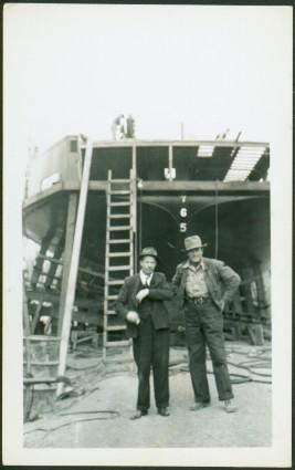
Photograph depicts two men standing in foreground, hull of unfinished ship in background. Construction supplies and materials throughout.
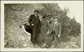
Photograph depicts four men wearing suits and ties, standing in front of mine adit in rocky area, bushes in background. Handwritten annotation on recto of photograph: "1939 H.F. (Bert) Glassey with black hit in middle" (information regarding Glassey believed to be incorrect).
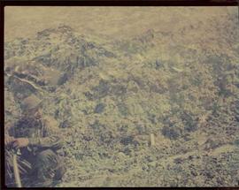
Image of man seated with shovel in mountainous area, loose asbestos fibre in background. This photograph is believed to be either a double exposure of two images, or a print made from two negatives at once. Photo depicts an unidentified man sitting on the south ridge of the Cassiar ore body, where the crusher and rock reject plant would eventually sit. Valley in background appears to depict the "Footwall Road," which was cut into the mountain from the pit to the crusher plant and became the mine's main haul road.
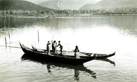
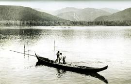
Photograph depicts an empty canoe floating beside a canoe full of fish. Hills visible on opposite shore in distance.
Handwritten annotation on verso reads: "Loaded with fish - Nass River".
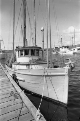
Photograph depicts the an unidentified fishing boat at the Prince Rupert marina.
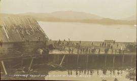
Photograph of a half-demolished building attached to a large dock. A large group is milling around the damage. Debris litters the water. Annotation on recto reads: "Undesired result of big blast at Prince Rupert. August 13 1908. Allen Photo."
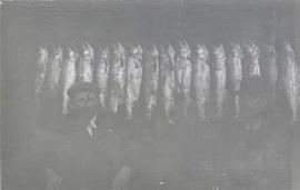
Photograph depicts two men seated in front of a row of hanging fish.
Handwritten annotation on recto of photograph: "Bill Giachino & 'Sam' June 1970 / #4 / 74% / by Tom Kiefer".
Photograph depicts two unidentified men at high elevation on mountain. Trucks and tanks visible in background, hose (possibly of air track drill) in right foreground. Mountain range in background.
Photograph depicts two unidentified men on road or mining bench at high elevation on mountain, valley in background.
Photograph depicts two men handling fishing net in canoe full of fish. Hills visible on opposite shore in distance.
Handwritten annotation on verso reads: "Oolichan Fishing on Nass River".
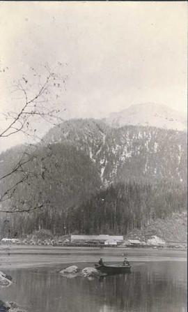
Photograph depicts two unidentified men fishing in a boat in front of Namu Cannery with a forested mountain visible in the background.
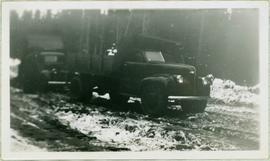
Photograph depicts two dump trucks on snowy dirt road in forest, the truck in back dumping its load.
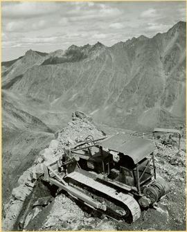
Photograph depicts unknown men driving bulldozers on edge of mine area at high elevation. Dozers are Internationals, model TD24 (manufactured between 1947 and 1955). Valley and mountain range in background.
Photograph depicts unknown men driving bulldozers on edge of mine area at high elevation. Dozers are Internationals, model TD24 (manufactured between 1947 and 1955). Mountain range in background.
Photograph of Prime Minster Pierre Trudeau standing with a group of men looking over the Cassiar valley. Trudeau stands in the middle wearing a yellow shirt.
Photograph of Prime Minster Pierre Trudeau standing with two other men at the Cassiar Mine.
Handwritten annotation on recto of photograph: "MINE DRY ON LEFT". Photograph was glued to cardboard backing with the annotation: "1962".
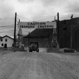
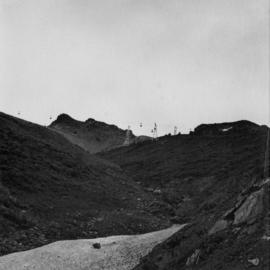
Gravel road in foreground, mountain in background. Sign over road reads: "CAUTION TRAMLINE CROSSING".
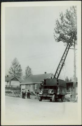
Photograph depicts a group of men standing to right of large truck, houses in in background. Boom of crane visible between truck and houses. Trees and power lines also visible.
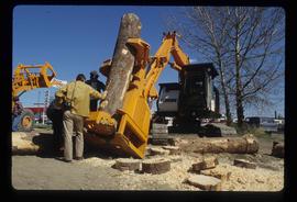
Image depicts two unidentified individuals examining a thick log still attached to the machine that cut it down. It is located somewhere in Prince George, B.C.
Al Elsey compiled his original footage from 1965 to produce this commercial film that deals with trapping beaver, the Anahim Lake Stampede and Caribou migration. The video provides a compilation of film footage shot by Elsey and is narrated by him describing the activities documented in the footage
Map depicts various gas projects across North America including: the "El Paso Project" along American and Mexican boarder; the "Arctic Gas Project" which runs from the Beaufort Sea through Alberta towards San Francisco and Chicago; the "Alcan Project" which runs through Alaska, British Columbia, Alberta and onwards to San Francisco and Chicago; the "Maple Leaf Project" which runs from the Beaufort Sea into Alberta; and the "Polar Gas Project" which runs from the Parry Islands and circles the Hudson Bay towards Quebec.
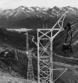
This photograph is part of tramline study of bucket loads. It depicts the tramline station at the top of the mountain and terrain it runs above.
Photograph depicts towers and bucket in foreground, plantsite midground in valley, opposite mountains in background. Handwritten annotation on recto of photograph: "GENERAL VIEW VISIBLE TOWERS ARE IN #1 SECTION PLANT IN BACKGROUND". Photograph was glued to cardboard backing with the annotation: "1962".
Photograph depicts towers and buckets in distance. Gravel road in foreground winding through hills of dirt. Handwritten annotation on recto of photograph: "#1 SECTION". Photograph was glued to cardboard backing with the annotation: "1962".
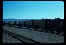
Image depicts a train carrying logs somewhere in Prince George, B.c.
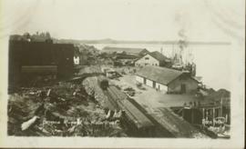
Photograph of a train traveling through Prince Rupert. Several people are gathered on the dock and around various buildings. Two small vessels are docked in the harbour. Annotation on recto reads: "Prince Rupert, Waterfront. Allen Photo May '4."
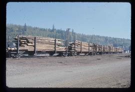
Image depicts a train transporting wood planks, possibly in Prince George, B.C.
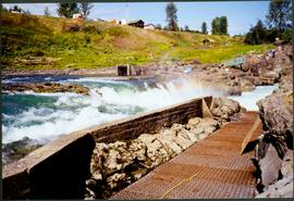
Photograph depicts fishing territory at waterfall rapids in Bulkley River, B.C. Highway and buildings on opposite shore in background.
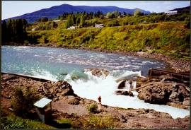
Photograph depicts an unidentified individual standing on cliff above waterfall at Bulkley River, B.C. Fishing territory visible below; highway, buildings, and hills visible in background.
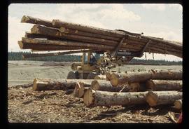
Image depicts a tractor with a claw lifting logs at a saw mill in Prince George, B.C.
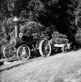
Photograph depicts a tractor owned by G. Wellburn at the Duncan Forest Museum.
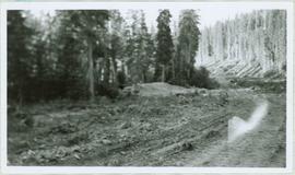
Photograph depicts tracks made by machinery in an earth road turning left in forest.
Photograph depicts the Cassiar valley. Handwritten annotation on verso of photograph: "1958 [1961 crossed through]", on recto: "Cassiar Asbestos Corporation Limited. Cassiar B.C. Townsite in foreground mill and ore storage in left middle ground," "Toronto set". It is believed that this photograph was made into a post card.
Photograph depicts the Cassiar plantsite in foreground, including the mill, dry rock storage building, tailings pile, and many other buildings. Townsite in midground, mountains in background. Handwritten annotation on recto of photograph: "Cassiar."
Photograph depicts the Cassiar plantsite including the mill, dry rock storage building, tailings pile, and many other buildings. A portion of the townsite can be seen on left.
Photograph depicts the Cassiar townsite in foreground. Mill, dry rock storage building, and tailings pile can be seen in background. Handwritten annotation on verso of photograph: "1958 [1961 crossed through]."
Photograph depicts the town of Cassiar in foreground, mountain base in background. Photograph was taken from the air, portion of plane visible in top left of image.
Photograph depicts the town of Cassiar, mountain base in background.
Photograph depicts the town of Cassiar behind plant and tailings pile in foreground. Mountain range in background.
Photograph depicts the Cassiar valley: town on left, plant on right, mine valley in background. Photograph was taken from above, facing north east.
Photograph depicts the town of Cassiar, mountain base in background. Mine road visible in top right of image.
Photograph depicts the town of Cassiar, mountain base in background. Mine road visible in top right of image.
Photograph depicts the town of Cassiar behind plant buildings in left foreground. Mountain base in background. Photograph was taken from the air, portion of plane visible in top left of image.
