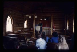
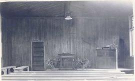
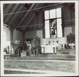
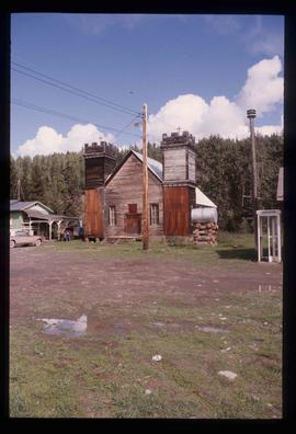
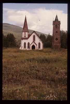
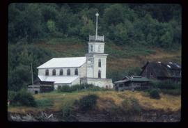
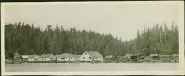
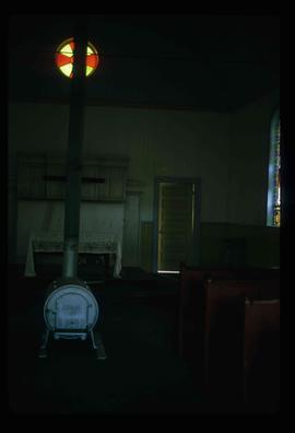
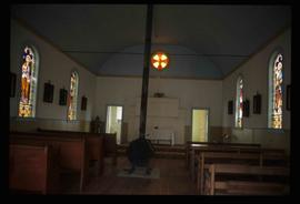
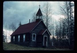
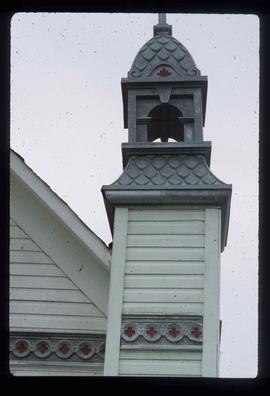
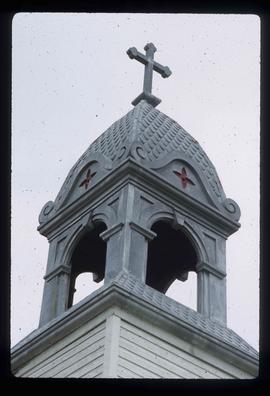
Image depicts several unidentified individuals exiting a church made of logs, possibly in Fort St. John, B.C.
Image depicts several unidentified individuals inside of a church made from logs, possibly located in Fort St. John, B.C.
Image depicts a Catholic church in Giscome, B.C. Map coordinates 54°04'15.5"N 122°21'52.1"W
Image depicts a church in Giscome, B.C. Map coordinates 54°04'16.2"N 122°21'54.3"W
Photograph depicts a group of First Nations boys with a minister posed for a photo on what appears to be a boat. Possibly a Mission School class photo.
Photograph depicts a group of First Nations girls posed for a photo with two women on what appears to be a boat. Possibly a Mission School class photo.
Photograph depicts a group of people standing on the boat "Columbia" with a forested environment visible in the background. Handwritten annotations on verso read: “Christening at Dedricksons Camp. Drury Inlet”; “Three babies baptized this time”
Image depicts a church on a hill in Hagwilget, B.C.
Image depicts a row of houses, as well as a United Church of Canada on the right side of the image, located in Wells, B.C.
Photograph of the interior of an unidentified church with a view of the central altar.
Photograph features interior perspective of the front of an Anglican church as seen from the nave. A large stained glass window, a carved Thuderbird lecturn and the altar are visible.
Item consists of transcript of recorded interview with Reverend Francis Edward Runnalls who discusses his career as a United Church minister in Prince George c.1920s-1940s. Also discusses his historical works written about Northern British Columbia and Prince George.
Image depicts an Anglican church in Kitwancool Lake, B.C.
Image depicts an Anglican church and a bell tower in Kitwanga.
Image depicts a Knox United Church at an uncertain location, though possibly in either Hixon or Woodpecker, B.C.
Image depicts an old church located somewhere in Lillooet, B.C.
Image depicts the All Saints Anglican Church in McBride, B.C. The slide labels it as having "moved to PG."
Image depicts a church somewhere in McBride, B.C. The sign in front possibly reads "St. Patrick's Church."
Photograph depicts a brick Methodist church on a street beside houses. Annotation on recto of photograph states: "METHODIST CHURCH, ENDERBY, B.C."
Photograph depicts the exterior of a church with a steeple surrounded by trees. Annotation on recto of photograph states: "Methodist Church Port Simpson BC"
This file consists of copies of two manuscript items relating to the history of the Oblates in Northern British Columbia; the third item is a copy of the transcription and translation of one of these accounts. Includes:
- A copy of a type-written unpublished account possibly written c. 1922 entitled "Indian Schools of Fort St. James and Fraser Lake, B.C." The account is written by Father Elphage Allard, OMI on the founding of the residential school at Fort St. James and later of the building of the residential school at Lejac, near Fraser Lake, BC. Allard refers to his, and his younger siblings', also named Father Allard, involvement in the building of the residential schools at Fort St. James in 1916-1917 and subsequently at Fraser Lake ca. 1920-1922. Father Allard provides a detailed account of daily life and spiritual work conducted by the Oblates at the schools including daily routines of the First Nations students, dormitory life, educational curriculum, religious education, and arrival of a group of the Sisters of the Infant Jesus Congregation to assist at the school. The account provides descriptions of the 1918 flu epidemic and deaths that occurred among communities at Fort St. James, Pinchi, Tachi, Fraser Lake and Lake Porteur; involvement of the Anglo-Europeans in the construction of the schools; and interactions with the Chinese cook and Indian Agent in the communities. The manuscript also provides brief account of Allard's journey to provide religious services to other First Nations communities including Fort Graham, McLeod Lake, Atlin and Whitehorse. Both Father Allards were subsequently dismissed from involvement in the Fraser Lake School in 1922.
- A copy of a handwritten account by Father Jean-Marie Lejeune entitled "Comment la Sténographie a été introduite dez les sauvages" written by Lejeune at the Indian Missionary, Kamloops, B.C. c.1890-93 in which he describes his introduction of the shorthand in British Columbia to First Nations in the Kamloops region and the subsequent publication of the newsletter entitled Kamloops Wawa.
- A transcription and translation of Father Lejeune's account by William Poser with annotations.
Image depicts a church on a hill in Moricetown, B.C.
Image depicts the Oblates of Mary Immaculate Catholic Church in Aleza Lake, B.C. Map coordinates 54°07'08.2"N 122°02'00.0"W
Image depicts an old, abandoned church located somewhere in Seton Portage, B.C.
Image depicts an Anglican church in Old Aiyansh.
Image depicts an open field and numerous buildings, including a church in Giscome, B.C. Map coordinates 54°04'03.2"N 122°22'04.6"W
Photograph depicts a fishing camp with boats and buildings on floating docks and a forested environment visible in the background. Handwritten annotation on verso states: “1960 Seymour Inlet. Oscar Johnston’s Camp on the Move. Taken from Mission Ship Columbia”; photographer’s stamp on verso states: “W.E. Nicholson”
The images consists primarily of 130+ photographs taken by or belonging to Reverend R.W. Large, MD which depict communities on the Northwest Coast between approximately 1898 and 1920 including Bella Bella, Rivers Inlet, and Port Simpson, including native villages in which Reverend Large worked. Images show scenes of native fishing, canneries, mission hospitals, churches, girls schools, portraits of native families, and Northwest Coast totems. Other images include 25+ photographs and postcards from the Large family depicting ships and boats on the North Coast.
Image depicts the interior of a church in Shelley, B.C.
Image depicts the interior of the church after its restoration, in Shelley, B.C.
Consists of 165 black and white photographs depicting Northwest Coast communities including Bella Bella, Rivers Inlet, Port Simpson, and Prince Rupert between approximately 1900 and 1920. Also includes postcard images of ships and boats on the North Coast belonging to the Large family, from Reverend Large's son Dr. R.G. Large. Also includes 39 colour slides ca. 1960 of ship scenes and weather balloon launches from the Dr. R.G. Large family.
Large, R.W., Rev.Image depicts an old Catholic church in Salmon Valley.
Photograph depicts men and women standing on the floating platform of Mrs. Lanes’ floating home with two boats docked in the foreground. Handwritten annotation on verso reads: “This taken after service at Mrs. Lanes”. Photographer’s stamp on verso states: “W.E. Nicholson”
Image depicts a church and several houses in Seton Portage, B.C.
Photograph depicts several buildings along a forested shoreline with a church in the background.
Image depicts a small section of the boarded up church in Shelley, B.C.
Image depicts a section of the boarded up church at Shelley, prior to its restoration.