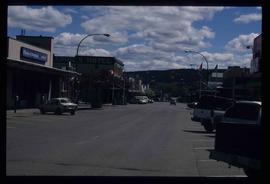
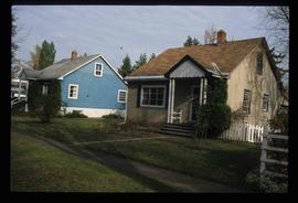
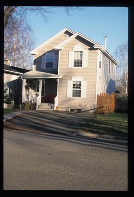
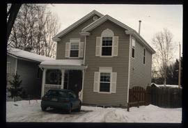
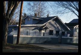
The item is a photograph depicting 5th Avenue looking West from Vancouver Street. Annotations on the back states, "Monday 11:00 am - 29 Apr. /91 5th Ave looking W. from Vanc."
This item is a photograph of 575 Quebec Street, Prince George. Building is white, pink and blue. Telus tower can be seen in the background.
The item is a photograph that depicts the back of veteran housing at 510 Douglas Street. House is on the south east corner. Beige stucco house with brown roof.
The item is a photograph that depicts the front of veteran housing at 510 Douglas Street. House is on the south east corner. Beige stucco house with brown roof.
The item is a photograph that depicts the side of veteran housing at 510 Douglas Street. House is on the south east corner. Beige stucco house with brown roof.
The photograph depicts a white duplex on Marston Road. The addresses on the duplex read 4603 and 4633. A blue Chevrolet truck is parked next to the building.
The photograph depicts a white duplex on Marston Road. The address on the duplex reads 4555.
The photograph depicts a two-story white house at 4486 Zilkie Rd. Prince George. Annotation on reverse side of photograph states, "Zilkie Rd."
Image depicts 411 Patricia Boulevard in Prince George, B.C.
The photograph depicts a duplex on the lot located at 4084 Old Cariboo Highway outside of Prince George, BC. The house is white stucco with a sheet metal roof.
The photograph depicts a duplex on the lot located at 4084 Old Cariboo Highway outside of Prince George, BC. The house is white stucco with a sheet metal roof. The duplex on the right side has Halloween decorations on the door and in the window.
Image depicts a view of the corner of 3rd Avenue and Brunswick Street in Prince George, B.C.
Image depicts the Europe Hotel on the south side of 3rd Ave in Prince George, B.C.
Image depicts the south side of 3rd Ave in Prince George, B.C.
Image depicts a view of 3rd Avenue with the Columbus Hotel prior to the fire that destroyed it in 2008.
The item is a photograph that depicts the front of a beige house at 321 North Moffat Street.
The item is a photograph that depicts the backside of a beige house at 321 North Moffat Street.
The item is a photograph depicting the side entrance of the house located at 2542 Hazelton Street, Prince George. The stucco house has multiple units.
The item is a photograph depicting the front and side of the house located at 2542 Hazelton Street, Prince George. The stucco house has three levels and multiple units.
The item is a photograph depicting the back of the house located at 2540 Hazelton Street, Prince George. The house has grey stucco and is two stories.
The item is a photograph depicting the front of the house located at 2540 Hazelton Street, Prince George. The house has white siding and has multiple units. Annotation on the reverse side of the photograph states, "2540 Hazelton."
The item is a photograph of a grey concrete brick house in Prince George. The address appears to be 2299 on an unknown street.
The item is a photograph depicting a house at 1705 Fir Street, Prince George. Annotation on the back of the photograph states, "1705 Fir St. - N. of F-C school at 17th. 1st Cath. Church off reserve Sept. 13? Rev. Rivet."
The item is a photograph slide reproduction depicting a wooden walkway set up during a flood in Prince George. There are multiple people on the walkway and a man on a raft next to the walkway. Annotation on the slide states, "1936."
The item is a photograph depicting the back of a white coloured house at 1711 Elm Street, Prince George. The house is located in the Millar Addition. Annotation on reverse side of photograph states, "1711 Elm at 17th N. edge of FG Park."
The item is a photograph depicting the front of a white coloured house at 1711 Elm Street, Prince George. The house is located in the Millar Addition. Annotation on reverse side of photograph states, "1711 Elm at 17th N. edge of FG Park."
The item is a photograph depicting a house with a blue car at 1705 Fir Street, Prince George. Annotation on the back of the photograph states, "1705 Fir St. - N. of F-C school at 17th."
Image depicts an old log cabin at an uncertain location.
Image depicts 1690 Dogwood Street, on the corner of 17th Ave and Dogwood St. in Prince George, B.C. Also depicts a portion of 1670 Dogwood Street at left.
The item is a photograph depicting the front and side view of a white coloured house at 1699 5th Avenue in Prince George. Annotation on reverse side of picture states, "1675 5th Sept 94."
The item is a photograph depicting the front view of a white coloured house at 1699 5th Avenue in Prince George. Annotation on reverse side of picture states, "1675 5th Sept 94."
The item is a photograph depicting the Gaul residence at 1651 5th Avenue in Prince George. House is a proposed heritage building.
Image depicts 1650 Dogwood Street and 1670 Dogwood Street in the Millar Addition neighbourhood in Prince George, B.C.
The item is a photograph depicting the front of a grey house at 1643 5th Avenue, Prince George.
The item is a photograph depicting the side view of a white coloured house at 1633 10 Avenue in Prince George. Annotation on reverse side of picture states, "983 Vanc. St."; however, this annotated is believed to be an incorrect identification of the photograph.
File consists of notes and typescript documents relating to a heritage house owned by Dr. Carl Ewart and Hubert King. Includes: "Rosel's Restaurant" typescript document (1992) and "The Hub King Residence" typescript document (1992). Also includes photographs depicting a painting of 1624 Seventh Avenue in Prince George (Aug. 1992).
The item is a photograph depicting the front and side of a white house located at 1616 8 Avenue, Prince George. Annotation on back states, "Van Horlick to north of property / Alex 1616 8th - Trimble house."
This item is a photograph of a blue building at 1601 4th Avenue, Prince George. Building includes the Freemason Lodge.
The item is a 35 mm photograph negative of a five story blue and white apartment complex located at 1600 3rd Avenue, Prince George.
Image depicts the intersection of 15th Ave and Highway 97 in Prince George, B.C.
Image depicts 1598 Fir Street in Prince George, B.C.
The item is a photograph depicting the side of a beige house at 1589 7th Avenue, Prince George.
The item is a photograph depicting the front of a beige house at 1589 7th Avenue, Prince George.
Image depicts 1590 Fir Street in Prince George, B.C.
File consists of notes, letters, clippings, and reproductions relating to a heritage house at 1589 Seventh Avenue in Prince George, which had been previously owned by Dr. Edward James Lyon, a medical doctor who began practicing medicine in Fort George in 1916. Includes: "RE: Heritage House" fax message from Kent Sedgwick to Kirk Gable (23 May 2001); "House at 1589 - 7th Ave". typescript letter to Public Hearing RE: by-law 4913 from the Heritage Advisory Committee (8 Apr. 1987); and "Ingenika Tribal Administration" typescript letter from Lorna Wandio to the Mayor and City Council of Prince George (19 Sept. 1998). Also includes photographs depicting a house at the address 1589 7th Avenue, Prince George (8 Apr. 1987).