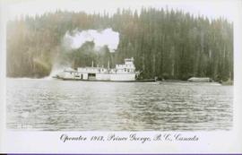
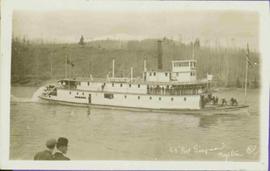
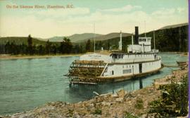
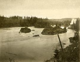
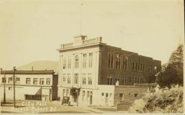
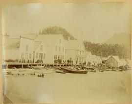
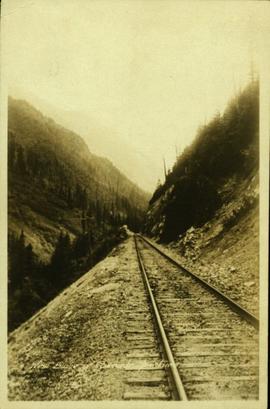
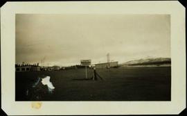
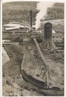
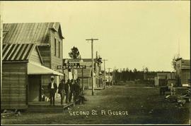
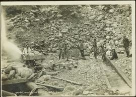
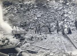
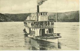
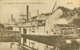
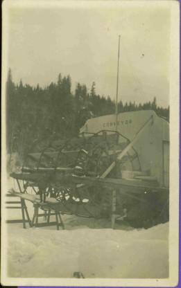
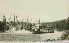
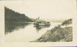
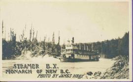
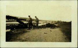
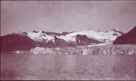
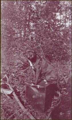
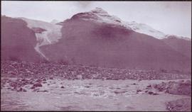
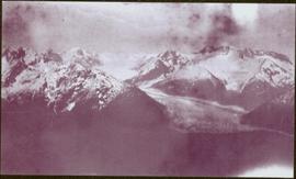
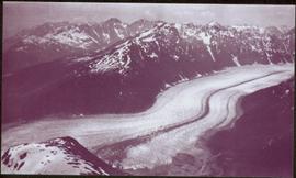
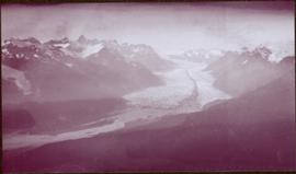
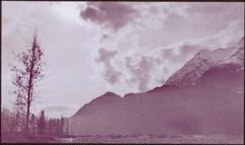
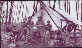
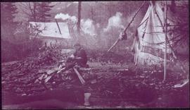
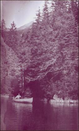
This file consists of 4 copy prints and negatives depicting town buildings around Pouce Coupe, B.C.
This file consists of 4 copy prints and negatives depicting the Pouce Coupe landscape and townsite.
Postcard image depicts streetview looking west along 3rd Ave in Prince George, B.C. Storefronts and period automobiles are visible. Handwritten annotation on photographic negative, now visible along bottom of print image reads: "3rd Ave, Prince George B.C. Looking West. HND 41".
Postcard featuring a car parked outside of Prince Rupert City Hall. Handwritten annotation on verso reads: "Alex Hall, Glyn P.O., Victoria, B.C. Prince Rupert, Billy S."
Photograph consists of a section of railroad running along the edge of a forested mountain. Handwritten annotation along bottom of recto reads: "West Slope of Cascade Mountains."
Photograph features a sign in the middle of a field at the Royal Canadian Air Force base in Whitehorse, YT that reads: "Taking Photographs Prohibited". Handwritten photo album caption below this photo reads: "Our Authority". See also items 2006.20.12.39 & 2006.20.12.43.
Royal Canadian Air ForceHandwritten annotation in pencil on verso: "Daily Capacity 100,000 f.b.m. sawmill in foreground planer mill and lumber yard in background.”
Includes 1 original mounted photograph of 6 men standing and 1 sitting at an unnamed building beside Rigg's Restaurant on what has been labelled as Second St. in Fort George.
Photograph depicts a street scene along Second St. in Fort George. Wagons line the dirt road which is flanked by wooden buildings. A group of unidentified men stand on the boardwalk outside of Rigg's Restaurant. Handwritten annotation along bottom of photograph: "Second St. Ft. George".
Japanese (?) Man standing in a canoe
Photograph depicts Slim Williams and four members of his dog team in the centre of the image, with a group of men, women and children standing behind him looking towards the camera. Handwritten annotation along bottom of photograph reads: "'Slim' Williams and Dog Team From Alaska to Chicago 1933". It is believed this photograph was taken in Hazelton, BC. and documents Slim Williams on his way to the Chicago Fair.
Includes 1 original mounted photograph of "Slim" Williams and his dog team standing in front of a group of children and men.
Group of five miners stand in mining area on left. Woman, man, and young girl sit and stand on far right in more formal attire. Mining tools and equipment throughout.
Printed annotation on recto of photograph: "Société Minière de B.C., Atlin B.C. July 28th, 1901, A.C. Hirschfeld, No. 707".
Photograph depicts men on sternwheeler in river, opposite shore in background.
Printed annotation on recto reads: “S.S. “Charlotte,” Quesnel. B.C.” Handwritten message on verso is addressed to “Mr. O. Winter 1016 V Park St. Victoria B.C.” Cancellation stamp on Canadian 1 cent stamp reads: "ASHCROFT B.C. JUN [10?] 11".
Postcard photograph depicts two sternwheelers in dock. Group of men can be seen standing on dock. Steep banks of opposite shore visible in background.
Printed annotation on recto reads: “S.S. “Operator” and “Conveyer” at Fort George, B.C. No. 107.”
Postcard photograph depicts sternwheeler in river, trees on opposite shore in background.
Printed annotation on recto reads: “Operator 1913, Prince George, B.C. Canada”, handwritten in pencil on verso: “Operator 1913”.
Postcard photograph depicting Sternwheeler traveling in river with mountains in the background. Large group of people can be seen on deck, and two unidentified men stand on shore in foreground.
Printed annotation on recto reads: “S.S. Port ‘Simpson Hazelton BC”. Handwritten message on verso is dated “July 31st 1911”.
Postcard photograph depicts sternwheeler tied to riverbank.
Printed annotation on recto reads: “On the Skeena river, Hazelton, B.C.” Handwritten message on verso is addressed to “Mrs. Flossie Strong 6 Nah St. Watermill ME, U.S.A” 1 cent Canadian postage stamp has been canceled with stamp reading “Dec 24, 5:30 PM 1915 Buffalo N.Y.”
View of a sternwheeler in the distance making its way down Fort George Canyon. Printed annotation on recto reads: "Fort George Canyon."
Photograph features paddle of sternwheeler with the word "CONVEYOR" visible above paddle. Snow on ground, forest on hill in background.
Handwritten annotation on verso in pencil reads: “Tete Jaune B.C.”
Rocks and trees on either shore.
Printed annotation on recto reads: “Steamer B.X. Monarch of New B.C. Soda Creek, Quesnel and Fort George”
Handwritten annotation in pencil on verso reads: “Prince George to Tete Jaune” Hand written message in ink on verso is addressed to “Mademoiselle Elisabeth Joliet, Terrguy – Les Dijore Cote a Or France”.
Rocks and trees on either shore.
Printed annotation on recto reads: “Steamer B.X. Monarch of New B.C. Photo by James Heay”.
Postcard photograph depicts lofty view of sternwheeler in river. Scattered buildings and tents in background, river and shore in foreground. Printed annotation on recto reads: “South Fort George Oct 30th 1910”
Photograph depicts a small car and passengers on log ferry in foreground and one man on dock. Stuart River and forested banks in background. Handwritten photo caption below photograph reads: "Stuart River Ferry."
Handwritten photo album caption below this photo reads: "The above ship, after 'doing' a barrel-roll 50 feet above the runway." Photograph depicts three men in uniform bent over wreckage of plane crash in airstrip believed to be at Whitehorse, YT. Large group of men and vehicles in background on right, trees and hillside in background on left.
Royal Canadian Air ForcePhotograph depicts two unidentified men standing and sitting at campfire by large fallen trees. Forest and mountains in background. Handwritten annotation on negative: "[?] Taken Near Kopoka".
Image is one of 65 photos documenting a survey of the Canada-Alaska Boundary, Taku River area, May 23 to Oct. 15, 1906.
This particular photo is one of 8 found in original enclosure with the following handwritten annotation: "From main camp up Kopoka River. Scenes with persons in." See also items 2006.20.3.14 - 2006.20.3.21.
Photograph depicts tent among trees, hills visible in background.
Image is one of 65 photos documenting a survey of the Canada-Alaska Boundary, Taku River area, May 23 to Oct. 15, 1906.
This particular photo is one of 13 found in original enclosure with the following handwritten annotation: "Kopoka River - river scenes Aug 29 to Oct. 9 [19]06". See also items 2006.20.3.1 - 2006.20.3.13.
Mountains stand behind water in background. Handwritten annotation on negative: "looking [over?] Kopoka".
Image is one of 65 photos documenting a survey of the Canada-Alaska Boundary, Taku River area, May 23 to Oct. 15, 1906.
This particular photo is one of 13 found in original enclosure with the following handwritten annotation: "Kopoka River - river scenes Aug 29 to Oct. 9 [19]06". See also items 2006.20.3.1 - 2006.20.3.13.
Water spans foreground, cliffs cross midground, mountains stand in background.
Image is one of 65 photos documenting a survey of the Canada-Alaska Boundary, Taku River area, May 23 to Oct. 15, 1906. This particular photo is one of 5 found in original enclosure with the following handwritten annotation: "Boundary No.2 camera Sta. Twin Lake & Glacier.” See also items 2006.20.3.42 - 2006.20.3.46.
Image is one of 65 photos documenting a survey of the Canada-Alaska Boundary, Taku River area, May 23 to Oct. 15, 1906.
This particular photo is one of 13 found in original enclosure with the following handwritten annotation: "SOME OTHERS." See also items 2006.20.3.22 - 2006.20.3.34.
Photograph depicts river and rocky shores, glacier visible on mountain in background. Handwritten annotation on negative: "Glacier [?] Kopoka".
Image is one of 65 photos documenting a survey of the Canada-Alaska Boundary, Taku River area, May 23 to Oct. 15, 1906.
This particular photo is one of 13 found in original enclosure with the following handwritten annotation: "Kopoka River - river scenes Aug 29 to Oct. 9 [19]06". See also items 2006.20.3.1 - 2006.20.3.13.
Photograph depicts valley in snowy mountain range. Handwritten annotation visible on negative: "Pan. From Camera Sta no w. looking at [?] Glacier."
Image is one of 65 photos documenting a survey of the Canada-Alaska Boundary, Taku River area, May 23 to Oct. 15, 1906. This particular photo is one of 5 found in original enclosure with the following handwritten annotation: "Boundary No.2 camera Sta. Twin Lake & Glacier.” See also items 2006.20.3.42 - 2006.20.3.46.
Image is one of 65 photos documenting a survey of the Canada-Alaska Boundary, Taku River area, May 23 to Oct. 15, 1906. This particular photo is one of 10 found in original enclosure with the following handwritten annotation: "From [Wahut?]-Azmuth and Koshu.” See also items 2006.20.3.48 - 2006.20.3.56.
Photograph depicts wide glacier winding through mountain range.
Image is one of 65 photos documenting a survey of the Canada-Alaska Boundary, Taku River area, May 23 to Oct. 15, 1906. This particular photo is one of 10 found in original enclosure with the following handwritten annotation: "From [Wahut?]-Azmuth and Koshu.” See also items 2006.20.3.47 - 2006.20.3.56.
Photograph features iceberg floating in water, mountains on shore in background.
Image is one of 65 photos documenting a survey of the Canada-Alaska Boundary, Taku River area, May 23 to Oct. 15, 1906. This particular photo is one of 7 found in original enclosure with the following handwritten annotation: "Around River Taku and main camp on same." See also items 2006.20.3.35 - 2006.20.3.41.
Photograph depicts glacier in valley below mountains. Handwritten annotation on negative: "K. Glacier [...illegible]".
Image is one of 65 photos documenting a survey of the Canada-Alaska Boundary, Taku River area, May 23 to Oct. 15, 1906.
This particular photo is one of 13 found in original enclosure with the following handwritten annotation: "Kopoka River - river scenes Aug 29 to Oct. 9 [19]06". See also items 2006.20.3.1 - 2006.20.3.13.
Photograph depicts river water in foreground, mountains in background. Handwritten annotation on negative: "Looking down Kopoka River from main camp."
Image is one of 65 photos documenting a survey of the Canada-Alaska Boundary, Taku River area, May 23 to Oct. 15, 1906.
This particular photo is one of 13 found in original enclosure with the following handwritten annotation: "Kopoka River - river scenes Aug 29 to Oct. 9 [19]06". See also items 2006.20.3.1 - 2006.20.3.13.
Photograph depicts rocks among river rapids, opposite shore in background. Handwritten annotation on negative: "Rough water rap".
Image is one of 65 photos documenting a survey of the Canada-Alaska Boundary, Taku River area, May 23 to Oct. 15, 1906.
This particular photo is one of 13 found in original enclosure with the following handwritten annotation: "Kopoka River - river scenes Aug 29 to Oct. 9 [19]06". See also items 2006.20.3.2 - 2006.20.3.13.
Photograph depicts river water in foreground, mountains in background. Handwritten annotation on negative: "Rough Water, Kopoka".
Image is one of 65 photos documenting a survey of the Canada-Alaska Boundary, Taku River area, May 23 to Oct. 15, 1906.
This particular photo is one of 13 found in original enclosure with the following handwritten annotation: "Kopoka River - river scenes Aug 29 to Oct. 9 [19]06". See also items 2006.20.3.1 - 2006.20.3.12.
Photograph depicts white rapids, shore visible on either side of river. Handwritten annotation on negative: "Rough water at [Kopoka?] River".
Image is one of 65 photos documenting a survey of the Canada-Alaska Boundary, Taku River area, May 23 to Oct. 15, 1906.
This particular photo is one of 13 found in original enclosure with the following handwritten annotation: "Kopoka River - river scenes Aug 29 to Oct. 9 [19]06". See also items 2006.20.3.1 - 2006.20.3.13.
Photograph depicts water scene, opposite shore and mountains in background. Handwritten annotation on negative: "Rough water, Kopoka".
Image is one of 65 photos documenting a survey of the Canada-Alaska Boundary, Taku River area, May 23 to Oct. 15, 1906.
This particular photo is one of 13 found in original enclosure with the following handwritten annotation: "Kopoka River - river scenes Aug 29 to Oct. 9 [19]06". See also items 2006.20.3.1 - 2006.20.3.13.
Photograph depicts group of six men standing and sitting in forest in front of tent structure with log base. Handwritten annotation visible on negative: "[Myself?] Main Camp".
Image is one of 65 photos documenting a survey of the Canada-Alaska Boundary, Taku River area, May 23 to Oct. 15, 1906. This particular photo is one of 9 found in original enclosure with the following handwritten annotation: "Pictures of different members of ‘our’ party.” See also items 2006.20.3.57 - 2006.20.3.65.
Photograph depicts man seated by campfire, duck in hand. Tent buildings can be seen in background. Handwritten annotation on negative: "Billy Pulling ducks".
Image is one of 65 photos documenting a survey of the Canada-Alaska Boundary, Taku River area, May 23 to Oct. 15, 1906.
This particular photo is one of 13 found in original enclosure with the following handwritten annotation: "Kopoka River - river scenes Aug 29 to Oct. 9 [19]06". See also items 2006.20.3.1 - 2006.20.3.13.
Photograph depicts silhouette of unknown man standing in front of tent, trees in background. Poor image quality.
Image is one of 65 photos documenting a survey of the Canada-Alaska Boundary, Taku River area, May 23 to Oct. 15, 1906.
This particular photo is one of 13 found in original enclosure with the following handwritten annotation: "SOME OTHERS." See also items 2006.20.3.22 - 2006.20.3.34.
Photograph depicts unknown man standing in water while pulling loaded canoe by rope. Rocky shore in foreground, mountains in background. Handwritten annotation visible on negative: "[?] hauling canoe. Big [?], Kopoka".
Image is one of 65 photos documenting a survey of the Canada-Alaska Boundary, Taku River area, May 23 to Oct. 15, 1906.
This particular photo is one of 8 found in original enclosure with the following handwritten annotation: "From main camp up Kopoka River. Scenes with persons in." See also items 2006.20.3.14 - 2006.20.3.21.
Photograph depicts unknown man in canoe, opposite shore and hills in background.
Image is one of 65 photos documenting a survey of the Canada-Alaska Boundary, Taku River area, May 23 to Oct. 15, 1906.
This particular photo is one of 8 found in original enclosure with the following handwritten annotation: "From main camp up Kopoka River. Scenes with persons in." See also items 2006.20.3.14 - 2006.20.3.21.