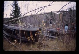
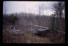
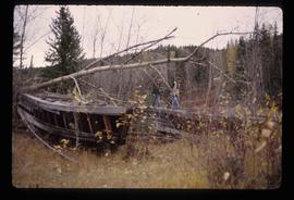
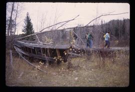
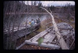
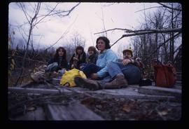
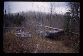
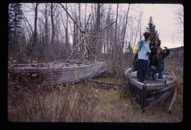
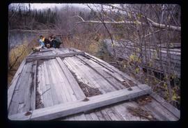
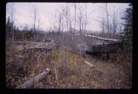
Image depicts a few old buildings, as well as several unknown individuals somewhere in Moricetown, B.C.
The item is a photograph depicting a woman and dog sitting on a log cabin porch. Annotation on reverse side of photograph states, "Morehead Cabins 2010."
File consists of notes, clippings, and reproductions relating to 3067 Queensway, Prince George. The Queensway home was built in 1910 by Harry Close and Charlie Brown who operated a general store in South Fort George. It was purchased by a man named McLaughlin who was a wealthy lumberman, and later sold to Bert Roddis a government agent. The house had many occupants, but was next passed to Pat Moran in 1965 who continued to occupy the house into the late 1970s. Pat Moran owned Moran's Trailers in Prince George. Includes: "Queensway home built in 1910 by bachelors" clipped article from the Prince George Citizen (8 Dec. 1977); Also includes a photograph depicting a house on Queensway, Prince George and printed photographs depicting the house after a fire in 1998.
The item is a photograph depicting a white heritage house in old South Fort George. It was known as the Moran house and was located at 3067 Queensway, Prince George. Annotation on the reverse side of the photograph states, "S. Ft Geo burned, demolished."
Image depicts an old earth flow in Moran Canyon, somewhere in the Lillooet area.
Image depicts the Fraser River running through the Moran Canyon near Lillooet, B.C.
Image depicts a view of Moran Canyon in the Lillooet area. The Fraser River is visible on the left.
Image depicts the Fraser River running through the Moran Canyon near Lillooet, B.C.
Image depicts a view of Moran Canyon in the Lillooet area.
Image depicts the Fraser River running through the Moran Canyon near Lillooet, B.C.
Image depicts the Moran Canyon near Lillooet, B.C.
Image depicts what is possibly the Fraser River running through the Moran Canyon near Lillooet, B.C.
Image depicts the Moran Canyon; the Fraser River is visible near the bottom.
File consists of clippings, notes, and reproductions relating to Moore's Meadow in Prince George. Includes: "Charles W. Moore" handwritten notes by Kent Sedgwick (2000); "The origin of Moore's Meadow" typescript by Kent Sedgwick; and "Moore's Meadow" typescript document by Mary Fallis (Jan. 1991).
File contains a spiral bound book titled "Monumental Transformation: The Story of Prince George's National Historic Monument" written by Kent Sedgwick and published by CNC Press (2009).
File consists of notes, clippings, and reproductions relating to the Monkman Pass mentioned in newspapers.
File consists of notes, clippings, and reproductions relating to the Monkman Pass area. Includes: "Monkman Pass Memorial Trail" brochure prepared by Tumbler Ridge (2006); "The trail to Monkman Pass" clipped article from BC Outdoors magazine (July 1983); "Regional District of Fraser-Fort George" typescript letter from Y.D. Kennedy to Kent Sedgwick (5 Sept. 1973); and "Alberta Wilderness Association Newsletter" newspaper vol. 13 no. 1 (1983).
The item is a photograph depicting the exterior of old damaged buildings on the Moffat farmland. There is a fence at the entrance to the driveway with an address sign that reads "1820."
The item is a photograph depicting the exterior of old damaged buildings on the Moffat farmland. There is a fence at the entrance to the driveway with an address sign that reads "1820." Annotation on the back of the photograph states, "Moffatt (Gunn) farm 2005."
The item is a photograph depicting the exterior of old damaged buildings on the Moffat farmland. There is a fence at the entrance to the driveway with an address sign that reads "1820."
File contains slides depicting Prince George.
File contains slides depicting logging and equipment. Most appear to be locations around Prince George.
The item is a photograph depicting a 1/48 scale model of the Cameron Street bridge. The angle is looking down the bridge with a blue and a yellow model car on the bridge. Annotation on the reverse side of the photograph states, "Oct. 2008 1/48 scale model of the Cameron St. bridge 1931-2005 by Roy Groeneveld."
The item is a photograph depicting a 1/48 scale model of the Cameron Street bridge. The angle is a side view of the bridge with a blue and a yellow model car on the bridge. Annotation on the reverse side of the photograph states, "Oct. 2008 1/48 scale model of the Cameron St. bridge 1931-2005 by Roy Groeneveld."
Image depicts a dog and dog house in the back of a pick-up somewhere near Prince George, B.C.
Image depicts a delta at Moberly Lake north of Chetwynd and south of Hudson's Hope, B.C.
Image depicts an obstructed view of Moberly Lake, located north of Chetwynd and south of Hudson's Hope, B.C.
File contains slides depicting the remains of the old Miworth Ferry in Miworth, B.C.
Image depicts two unknown individuals and the remains of the old Miworth Ferry, somewhere near Miworth, B.C.
Image depicts the remains of the old Miworth Ferry, somewhere near Miworth, B.C.
Image depicts four unknown individuals and the remains of the old Miworth Ferry, somewhere near Miworth, B.C.
Image depicts two unknown individuals and the remains of the old Miworth Ferry, somewhere near Miworth, B.C.
Image depicts four unknown individuals and the remains of the old Miworth Ferry, somewhere near Miworth, B.C.
Image depicts five unknown individuals sitting on the remains of the old Miworth Ferry, somewhere near Miworth, B.C.
Image depicts four unknown individuals and the remains of the old Miworth Ferry, somewhere near Miworth, B.C.
Image depicts the remains of the old Miworth Ferry, somewhere near Miworth, B.C.
Image depicts the Mist Glacier on the slope of Mt. Robson.
The item is a photograph depicting the front of a white house. The sign on the front reads, "Ministry of Agriculture & Food Reception."
The item is a black and white photograph depicting the front of a white house. The sign on the front reads, "Ministry of Agriculture & Food Reception."
File consists of notes, clippings, and reproductions relating to mining in British Columbia. Includes various clipped articles from the Prince George Citizen newspaper (2003-2008).